Showing posts with label Trikeri. Show all posts

Thursday, December 29, 2022

Crossing of Tisseon, west part (Panagia-Tsitsourava peak 424 m.-Trikeri-Agia Kyriaki)

Αegean Blue

Distance: 9,4 km.

Time: 6 hours

Altitude: from 15 m. (Panagia) to 424 m. (Tsitsourava peak) to 0 m. (Agia Kyriaki)

Total elevation gain:  629 m.  Total elevation loss: 641 m. 

Signing: red paint marks, cairns

Drinking water on walk: no

Start: Panagia chapel (signpost on the asphalt road)

End: Agia Kyriaki harbour

Last checked: December 2022

Download GPS file (gpx):  from Wikiloc

*

Powered by Wikiloc

        This is the western part of the Tisseon crossing. Starting from the chapel of Panagia next to the asphalt, we climb towards the Karatassos pit and then, moving along the ridge to the west, we reach the village of Trikeri, from where we finally descend to finish in Agia Kyriaki. The route has spots that offer excellent views of the Aegean sea and Pagasitic gulf.


        From Panagia to Karatassos clearing we walk through mixed Mediterranean vegetation that offers enough shade, but then the holly trees dominate on stony ground, as is the case in the rest of Tisseon. This makes walking more tiring and at the same time requires continuous attention, because the stones slip treacherously if wet from the morning moisture. And the holly trees (quercus coccifera) have a tendency to flare up in the absence of a goat flock, making it difficult to pass. Nevertheless, the route is expected to be cleaned and signposted within 2023, along with others, with money from the European Leader program.


           Note: the new recording of the route near the peak of Tsitsourava at 424 m. is more correct, easier and offers a much better view than the previous recording, shown on the maps so far. We recommend it.

           On the road from Milina to Trikeri, after the fish farm, we see by the road the sign (in Greek) ΙΕΡΟΣ ΝΑΟΣ ΠΑΝΑΓΙΑΣ, meaning "Holy Church of Virgin Mary (Panagia)"). The church is located a little lower, close to the sea and is not visible from the asphalt. Next to the road there is also a fallen marble commemorative plaque that refers to the battles fought here by the rebel Greeks, led by Karatassos, with the Turkish army under Mahmud pascha (Kiutachi) in 1823.

The path near Panagia

         A signpost on the other side of the road marks the beginning of the path. It climbs through a maquis forest. We pass a first small uphill glade and soon we come out to a large, elongated clearing, named after Karatassos. Approximately in the middle, there is a cairn marking  the path that leads to the peak Evzonos (644 m.) to the left.


       We do not follow this, but continue straight ahead on a westerly diretion. From the upper edge of Karatassos glade we find a path with red markings, that heads west-southwest. We pass through a couple of other clearings and eventually we reach a small rocky plateau. If we stand on the edge of the cliff that is to our left, we will have a wonderful view towards the Aegean.


         From here on, the path becomes unclear, as we climb into stony ground with holly oak vegetation. We walk close to the edge of the cliff in the direction of the pillar of the Tsitsourava peak (424 m.) and the wind measuring mast next to it. Note: this beautiful and unique natural environment is in danger of becoming a wind  farm by greedy investors,  thus suffering an irreversible damage. Let us hope this will never be allowed to happen.


        After reaching the top, we continue in the same direction, passing close to a cairn on our left.


            Finding a passage through the holly trees, we descend and reach a small glade at the foot of the hill in front of us. From there, moving in a westerly direction, we climb on a narrow goat-path, pass by another small glade and climb to the top of the next hill.
Trikeri at a distance
       
         Keeping the same direction, after a while the path brings us to another hill (Kastro (Castle), 281 m.), where we meet a wall that extends for quite some time on the ridge and we walk next to it. This was built during the Greek revolution, at the time of the battles with the army of  pasha Kioutachi in 1823 (more information can be found in the book of  Kostas Liapis "Tα Παλιόκαστρα του Πηλίου'', Ta Paleokastra tou Piliou-The old castles of Pelion (in Greek, Volos 2010).
Κastro

        Continuing in the same western direction, we pass by another mast and further down we come out on a dirt road, at the location called Diakopi, near a pen. In a few meters we meet the asphalt that goes to Agia Kyriaki on the left. 
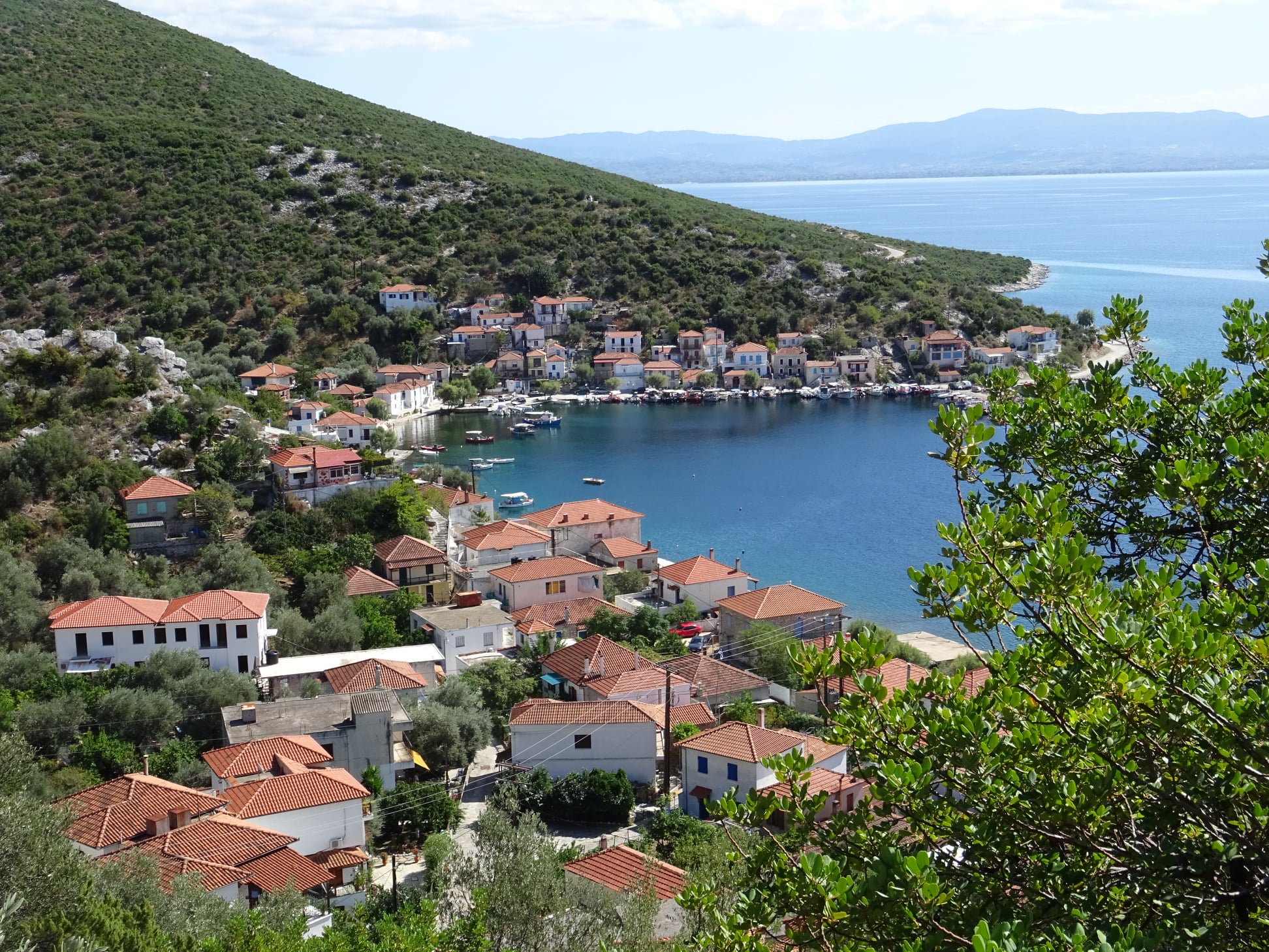
Agia Kyriaki

        Here in Diakopi we have two options: either we will walk for half an hour downhill on the asphalt to go to Agia Kyriaki, or we will go straight uphill on the dirt road, which will take us to the cemetery of Trikeri and then, as a stone paved road, to the village square (a 2-3 meter section of the old kalderimi still survives near the cemetery).
Trikeri square (in summer)

        From the square we will descend on a nice cobblestone road towards Agia Kyriaki. For this second option, which we followed here, the time from Diakopi to Agia Kyriaki is one hour and 15'. In the picturesque port of Agia Kyriaki, at least one restaurant-café operates all year round.


Thursday, September 29, 2022

Alogoporos-Anisvales-Theriakodas (circular)

Theriakodas


Distance: 6,9 km

Time: 3-3,5 hours with stops

Altitude: from 0 m. to 244 m. (max)

Total altitude gain/loss: 265 m. 

Signing: red paint, round metal signs

Drinking water on walk: no

Start/end: Alogoporos beach

Download GPS file: from Wikiloc

Powered by Wikiloc

       Centered around Alogoporos beach, we combine the Trikeri-Alogoporos and Trikeri-Theriakontas trails to create a three-hour circular walk. Long pants are recommended, as the path to Theriakodas is narrowed by overgrown vegetation, but still remains passable (and beautiful). 

        Starting from the beach of Alogoporos, we first walk on the asphalt. A little further up, the asphalt makes a right turn and we continue straight ahead through an olive grove. We cross a dirt road (it's the same one that goes to Theriakontas) and climb continuously on a clear path, from some parts of which you can see the sea.  


            We reach a small clearing, where the climbing ends. This location here is called ''Vlachi'', according to Nikos Haratsis. There used to be a pen here. We now begin to descend on the path heading south. Finally we reach a long and narrow pit with grass, called ''Anisvales'', again according to Haratsis. If we cross it transversely, we will find on the other side an uphill path that goes to Trikeri.   We do not do this, but turn left descending to the pit, and from its lower end we find a path on the right that descends smoothly to the east, crosses a small stream and, climbing a little, meets on the other side a path that runs parallel to the stream. This is the path that goes to Theriakontas and we follow it to the left (north). 


        The vegetation is quite overgrown, but the path remains passable, pending an initiative to clean it. In any case, long pants are recommended for the time present. 

The hut near Theriakodas

        Walking along the nice unpaved path, we pass by a hut and have the stream right next to us on the left. We follow a fence and finally come out on the pebbly and deserted beach of Theriakontas. There is no tourist development here, nothing to disturb the tranquility of the landscape.

Theriakodas

       At the left end of the beach begins a road that climbs roughly parallel to the coastline. We follow it, and after about 700 meters, paying attention to our right, we find a path that faithfully follows the coastline and takes us to the eastern end of Alogoporos beach.


Seeing Alogoporos

       A cafe with rooms for rent operates here. From here you can also take the water taxi to go across to the island of Paleo Trikeri. Here lies the monastery of Evangelistria, as well as a few rooms for rent and two cafe-restaurants at the seaside.

The water taxi to the island

Τrikeri island


Friday, April 15, 2022

Τrikeri-Theriakontas-Trachili (circular)


Trachili -the cottage in the olive grove

Distance: 14,6 km

Time: 6 hours with stops; walking time 4.45'

Altitude: from 307 m. (Trikeri) to 0 m. (Theriakontas) to 230 m. (kiosk)

Total elevation gain: 285 m. Total elevation loss: 336 m.

Signing: round yellow signs, red paint

Drinking water on walk: no

Start: parking lot next to Trikeri square  

End: kiosk on the main asphalt, 2,5 km before Trikeri

Download GPS file (.gpx): from Wikiloc


Powered by Wikiloc
 
        The beach of Theriakontas lies next to Alogoporos on the east.  The walking route is initially common for both, and then splits. In this almost circular walk, after reaching Theriakontas we continue on a coastal path to get to cape Trachili. Τhen we return back via an earth road. 

        As we approach Trikeri, there is a kiosk on the side of the asphalt road, 2,5 km before reaching the village. This marks the end of the recorded walk. We start walking from the parking lot, which lies close to the village square. We initially walk on the asphalt that goes to Agia Kyriaki, but shortly, as the asphalt takes a left turn, we leave it to the right and take an uphill stone paved  track. Further on, there are sections where the old kalderimi is preserved. 
On the path to Theriakontas

      We cross an earth road and continue on the path amid  kernes oak vegetation (quercus coccifera). Τhe path approaches the asphalt road,  eventually crosses it at an angle and continues on the other side. We walk next to a fence. Further on, we join an earth road that opens to the asphalt, on which we walk fo r 100 meters and then turn right onto another earth road, close to a pen. Soon the earth road becomes earth path heading north. 

On the path to Theriakontas

      Bushy vegetation is annoyingly overgrown at places, in need of cleaning, but the path remains open anyway.  Gradually a ravine is formed on our left and we walk parallel to it. On our right is an old cottage. As we approach to the sea, we join an earth road, then walk next to a pen fence on our right. Finally we come to the beach of Theriakontas close to its left (west) end.

Theriakontas

     An earth road continues towards Alogoporos. We don`t take that, but walk to the opposite end instead and find a narrow path marked with red paint, that goes roughly parallel to the coastline, a few meters above the sea.


      Further on, we come to join an earth road that goes around the cape Trachili. The Trikeri Island is close to us to the north and we can also see Volos at the distance. Α cottage is built here into an olive grove.

At Trachili

The earth road passes next to the cottage and we take it, walking constantly uphill on a southerly direction. After 5 km on that road, we  come to join the main asphalt near the kiosk, 2,5 km away from the village of Trikeri.


The kiosk


Tuesday, November 3, 2020

Κottes-Trikeri-Lighthouse-Agia Kyriaki (circular)


Shrine near Kottes

Distance: 15,5 km

Time: 5-5,5 hours (with stops)

Altitude: from 0 m. to 311 m. (Trikeri, Agia Triada church)

Total elevation gain/loss: 625 m.

Signing: round yellow signs 

Drinking water on walk: no

Start/finish: seaside at  Kottes

Download GPS track:  from Wikiloc


Powered by Wikiloc
 This is a 5-hour circular walk around Trikeri (time including stops), starting from the seaside settlement of Kottes. Τhe best season for it is spring and autumn, due to the lack of shade. There is also an option for a shorter 3-hour walk (see below).

    From the middle of the seaside of Kottes, we follow the stone paved track going uphill. Τhe climb to Trikeri will take about an hour. Reaching the village, we climb the steps to get to the square, where we can have a stop for coffee or refreshment. We continue in a southerly direction through the village`s narrow alleys to the highest point where lies the church of Agia Triada (Holy trinity). Descending steadily in the same direction, we get to join a narrow asphalt road, and i a few meters we reach the location ''Vigla'', offering a spectacular viewpoint.

View from Vigla

    We continue on the narrow asphalt, eventually joining a wider asphalt and walk on it downhill. At the sharp left turn we continue straight ahead on an earth road. At the V-junction we go left downhill and i9n a few minutes reach the lighthouse built just above the sea at the location ''Kavoulia''. A guard  is staying there permanently.

The lighthouse at Kavoulia

    Leaving the lighthouse, we walk on a path following the coastline.

On the coastal path

    Going through the beach ''Geroplina'' (with the option of taking a swim) and through the shipyard, we come to the seaside settlement of Agia Kyriaki. 
Agia Kyriaki

    With the fish taverns on our right, we walk away from the sea on a kalderimi climbing sharply and constantly. Higher up we cross the narrow asphalt and continue straight ahead to reach the square of Trikeri and continue downhill to return to Kottes, where we can have a swim and lunch at the seaside tavernas.

On the way down to Kottes

    Now, as some people may find the idea of a 5-hour walk distressing, there is the option of a smaller, 3-hour circular walk if we skip Kottes altogether. In that case, it is best to start from Agia Kyriaki, climb the kalderimi up to Trikeri square, then descend as described via Vigla to the Lighthouse and return to Agia Kyriaki and its taverns by the coastal path. 

Trikeri square

Monday, July 27, 2015

Panagia chapel-Tiseon-Trikeri

Distance: 10,9 km
Duration: 6 hours (walking time 4.45')
Altitude: from 30 m. (Panagia chapel) to 644 m. (top)
Total elevation gain: 839 m.  Total elevation loss: 754 m.
Signed with red paint marks
Drinking water on walk: no
Download GPS track:  from Everytrail   from Wikiloc

                                       At the south end of the Pelion peninsula, after the gently descending foothills of Lafkos fade out, the rocky and arid mountain of Tiseon (previously called Bartzogia by locals) rises up. On its boundary, at the entrance to the Pagasitic Gulf, the village of Trikeri is built. There is no proper path joining Trikeri to the rest of Pilion, and communication was only by sea. However, there is a path from the village which goes along the mountain ridge and descends to the sea to the chapel of Panagia.
       Going along the coast road from Milina to Trikeri, we pass the fish farm and then see a sign next to the road with the inscription ''ΙEΡΟΣ ΝΑΟΣ ΠΑΝΑΓΙΑΣ'' (in Greek). The chapel is a little lower down near the sea, not visible from the road. Next to the road there is also a fallen marble memorial plaque commemorating the fight in 1823 of the Greek revolutionaries under the leadership of Karatasos against the Turkish army led by Kioutachi pasha.
Tzasteni, on the way to Trikeri
        The footpath, indicated by red marks, begins here from the side of the road and ascends through the maquis vegetation. We pass through a first clearing and shortly come out at a larger long narrow one, called the Karatasos glade. Walking along its length, half way along we find the path to the left, indicated by red marks and a small sign, which leads towards to peak. Walking to the east, we come out at a new clearing on the col. 

         From the col we begin to ascend on goat tracks over rocky terrain with low vegetation which thins out as we continue climbing in an easterly direction. We pass successive cairns and keep to the southern edge of the ridge (towards the Aegean side). We eventually reach the highest point (644 m) where there is a cement column after about one hour and forty minutes of walking (two hours with stops).
         From here, especially on a clear day, we can enjoy a unique view of Greek nature, which compensates us amply for any difficulty we may have had in reaching this point. At moments like these we feel fortunate to be in this much-afflicted place enjoying the magical and unique beauty that it has been blessed with. Rocks and cliffs, sky and sea, white and blue – we can’t take in enough of the view all around us. It’s not possible to describe the feeling – one has to experience it for oneself. In the words of the unforgettable Nikos Haratsis: “I don’t know, Lord, how else to sing the praises of this holy place that you have given us”.
       Comes the time when we must set out on our return. We go back to the Karatasos glade, from the upper (western) edge of which a path continues, marked by red marks, in a southwesterly direction. We pass a new clearing and, further on, the path becomes unclear as we ascend over a rocky hill, at the top of which there is an antenna.  In this recording, we go downhill on goat tracks under the antenna in a northwesterly direction until we meet a straight, narrow path a little further down, which we follow to the left (southwest) to come out at the glade on the col below the antenna. One reaches the same glade if one proceeds straight ahead to the southwest below the antenna going downhill, again on goat tracks.
Seeing Trikeri at the distance
            From the glade, moving to the west, we ascend on a narrow path-goat track, pass another glade and go up to the top of the next hill. In the same direction, after a short distance, the path leads us to another hill (Kastro, 281 m), where we find a wall extending for quite a distance along the ridge, and we walk next to this. The wall was built hastily at the time of the battles with Kioutachis’ army in 1823 (more details are available in Kostas Liapis’ book (''Τα Παλιόκαστρα του Πηλίου'', Volos 2010-in Greek).
          Continuing in the same westerly direction, we pass next to the asphalt road and take the narrow earth road which, after a short distance, comes to col next to a goat pen. Here we meet the asphalt road that leads left to Agia Kiriaki and the trail recording ends. If we cross the road and take the narrow earth road that we see to ascend the slope, we will reach the village of Trikeri in about forty five minutes. From there we can continue, if we want, for about thirty minutes (see the walk description Agia Kiriaki – Trikeri) on the well-maintained kalderimi that leads down to the picturesque coastal settlement –harbour of Agia Kiriaki.
Agia  Kiriaki