Showing posts with label 6-9 hours. Show all posts

Tuesday, January 17, 2023

Louziniko-Kaliakouda ravine-Alevizou bridge-Agios Athanasios (circular)


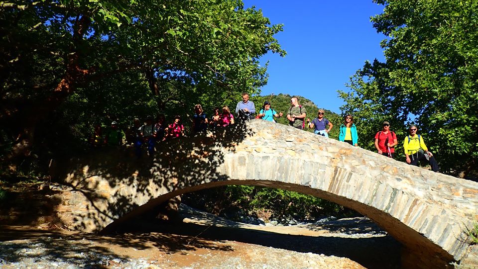
Reaching the bridge of Alevizou

Distance: 14,2 km

Time: 7 hours with stops, walking time 5.50'

Altitude: from 106 m. (Louziniko bridge) to 450 m. (Agios Athanasios)

Total elevation gain/loss: 455 m.

Signing: red paint, yellow signs

Drinking water on walk: no

Start/finish: Louziniko stone bridge 

Last checked: January 2023

Download GPS file: from Wikiloc


Powered by Wikiloc

            This walk has a particularity compared to all the others described in this blog: About half of it is done without a path, walking freely on the bed of the stream of Kaliakouda into the gorge, stepping on rocks and stones that can be slippery from the moisture (attention!). In three places, a bit of climbing is required on the rocks that block the passage, which in turn requires from participants to be in good physical condition and have some relevant experience. The stream is generally dry without water, except when the snows melt in the spring and when there is a recent downpour. It goes without saying that in these cases, and even if there is only a simple chance of rain, the walk must not take place for safety reasons.        

Experiencing the joy of climbing

          The ravine of Kaliakouda (or Kseria) takes its name from the sources of Kaliakouda located higher up, from which the city of Volos gets drinking water. Its beginning is at the peaks of Pourianos Stavros (1624 m. - Pelion`s highest) and Kotroni (1550 m.). There are four stone bridges built in this large ravine. In this walk, we meet the two lower ones on our way (Louziniko and Alevizou). The other two are the bridges of Leshiani and Karia.

The bridge of Louziniko

         So, we start from the stone bridge of Louziniko, which is in good condition. To get there we exit the Volos Ring road towards Fitoko. Shortly before reaching Fitoko the road forks and we go left on a narrow asphalt (attention). We can either descend immediately to the bed of the ravine, or initially walk through an olive grove parallel to the bed and then descend, as we did here.


          We are walking either on smooth, sandy ground, or on and between rocks, some of which are impressive with their colors, or even on large rocks that in three cases also require a bit of climbing ability to climb to a height of a few meters.


      Having covered a distance of about 7 kilometers in these conditions, we eventually reach the bridge of Alevizou. Unknown year of construction, by unknown masons - most likely coming from Epirus region in Northern Greece - this bridge is the second of four bridges built at the Kaliakouda ravine (the other three are of Louziniko, Leschiani and Karia). It got its name from a local landowner who paid for its construction. The span of its arch according to Haratsis is 9.2 meters and the height is only 2.25 meters.

The bridge of Alevizou

      The former president of Makrinitsa community, Spiros Kouikoumis, told Nikos Haratsis: ''I remember this bridge was very high, so much so that when we passed over it we were afraid to look down. The stream was very deep at this point and the rocks on the banks steep and high. But now it's been several years that the water has brought down a lot of gravel and rocks and it is in danger of  blocking from below" (source: Nikos Haratsis "Stone Arched Bridges in Pelion", in Greek).


         The bridge was for several years in a bad condition, ready to collapse. In 2009 it was repaired. However, this repair, in the way it was done, significantly altered its character and its current form is far from the original. Also, the addition of low side walls theoretically increases the resistance to the flow of water, so that in the event of a heavy rain there is danger of it being swept away by the flooded stream.


  Leaving the bridge, we go up the dirt road to the left. At the second sharp right turn above, there is a path with blue markings in a northwesterly direction, incorporating a few meters of cobblestone, that brings us to Agios Athanasios church.


        Below the church there is a sloping plateau, rather an abandoned field. Walking through the plateau in a southwesterly direction, we find a path that goes straight ahead smoothly in this same direction. Finally we come out on a dirt road, on which we walk crossing another large field, in the middle of which there is a ruined hut and we pass right next to it.

Crossing the field

     Further on, as we walk along the right edge of the field, keeping an eye out for the red arrow on our right, we leave the road (attention!) and join a path that crosses a small stream and then emerges into a smooth clearing with a few trees. Here the path becomes a bit unclear, so we watch out for the red markings on the trees. Our direction remains generally southwest.

        Descending between holly trees, we finally come to a small dry gully at the location Kokkinovrachos. Here we come to join the route Louziniko-Kato Kerasia (notice the signpost).

Returning to Louziniko, with Kserias stream on our left

   We now walk following the stream, which below joins another and finally joins Kaliakouda (Kserias)  while we, after crossing the small stream, walk on a path built on the right bank of the large stream. After a bit of cobblestone, the path becomes a rural road and finally we arrive back at the bridge of Louziniko, from where we started.


Friday, December 23, 2022

Crossing of Tisseon, east part (Evzonos peak 644 m., Floka peak 547 m. )


 Distance: 9,9 km.

Time: 5-6 hours

Altitude: from 31 m. (Panagia parking area) to 644 m. (Evzonos peak)

Total elevation gain: 741 m. Total elevation loss: 697 m.

Signing: red paint marks, round yellow signs, cairns

Drinking water on walk: no

Start: 1,5 km. after the road sign to ''KΟΥΚΟΥΛΕΪΚΑ''going towards Trikeri, taking the second earth road on the left, marked with red paint

Finish: Parking area of Panagia chapel (at the road sign ''IΕΡΟΣ ΝΑΟΣ ΠΑΝΑΓΙΑΣ'')

Download GPS file (.gpx): from Wikiloc         

Powered by Wikiloc

The West  part of Tisseon crossing is here       

The full crossing of Tisseon is a tempting idea for mountaineers, but it also presents significant difficulties. Starting from the quarries, having difficult access by narrow dirt roads, the hiker walks for hours on a hard, rocky landscape without water and shade, mostly on uneven ground without a proper path until he reaches Trikeri. On the contrary, the short crossing, in addition to the shorter distance, has the convenience of starting and ending on the asphalt and going up and down on a path. However, it does not fail to offer the experience of moving on the bare rocky terrain with unobstructed view of mountains and seas.


        Αttention is needed when walking on the rocky part of the route, as the rocks can be slippery when wet from the morning moisture and a fall can have unpleasant consequences...(it has happened). The walk is recommended for winter and early spring, when the sun is not burning, as there is no water anywhere, nor any shade on the ridge. It is very important to have clarity in the atmosphere, so that we`re able to enjoy the magnificent panoramic view that is the great asset of this crossing.


         The direction of the walk can be either east to west, or vice versa. In the first case, coming from Milina, about 1.5 km after the road sign for Koukouleika settlement (in Greek: ΚΟΥΚΟΥΛΕΙΚΑ), and before reaching Marathias, moving on the asphalt towards Trikeri, we see a red paint blob on the left side of the road, and we start walking on a dirt road that is passable by cars with average ground clearance, entering an olive grove. In about 2 km we reach a pen. Here we go right and in about a hundred meters we leave the road to the left going up a wide path. (Parenthesis: there also is another dirt road climbing from the asphalt to this point. This is after Marathias, at a distance of 4 km from the sign to Koukouleika. The distance we walk is the same in both cases, about 2 km).

Climbing from Panagia chapel

          The track on which we walk, initially seems to be rather an abandoned road. We keep following the red marks, continuously climbing towards the south, sometimes on stony ground and sometimes in a forest, while we also cross a clearing. At some point the forest ends and we come out onto the rocky ridge. We are close to the visible top of Floka (547 m.), where there is a fallen wind mast (wind turbines installation is scheduled, a terrible prospect that threatens to destroy the unique natural beauty of Tisseon for ever).


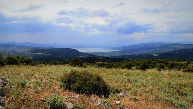
       We continue straight on the ridge, without the red paint marks anymore as they are unnecessary, to the highest peak called Evzonos (644 m.) Here, if the atmosphere is clear, we will enjoy a magnificent view. We are located between two seas, the Pagasitic and the Aegean. We  see the North Sporades islands (Skiathos, Skopelos, Alonissos). Evia (Dirfis peak) and Parnassos can be seen in the background and the other mountains of the mainland up to Olympus. Sometimes Athos is also visible. Opposite lies  Chlomo  mountain at the entrance of Pagasitic gulf. Trikeri, Tzasteni (perhaps the most photographed spot of Pelion), the south-facing villages and Volos can also be seen. On the side of Pagasitic, the slope is wooded and descends more smoothly, while on the Aegean side it is cut off sharply by a cliff of hundreds of meters. Only a few low trees can survive here on the rocky ridge.


           From Evzonos peak we descend the rocky slope to the west towards the clearing that appears in front of us at the base of the next hill, passing by successive cairns. As we descend, the rocky terrain becomes overgrown with holly trees.


        After the first clearing, there is a regular path. Then we come out in the middle of a second clearing (Karatasou Lakka). We follow the red signs downhill on a path passing through a third smaller clearing and finally we reach the asphalt, immediately above the small church of Panagia which is near the sea and not visible from the road (next to the road there is the sign "Holy Church of Panagia'' (in greek  IEΡΟΣ ΝΑΟΣ ΠΑΝΑΓΙΑΣ), as well as a marble plaque commemorating the battles that took place around there in 1823 during  the Greek war of Independence, between the rebel Greeks led by Karatassos and the Turkish army led by Kioutachi pasha).


                 We also have the option of walking in the opposite direction, if that suits us better. In this case, we start from the Panagia church and go uphill, reaching the clearing "Lakka Karatasou" where we turn left at the cairn and climb to Evzonos, the highest peak (644 m.). We continue east on the ridge and reach peak Floka (547 m.), where there is a pole and a fallen wind mast.


           Following now the red marks, we enter the forest path. Further down we walk on a section of stony ground. Eventually we come out on a dirt road and go right. At the pen in a hundred meters we go left and walk on the dirt road straight to the north. We cross an olive grove and the road opens to the main asphalt, 1.5 km before the settlement of  Koukouleika (in the direction of Milina).

Tuesday, October 18, 2022

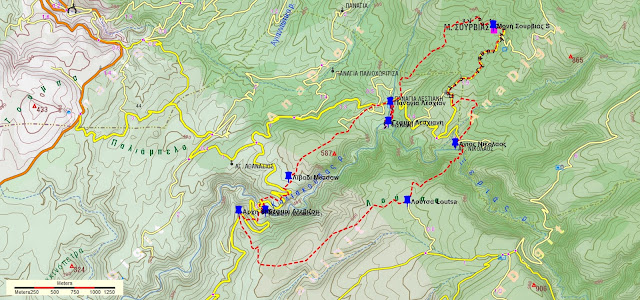
Alevizou bridge-Leschiani bridge-Sourvia monastery-Agios Nikolaos-Loutsa (circular)


Τhe bridge of Leschiani

Distance: 13,8 km

Time: 8 hours, with stops

Altitude: 709 m. (max) to 332 m. (minimum)

Total elevation gain/loss: 666 m.

Signing: red paint marks

Drinking water on walk: no

Start/end: Location ''Mavrolithari'', 5,5 km from Fitoko church (see further on)

Download GPS file: from Wikiloc 

Powered by Wikiloc

         This is a fairly long circular walk, with which we pass by two stone bridges (Alevizou and Leschiani), from the monastery of Sourvia and the chapel of Agios Nikolaos. The time when we recorded it (31/5/2020) was 8 hours, but with a relaxed pace and long stops. The walk can be shortened by about 2.5-3 hours if we skip the monastery of Sourvia and Agios Nikolaos and climb up to Loutsa from the Leshiani bridge (see below). 


        The walk starts and ends at the location by the name ''Mavrolithari''. We go there by a dirt road that is passable by normal cars (not with lowered suspension). Just before the parking lot of the church in Fitoko, turn left onto a concrete road with a sign for "Moni Gorgoypikoou''. The road becomes asphalt for a while and then continues as a dirt road. We keep going straight, ignoring successive intersections on the right towards "Loumbarda", "Gioni" and "Gorgoypikoou monastery". After 5.5 kilometers from Fitoko (of which 3.5 on dirt road), we reach the location ''Mavrolithari'', where the dirt road turns right, starting to descend towards the ravine of Kaliakouda (also called Kserias). There we leave our car and start walking.

          So we walk along the road, dense vegetation on our left. In a hundred meters, where the wild  vegetation ends and we have an (abandoned) grove on our left, we leave the road and go down in the grove. The path is not readily visible at first, but we walk along the lower part of the estate smoothly, following the contours of the terrain. A little lower down the path is clearer. We cross the road at an angle to the right and find the path again below. We keep descending, come out on the road again and reach the bridge of Alevizou.

The bridge of Alevizou

        Constructed in a year uknown, by unknown masons - possibly from Epirus - this is the second in a row of four bridges of the Kaliakouda gorge (the other three are of Louziniko, Leshiani and Karia). It got the name of the owner of a large estate in the area, who is believed to have paid for its construction. The span of its arch according to the book of Nikos Haratsis is 9.2 meters and the height is only 2.25 meters. The former president of the Makrinitsa community, Spyros Koikoumis, told Haratsis: ''I remember this bridge was very high, so much so that when we passed over it we were afraid to look down. The stream was very deep at this point and the rocks on the banks steep and high. But now it's been quite a few years that the water has brought down a lot of gravel and rocks, to an extent it is almost blocked from below.''

Alevizou bridge at spring

        The bridge used to be for many years in bad condition, ready to collapse. It was repaired in 2009,  however this repair has significantly altered its character and its current form is a far cry from the original. Also, the addition of low side walls increases the resistance to the flow of water, so that in the event of a heavy rain there is danger of it being swept away by the flooded stream.

         After the bridge we continue up the dirt road. At the second sharp right turn above, a path branches off on the left going north towards Agios Athanasios chapel. Just next to this path`s entrance, we leave the road  and follow another uphill path with red markings that heads east. On our way we cross the road twice. At the third time we walk for fifty meters on the road and find a path that continues climbing. Finally we come out on the upper side of a large meadow.

In the meadow

        Here we join an earth road that continues climbing and further up ends, opening to another large meadow. We cross the meadow walking roughly in the middle of it, and at the other end we find a path that continues smoothly to the northeast.. Further on we cross a smaller clearing, where there is a plastic water tank and a watering can on our right. A dirt road ends here on the left. We walk through the clearing in the same direction and continue on a path going downhill, always following the red marks.

The path in oak forest

        Eventually, we come out on a dirt road, on which we walk. We go down to a plateau and walk on a wider dirt road, going to the right. In a few meters there is a triple junction and we take the middle road, which soon brings us to the chapel of Panagia Leschiani. Next to it there is a stone water fountain, inscribed  with the date 1888 (usually without water) opposite to it a large plane tree.

          Ηaving got here, we must definitely visit the bridge of Leshiani. So, from the fountain we walk on the path to the south, and in five minutes find ourselves in front of the only three-arched bridge in Pelion. The span of the middle arch is 9.20 m and the height is 5.85 m.


        Nikos Haratsis writes in his book "Stone arched bridges in Pelion": "This bridge is a work of art, a real monument that anyone seeing it will stop to admire and wonder... I was amazed by its shapely line and carefully looked at its three arches. What symmetry, my God, and what a beautiful rhythm it has! As if it is ready to move with you, the medial arch, which dominates the whole body, presses lightly but firmly on the two pedestals, gently weighs on the two smaller arches that are right-sided, and finally fades to the banks and merges with these. The sycamores, the heathers, the holly trees, the cedars that are on the banks and embrace it, as if they are the extension of the bridge, bound in the same rhythm of perfect nature... Its pedestals and bases are rooted in rocky, stable ground. One pedestal, the northern one, on the side where the water comes, is wedge-shaped to withstand the pressure of the water. The stones that form the arches are long and narrow, with narrow joints between them, giving the impression that the masons have not used a hammer. The stones that are low in the bases are larger and harder. Its walkway is cobblestone, which is in good condition and traces a slightly curved path, thus following the entire line of the bridge. Its side walls had been washed out at some point when the stream flooded down a lot of water, and they have been rebuilt. However, the difference in construction style is easily discernible. In that same year the south base, high near the arch, was also damaged and has been repaired. Here too, the difference in the construction style and the quality of stone can be seen.'' 


        Here we have the option, if we wish, to shorten our walk by approximately 2.5 hours, skipping the Monastery of Sourvia and Agios Nikolaos, and continue climbing on the kalderimi  from the bridge of Leshiani straight up to the clearing of Loutsa. But for the full walk, we return back to Panagia Leshiani. Here we enter a dirt road going uphill slightly. To our right, an uphill road leads to the monastery of Sourvia. We do not take this, instead we go straight ahead and in a few meters at the corner of the fence we turn left and walk on a wide path that begins to climb entering an oak forest. We follow the red marks and finally arrive at the (usually locked) entrance to the monastery of Sourvia.

Sourvia monastery

        Dedicated to the Holy Trinity and celebrating on the day of Pentecost, it was built in the 16th century by Saint Dionysios in Olympus and later had Saint Gerasimos the Younger as abbot. In 1878 the monastery was burnet down in the aftermath of a battle between Greek revolutionaries and Turks. In 1943, a Resistance printing press operated inside the catholicon (the main church). Today Sourvia, without monks anymore, belongs to Flamouri monastery. Restoration works are ongoing.

Church interior at Sourvia mon.

        After the necessary stop to rest but also to enjoy the wonderful view to the south and west, we take the dirt road and continue downhill. After about 2 kilometers, paying attention to our left, we see the red signs marking the path to Agios Nikolaos. At first we move towards the east and then south, we cross a stream and finally we reach the chapel of Agios Nikolaos. Τhe dirt road we cross here comes from Leschiani. 

Agios Nikolaos

        We continue through the south side of the church going down the path and reach the bed of the stream of Kaliakouda. There is no bridge here. On the other bank, the path climbs uphill and we reach the large clearing-meadow of Loutsa with the characteristic tree, which stands out in the whole area. Here we intersect with the Makrinitsa-Kato Kerasia route. Near the tree there is a trigonometric pole (altitude 692 m.) next to an old shredding floor.

Loutsa

        Leaving back the pole, we take a southwesterly direction and descend straight on a path that is now (in 2022) clear. A black water pipe also descends alongside us. Further down we come out into a long narrow clearing-meadow and walk to its right edge. Here we find a dirt road, which we follow. Further on, we enter a large meadow and pass by a pen on our right. Finally, the road takes us to the location of Mavrolithari, from where our walk began.


Monday, May 30, 2022

Makrinitsa-Pliasidi-Zagora


View to Horefto 

Distance: 18,5 km.

Time: 8 hours (with stops)

Altitude: from 620 m. (Makrinitsa) to 1480 m. (max) to 510 m. (Zagora)

Total elevation gain: 1075 m.

Total elevation loss: 950 m.

Signing: red paint, some metal signs

Drinking water on walk: Agia Paraskevi mon. near Makrinitsa

Start: Brani parking lot,  Makrinitsa (end of asphalt road) 

End: Agios Georgios square, Zagora

Download GPS file (.gpx): from Wikiloc


Powered by Wikiloc

        In his book ''History of the Provinces of Volos and Agia'' (published in 1960) Yiannis Kordatos, a renowned scholar of Zagora,  mentions an alternative, higher way used by locals to go from Zagora to Makrinitsa-Volos: (sic) starting to climb from ''Kordateika'' or Platanovrisi, passing by the ''middle Kotroni'', reaching ''Schizopetras'', turn west, get past ''Machera fountain''  and from the peak ''Plesidi'' go down to Makrinitsa. We tried to unearth this forgotten route, and after some research came up with this 8-hour walk. 

 After having some rest and refreshments at Agios Georgios square in Zagora,  we may wish to  continue descending for an hour or so to get down to Horefto beach  for a refreshing swim to the sea.


          As we come to the higher parking lot at Makrinitsa, at the end of the asphalt road, we see on the right a kalderimi (cobblestone path) heading uphill. A red handmade sign indicating to ''Πουρί'' (Pouri village)) is nailed to a tree. This was made, along with  many others, by the late local hiker Dimitris Kottalis. One can also start from the drinking water fountain in the parking. On our way from Makrinitsa to Pliasidi, in addition to the usual plain red marks, there also are red-on-white  marks that belong to a mountain running race (Ultra Pelion Trail, UPT).

Makrinitsa

    The kalderimi winds uphill among the village houses, passing by a lone pine tree next to a bench and two fountains and eventually opens to a narrow dirt road, which leads us to the old monastery of Agia Paraskevi. 
Agia Paraskevi chapel

        Having enjoyed a refreshing stop at that tranquil spot and filling our water supplies from the fountain (no other fountain is on our way), we continue uphill on dirt road. After a right turn we find the path on our left. It soon opens to another dirt road, which then turns right and comes to an end. We continue on a path with sections of cobblestone, climbing into chestnut forest.

Path in chestnut forest

         We cross an earth road and further up turn left on another road. Watching on our right side, after about 30 m. we find the path again, climbing between chestnut trees. Further up, we walk parallel to a water ditch, noticing another handmade sign to “Pouri”. From a certain spot, we can see lake Karla at a distance to the west.

Agios Augoustinos chapel at Trano Isoma

         On our way is also the newly built chapel of Agios Augoustinos, where we can have a stop. We continue on dirt road and come to a signed road junction. We continue straight ahead on a northeasterly direction, next to a concrete irrigation ditch. The road ahead leads  to Flabouro springs and Pourianos Stavros peak. After 50 meters we turn right (attention!) on another dirt road that climbs steeply uphill. On a tree a small round sign indicates the direction to ''Pliasidi'' to the right. The red-on-white marks are still with us on this way.


        We pass by the Tzanopoulos estate, where there is a hut. On our left we see a square building, probably a water tank. Immediately after the estate the road makes a slight left turn downhill goeing to Flambouro. At this point we leave it and go straight ahead uphill in an easterly direction on a path, which eventually takes us to the asphalt that goes to the military radars. We are close to the peak of Pliasidi (1547 m.), which is on our right, but getting to the fenced  top is prohibited.


        Reaching the asphalt, the red-on-white marks turn to the right and we leave them (attention). Here we turn left and walk on the asphalt for about 2.3 km, going towards the radars. At the second junction with a dirt road on the right, we leave the asphalt and take the road, which descends northeast into the beech forest.  We pass by a large rock, which the locals call "Machera". From some points we have a very nice view to the south, seeing three large wooded ridges descending to the sea one behind the other.


       Further down, at an altitude of 1180 meters, as we join another dirt road (which comes from the asphalt just below Hania), we reach a small shelter hut for hunters and firewatchers that has the inscription "ΘΗΡΟΦΥΛΑΚEΙΟ ΠΥΡΟΦΥΛΑΚEΙΟ'' (in Greek). On the day we passed (7/11/21) it was being renovated by a group of hunters. 

At the hunters shelter

        We walk on the road to the left for two hundred meters and go right at the junction (straight ahead, the road goes to Xeforti and Agia Marina). The area here is called "Schizopetra". Descending, we find successive sections of path that alternate with sections of road and we need to pay attention to the red marks. Οur general direction is to the northeast.

Path in beech forest

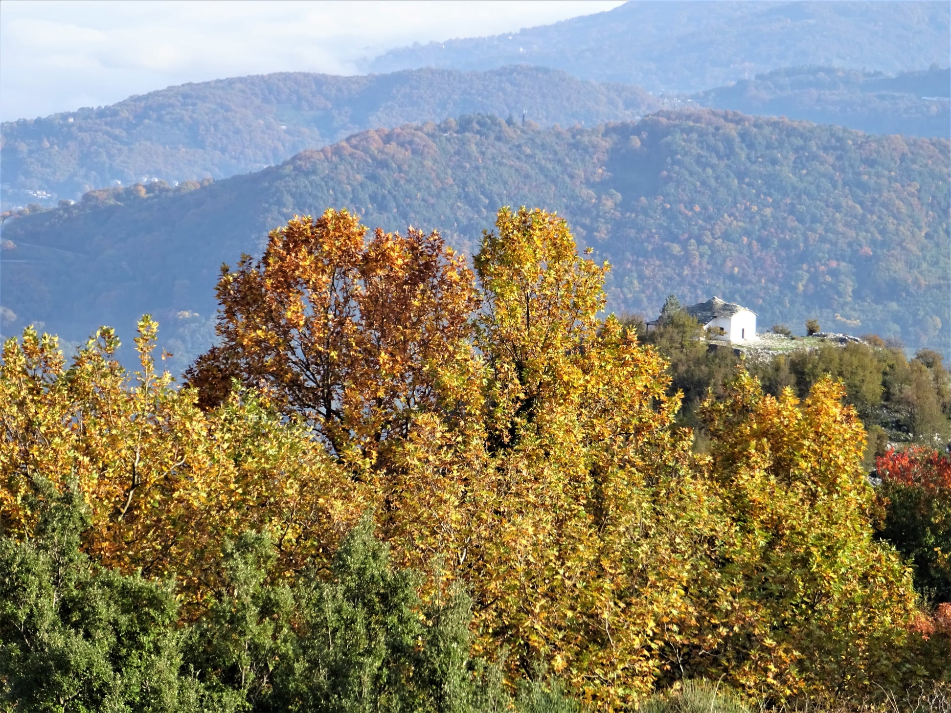
        Further down, we cross an apple grove (as the path on the side of the grove is very overgrown), and join a dirt road again turning right. Going downhill, the road below is paved with cement as it passes between cherry and apple groves. From one point we have a nice view to the chapel of Agios Athonas, built on a hill above Zagora. 
Agios Athonas chapel

         A little further north we see another hill with antennas at the top, which on the map is referred to as "Lefko Kotroni" (732 m.).

        Going down the concrete road and watching for the red signs at the intersections, we pass by the church of St. Magdalene. Further down we find a section of the original kalderimi as we descend next to the fence of a cottage. We continue on  kalderimi covered by cement. Further down, as we get into the village and cement paving ceases,  the original kalderimi reappears and leads us straight to the central square of Agios Georgios.

Agios Georgios (Zagora main square)


Sunday, May 29, 2022

Katigiorgis-Promiri-Rodia (circular)


Promyri

Distance: 18.2 km.

Time: 7.5 hours with stops

Altitude: from 0 m. (Katigiorgis) to 234 m. (Promiri square) to 373 m. (maximum)

Total ascent / descent: 622 m.

Marking: red marks and round signs

Drinking water on walk: Promiri

Start / end: Katigiorgis beach

Download GPS file (.gpx): from Wikiloc

Powered by Wikiloc

UPDATE 1/2025: After the floods the path is cut off at the stream near Promiri and remains impassable. We are working on a bypass.    

         In the book of the late Nikos Haratsis "A Pelion Guide for Walkers", published in 1995, there is a description of the route Promiri-Rodia, noting that "the route has been completely abandoned for many years, and therefore is closed at many points''. After another 28 years of complete abandon, one can imagine how closed the kalderimi-path was.

The path before cleaning

        However, in the winter of 2022, with voluntary work and with a lot of patience and perseverance we managed to find and open the lost path. So now, restored and signed, it can be used either in combination with the other route via Lyri (Promyri-Lyri-Katigiorgis)  to create a circular walk, as we did here, or to walk only the new path section from Promiri to Katigiorgis (Promiri-Rodia-Vromoneri-Katigiorgis, a distance of ten kilometers). In the latter case, we must have arranged how to return to Promiri. One option is to take the bus that makes the route from Katigiorgis to Promiri-Volos (summer and winter schedules are different, check timetables of Katigiorgis-Volos route at www.ktelvolou.gr ).

Approaching Promiri via Lyri

        In the circular route presented here, we first climb from Katigiorgis to Promiri via Lyri and then return by the new path via Rodia-Vromoneri. 

Katigiorgis

        Starting from the beach of Katigiorgis, we go up on the main road. After 100 meters, as the road turns, we go straight ahead on a narrow uphill concrete road, which surely was a cobblestone path in the past. We cross the asphalt and continue on a dirt road in a pine forest. At the intersection we go right, paying attention to the red marks. Here this road section looks abandoned. Our course is generally to the north-northwest. Further on, walking on a dirt road, after a fence on our right, we leave the road to the right and find a path that goes down and crosses a small stream.


        We climb through an olive grove, having a kiosk on our right and reach the ridge, where we cross a dirt road and  continue on a straight line, in a pine tree forest. Descending, we find ourselves in an olive grove again, keeping the same (northern) direction  and cross another small stream.

Ο
Through the olive grove

      We climb again in an olive grove, just next to its border with wild vegetation, which is on our left.  Reaching the ridge, there is a crossing of dirt roads and we go straight downhill. A little further down we have an intersection, where we go straight. In front of us is the Laskos estate. The path is on the left side of the road. After it was cleaned in 2018, it is again today (May 2022) closed by vegetation and needs cleaning again. In any case, if it`s closed, we can follow it walking on the road along its side, until we see it becomes passable again. It becomes a kalderimi for a few meters.

At Laskos estate

         Further on it comes out on a dirt road, which in turn comes out on the asphalt, opposite a bus stop shelter. We walk on the asphalt to the left, through the settlement of Lyri. At the exit of the settlement we cross with a stream. This is the large stream by the name ''Gerogianni'' that comes from Promiri.  There is a metal bridge on the right side of the road. We turn left, walking on a vague path with red signs next to the stream. Further on, we cross the stream and pass to its left bank. When we did the walks (June 2019 and May 2022) the path was maintained and we had no problem. If this section is unmaintained and blocked by vegetation and brambles, we can always walk into the stream bed (the stream is normally dry, unless there is rain, in that case walking is not recommended).

Walking on the streambed

         At the end of this path section, we cross to the right bank of the stream and walk parallel to it, into an olive grove. We cross the stream a couple more times, until we come to a dirt road that also crosses the stream. We are now walking on this road, having the streambed on our left. In a little while, at a fork in the road, we take the left branch, which goes just next to the riverbed. As we ascend, we can make out sections of kalderimi in the road. Approaching Promiri, the road becomes asphalt and then stone paved.

Dormition of Theotokos church, Promiri

        We pass over the central church of the Dormition of the Theotokos, built in 1760. A little further up is the village square, where we will definitely have a longer stop for coffee or refreshments. So far we have walked for about three hours from Katigiorgis.

Promiri square

         Now it`s time to walk back. Keeping on the main street we come to exit the village. After the gas station there is an information board on the side of the road made by the Friends of the Kalderimi of South Pelion. A few meters on, the cobbled stone path branches off descending into the ravine, going to Platanias and we follow it. We cross a stream and in a few minutes we reach a crossroads signed with a pole (attention!) The path to Platanias continues straight ahead, but we go left, changing direction now towards Rodia. In a few meters we see on our left an old fountain without water.

At Kanalaki

        We are now at the location "Kanalaki", in an impressive setting with rocks, running water in the streams, large plane trees whose trunks take strange shapes, a magic forest. The old half-ruined cobbled path, after crossing two small streams, begins to climb with sharp turns. Here it is wide and in good condition.

        Leaving the wooded ravine, we continue uphill on a grassy unused dirt road and in a few meters we see the path on our left and follow it. We continue in the same direction at the right border of an olive grove and higher up we cross a dirt road. Here at the making of the road, the bulldozer dug the ground half a meter below he path level, and we have to climb this to continue on the path. We ascend parallel to the road, which is on our left, but after a while the path joins the road, on which we come to walk on. Further on, we find the continuity of the path on our left (a cairn marks that point along with red paint). We are at Mavron Oros (Black Mountain), which is really a hill and not a mountain (422 meters high), located south of Promιri. On our way we reach a maximum altitude of 373 meters. 

View to Skiathos and Aegean sea

        A dirt road passes on the ridge as we come and cross it, next to a pole with round signs. From this point we have a nice view to the Aegean and Skiathos. 

A pole with round signs by the Friends of the Kalderimi of South Pelion


      The path now descends steadily in a southeast direction. We cross the stream of Kriovrisi on a section of kalderimi and then we ascend in a wooded area, until we reach an olive grove.

Crossing Kriovrisi stream

                 From now on, until we reach Vromoneri, we will be walking on rural earth roads. Reaching a  hut we go right and at a new intersection we go right again on the main (wider) road. We come to another intersection, where we go left on the wider road, noticing the round sign on the tree. Again at a new intersection we go left (to the right it goes into the settlement of Rodia, which is at close distance, but we do not need to go there). In a short while we see in front of us the chapel of Agios Ioannis the Theologian, a good place for a stop. 

Agios Ioannis Theologos chapel

        We continue on the dirt road to the east, then we take the asphalt for 500 meters and then we follow the road sign to Vromoneri beach.

Vromoneri beach

        A path continues from Vromoneri parallel to the coastline, through pine forest. Various signs help to guide us to Katigiorgis. On our way, we pass by the tiny beach of Vlachorema.

Vlachorema beach

Vlachorema


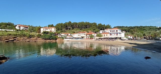
We go down through the yard of the '' Aura '' studios and finally reach the beach of Katigiorgis and the cafe-restaurants that operate there.  
Katigiorgis