 |
| Αegean Blue |
Distance: 9,4 km.
Time: 6 hours
Altitude: from 15 m. (Panagia) to 424 m. (Tsitsourava peak) to 0 m. (Agia Kyriaki)
Total elevation gain: 629 m. Total elevation loss: 641 m.
Signing: red paint marks, cairns
Drinking water on walk: no
Start: Panagia chapel (signpost on the asphalt road)
End: Agia Kyriaki harbour
Last checked: December 2022
Download GPS file (gpx): from Wikiloc
*
This is the western part of the Tisseon crossing. Starting from the chapel of Panagia next to the asphalt, we climb towards the Karatassos pit and then, moving along the ridge to the west, we reach the village of Trikeri, from where we finally descend to finish in Agia Kyriaki. The route has spots that offer excellent views of the Aegean sea and Pagasitic gulf.

From Panagia to Karatassos clearing we walk through mixed Mediterranean vegetation that offers enough shade, but then the holly trees dominate on stony ground, as is the case in the rest of Tisseon. This makes walking more tiring and at the same time requires continuous attention, because the stones slip treacherously if wet from the morning moisture. And the holly trees (quercus coccifera) have a tendency to flare up in the absence of a goat flock, making it difficult to pass. Nevertheless, the route is expected to be cleaned and signposted within 2023, along with others, with money from the European Leader program.

Note: the new recording of the route near the peak of Tsitsourava at 424 m. is more correct, easier and offers a much better view than the previous recording, shown on the maps so far. We recommend it.
On the road from Milina to Trikeri, after the fish farm, we see by the road the sign (in Greek) ΙΕΡΟΣ ΝΑΟΣ ΠΑΝΑΓΙΑΣ, meaning "Holy Church of Virgin Mary (Panagia)"). The church is located a little lower, close to the sea and is not visible from the asphalt. Next to the road there is also a fallen marble commemorative plaque that refers to the battles fought here by the rebel Greeks, led by Karatassos, with the Turkish army under Mahmud pascha (Kiutachi) in 1823.
 |
| The path near Panagia |
A signpost on the other side of the road marks the beginning of the path. It climbs through a maquis forest. We pass a first small uphill glade and soon we come out to a large, elongated clearing, named after Karatassos. Approximately in the middle, there is a cairn marking the path that leads to the peak Evzonos (644 m.) to the left.

We do not follow this, but continue straight ahead on a westerly diretion. From the upper edge of Karatassos glade we find a path with red markings, that heads west-southwest. We pass through a couple of other clearings and eventually we reach a small rocky plateau. If we stand on the edge of the cliff that is to our left, we will have a wonderful view towards the Aegean.

From here on, the path becomes unclear, as we climb into stony ground with holly oak vegetation. We walk close to the edge of the cliff in the direction of the pillar of the Tsitsourava peak (424 m.) and the wind measuring mast next to it. Note: this beautiful and unique natural environment is in danger of becoming a wind farm by greedy investors, thus suffering an irreversible damage. Let us hope this will never be allowed to happen.

 |
 |
| Trikeri at a distance |
 |
| Κastro |
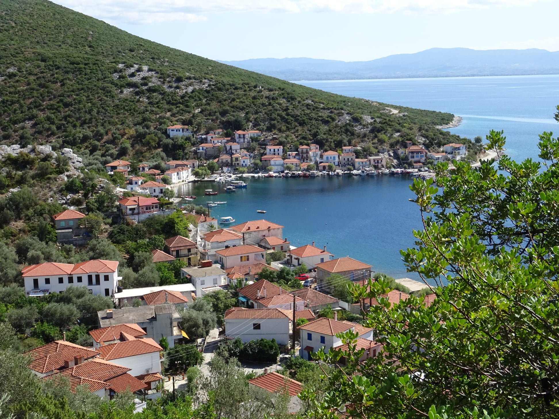 |
| Agia Kyriaki |
 |
| Trikeri square (in summer) |
.jpg)


