Showing posts with label Horefto. Show all posts

Sunday, April 17, 2022

Chorefto-Zagora-Panagia Rasova-Pouri (circular)


Parisena beach


Distance: 16,7 km

Time: 8 hours (with stops)

Altitude: from 0 m. (Chorefto) to 700 m. (max)

Total elevation gain/loss: 906 m.

Signing: red paint, metal and wooden signs

Drinking water on walk: yes (Zagora, Rasova, Pouri, Chorefto)

Start/end: Chorefto beach, at the turn of the asphalt to Zagora

Download GPS file (.gpx): from Wikiloc


Powered by Wikiloc
    This is a long circular walk in East Pelion, connecting Zagora and Pouri by a mountainous and a coastal way as well. If we do the walk in spring, we will get the bonus to admire at a distance the waterfall of Megalovrachos, the biggest in Pelion, that remains dry in summer.

    Starting from the beach of Chorefto, we walk on the asphalt as it takes an uphill turn heading to Zagora, and then leave it to the right, taking an uphill cement road going to Aegeus hotel. The road  has a central stone paved lane, and is obviously a former kalderimi. Higher up, cement paving ends and the stones of the kalderimi appear. This section suffers from a landslide and a fallen tree, but we manage to keep on the track and eventually join an earth road. 

On the kalderimi to Sotira -or into the jungle?

    Here there are two options. We either walk on the earth road to the right, as in this recording, only taking attention at the road junctions (1st junction-to the left, 2nd junction-right, 3rd junction-left), or we take the path signed by rsctangular metal signs and red paint. Both routes meet higher up, becoming a wide, well-preserved kalderimi, that however soon becomes cement paved. 

View to Chorefto from above

    Following this uphill, we have to deal higher up with another kalderimi section affected by landslide and fallen trees. With some difficulty we can get through crawling on our knees. Then we get past a mule stable, trying not to scare the mules, and finally get to Metamorphosis (Sotira) church in Zagora. The building is relatively new, built in 1889 to replace the old church dating from 1168, that was unfortunately destroyed by devastating landslides and fire. Near the church is a drinking water fountain, highly appreciated after all this uphill walking. 
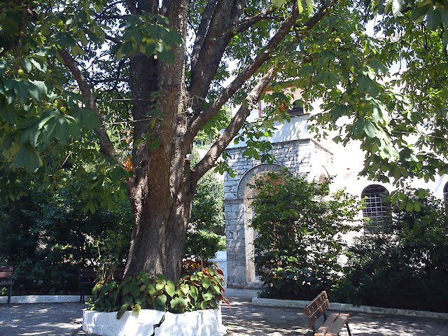
At the church of Metamorphosis (Sotira)

     Leaving the fountain, we continue uphill on a cement road (ΒΟΛΤΟΥ street) that again has a central stone lane. This opens on the main asphalt road of Zagora. We turn left and then leave it at an angle to the right. We keep climbing up in zigzags through the houses of Zagora, walking on kalderimi, paved or unpaved. At some point we pass near a characteristic old drinking water fountain, Platanovrisi.

Platanovrisi fountain

    Leaving the last houses of Zagora, we keep climbing on earth or cement roads in a generally westerly direction.

The waterfall of Megalovrachos


    From a certain point we can see a a distance the waterfall of Megalovrachos, an impressive sight as it is the biggest and highest waterfall in Pelion. It only has water in the spring when the snow is melting, and gets dry in summer. We will have to take our shoes off to cross the stream of Kalokerinou.

Crossing Kalokerinou stream

    The road crosses the stream of Kalokerinou above the waterfall, then two more smaller streams and then we start going downhill, eventually reaching the old church of Panagia Rasova, one of the oldest in Pelion.

Panagia Rasova church

    Built around 1250, it is the only remnant of a fortress-like monastery, whose last monk died in 1885. The surrounding cells and other buildings have collapsed and been removed over the years. It  is open only on its celebration day on November 21st, the Entrance (or Presentation) of Virgin Mary.


    We continue on the road downhill, keeping attention on the left for the cedar tree. When we reach this, we turn left and traverse an apple grove. On the other side of the grove we continue on a downhill road that gets us to the upper quarter of Pouri.  We take a kalderimi on the right, that opens to the main asphalt road at the entrance of Pouri. Here also is a drinking  water fountain. We walk a short distance on the asphalt and, just as we reach the parking lot and the taverna of Makis, which is on our left, we take the narrow cement paved road on the right, descending through the houses. Shortly, cement paving ceases and we now walk on proper kalderimi. 

Pouri

    This brings us down to the villages graveyard, a good place to have a stop with the Aegean sea in sight, and then continue downhill. Eventually we join an earth road and then a narrow asphalt. As it takes a sharp left turn to end at Elitsa beach and the picturesque little church of Agii Pantes (All Saints), We continue on a straight line southbound, cross again Kalokerinou stream over a bridge, get past the church and reach the pebbly beach of Analipsi. 

Analipsi beach

    An earth road branches off to the right, going to Chorefto. Walking on the beach we pass a summer taverna (Plimari) and, at the last house we climb a few steps, then walk on an earth path having a cottage on our right. An uphill path (not visible from distance) marked with red paint leads us to the small chapel of Agios Nikolaos, a nice place to have a stop under the shade of the trees.

Agios Nikolaos chapel

     We continue on a cement road downhill, walking along fenced property. This section of the path suffered heavily from a landslide some years ago, forcing us to take the detour via Agios Nikolaos as the original path has disappeared. Anyway, the last fence is soon left behind and we find ourselves walking on a beautiful path-kalderimi a few meters above the sea. 

The shrine between Parisena and Tourkou beaches

    A large shrine is built on the side of the path inbetween the beaches of Tourkou and Parisena. These two beaches carry a ''hippie'' style due to nudism and free camping practiced  by its summer visitors.

Parisena beach

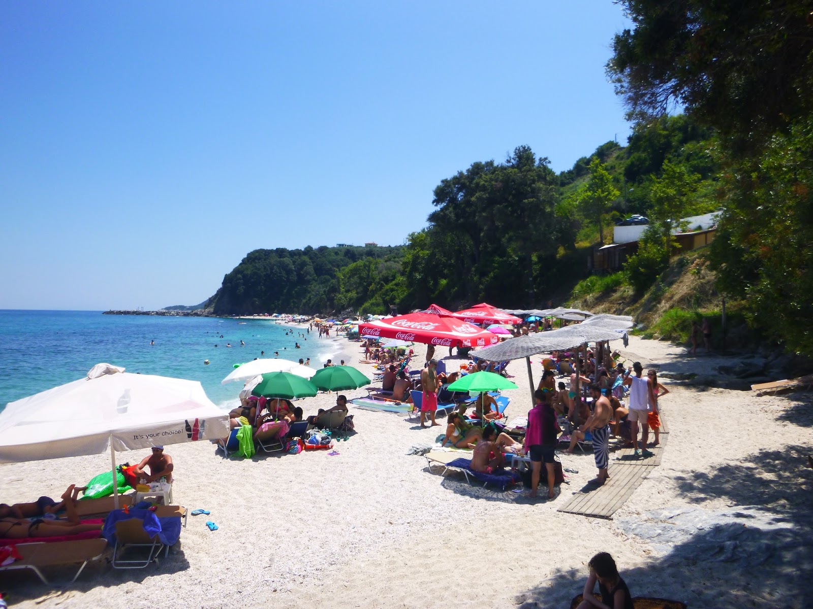
     The kalderimi eventually takes us down to the large sandy beach of Parisena. After walking along it, we climb on kalderimi past the rocks and reach the northern end of Chorefto beach, coming to the point where our walk had started from.          

Chorefto beach


Sunday, April 20, 2014

Chorefto-Agios Ioannis (Αi Giannis)

Agii Saranda beach, view from the south

Distance: 7,5 km
Duration: 3,5 hours (walking time 3 h)
Altitude: from 0 m. (Ηorefto) to 190 m. to 0 m. (Ai Giannis)
Total ascent/descent: 420 m. 
Signing: red marks, a few round yellow signs
Drinking water on walk: Panagia Faneromeni chapel
Download GPS track:  from Everytrail   from Wikiloc


       Τhis route connects the two main tourist beaches of Pelion`s eastern coast, Chorefto and Ai Giannis, passing from another three beaches that lie in between (Agii Saranda, Banikas, Plaka). It is not entirely coastal though, as it reaches a maximum altitude of 190 meters. 
Route B
           Starting from the camping at the south end of Chorefto beach, we walk uphill on the asphalt.  The original path`s course followed the earth road on the left, that eventually ends at a fenced grove.  Unfortunately, because of a landslide, the path section at that spot now has collapsed and disappeared, so we have to pass through the fence, but the owner objects and does not permit passing through his property. So, to avoid any trouble, we prefer to follow the asphalt uphill.
Agii Saranda, view from the north
          At the third turn of the asphalt, we head straight to guesthouse ''ENASTRON''. Walking on the right side of the building, we continue straight ahead on a path which soon joins an earth road. We head left and then to the right, and pass just under a small hut on our left side. After that hut, the path is obvious and goes downhill to reach the narrow asphalt road leading to the beach of  Agii Saranda.
Agii Saranda beach (in February)
          Having reached the large sandy beach of Agii Saranda, we walk to the other end and just after the statue on the rock, next to the taverna on the right, we start walking on an earth road going uphill. An earth road coming from the beach bar Monk joins in from the left.
          After about seven hundred meters, we reach a junction where we head left downhill. Further down, at a sharp right bend of the road (attention!), we go straight ahead to find the only surviving section of the old path and we soon get down to the quiet pebbly beach of Banikas.
On the surviving section of the old path to Banikas beach
          We cross the stream (called Mega Rema). To our left is a deserted house next to the sea and to the right a renovated cottage.
Banikas beach
         At the end of the beach is a third cottage and we take the earth road starting from there going uphill.
Renovated cottage at Banikas
             At a short distance there is a junction, and we take the narrow road to the left, passing just above the cottage leading to a grove. We keep climbing up steeply and at the upper edge of the grove we notice an unused concrete irrigation ditch. Following this, a few meters higher up we find the continuity of the path which ascends steeply in holm oak (quercus ilex) forest. The path may be overgrown at some spots, so it is advisable to wear long trousers. Eventually we come to an olive grove and continue straight ahead uphill to the chapel of Agios Charalambos.
Agios Charalambos chapel
             Next to the chapel lies a wooden kiosk. We continue on the earth road and, after 150 meters at a right uphill turn of the road, watching on the left side (attention!), we find the continuity of the path. It goes down through jungle-like vegetation, crosses a small stream and then opens to another earth road, on which we walk to the left. After another 100 meters, at a left downhill turn of the road (attention!) we find the path on the right and keep going downhill.
       Further down, we join another earth road at a junction. Here it is highly recommended to continue on the road downhill for ten minutes, to reach the quiet  chapel of Panagia Faneromeni. Built on a rock just above the Aegean sea, this is an excellent and beautiful example of Pelion`s hidden treasures, an absolute gem. Take some time to relax in quiet and refresh drinking the cool water that comes from a spring through the rock.
Panagia Faneromeni chapel
       Retracing our steps  back to the road junction, we now head left (south) on the road and after 500 meters we reach the fence of Hotel Eden. At that point we head left towards the sea (to the east), walking downhill on a path/kalderimi. Some sections of the old kalderimi have survived and others have been rebuilt, but unfortunately not to the best standard (the flat stones that were used can be slippery when wet-attention!).
Plaka beach in summer
         We walk next to a kiosk with a fallen pole and soon end down to the excellent sandy beach Plaka, which, like Banikas, belong to the village Anilio. In the past this used to be a quiet, remote place (fortunately it remains unaccessible by cars), but nowadays the bar-restaurant of Eden hotel from above makes it more lively, by virtue of the loud dance music played all day in summer (thankfully not heard at the other end of the beach).
Plaka beach (in February)
       We continue along the beach to the south, pass over the rocks at the end of it and arrive finally to the tourist seaside settlement of Ai Giannis (Agios Ioannis).

Wednesday, August 15, 2012

Pouri-Chorefto

Pouri

Distance: 5,7 km
Duration: walking time 1.50', total time (with stops) 2,5 h.
Altitude: from 423 m. (Pouri) to sea level
Signed with: red marks, a few signs
Drinking water on walk: beaches Analipsi, Tourkovrisi, Parisena


  Download GPS track:   from Wikiloc    from Everytrail     

          This is an excellent route, with sections of unique natural beauty offered by the paradise on earth that  Pelion mountain is. In the first part we climb on calderimi (cobbled stone way) down to the church of  St. John the Baptist (the kato [lower] Ai Giannis, as it is called by the locals), and then walk along the Aegean coastline, passing from several beautiful beaches, to finish at the large tourist beach of Horefto. Here, as well as in Pouri and Zagora of course, one can find restaurants and hotels and we can return by bus (check the timetables at www.ktelvolou.gr). The whole route is clean, except maybe from a tiny section of path near Ai Giannis church, which can be bypassed if necessary.
         At the end of the main asphalt road at Pouri, the bus stops to turn back at a concrete plateau that also serves as a parking lot. From its south edge (in the direction of Zagora) we follow a narrow downhill asphalt road (formerly kalderimi). In a few meters, next to the elementary school, the asphalt turns right and reveals a kalderimi in excellent condition on the left. Further down, it opens to a narrow asphalt next to a plane tree. Walking on the asphalt for 30 m downhill, we find again the kalderimi on the right and continue to descend.
Approaching the graveyard of Pouri

           We cross another asphalt and the kalderimi leads to the graveyard of Pouri. We pass next to a church and after a few meters (attention), watching out for the red marks, turn left downhill into forest. We descend in a beautiful natural scenery, first in forest and then amidst lower vegetation, in alternate sections of kalderimi and path. Eventually, the path opens to an earth road, descending in a southeasterly direction. We pass by a cottage and reach a junction with another road. Here we turn left and in a few meters right to a downhill path. The last time we passed (July 2012), unlike previous times, it was all but blocked by vegetation for 10 meters and we had to clean it with hand tools. If it is blocked indeed, then going back to the road junction we take the road to the right, heading southeast and after 150 m. there is an earth road on the left with a metal door, that after an initial bend leads straight to the church, which we see near the sea next to a few cypresses. The path I mentioned before opens to another earth road that immediately crosses the road to Ai Giannis and we go left.
Ai Giannis church near the sea rock
          In his book ''A hikers` guide to Mt.Pelion'', Nikos Haratsis says referring to Ai Giannis of Pouri: ''Of all the small country churches of Pelion, I think that this one has unique grace, unique solitude and  a unique view of the Aegean. Like a lonesome lighthouse keeper, rooted on this steep rock, twenty meters above the sea. Its only companions are a few trees-walnut, lemon, olive, cypresses-and a small hut beside it. If you walk to the edge of the rock and look to the east, you can see the capes of Horefto, Agios Ioannis of Kissos and Damouchari. Dear Lord, there are not enough hymns to praise this holy place you have blessed us with''.
       Coming back from the church,  we walk straight on the road, pass through the metal door (it was open anyway) and continue to the left on earth road, that soon becomes concrete and opens to a sharp bend of the asphalt coming from Pouri. Walking on the asphalt downhill, we get to another bend, with a sharp left turn towards Elitsa beach that is nearby. At this point we continue straight ahead on an earth road, and pass a stream over a concrete bridge. At a junction we take the road to the left and pass by the small chapel of Analipsi, newly built, as the stream flooded in recent years and destroyed completely the old church. We then reach the homonymous beach (Analipsi), pass by a taverna near the sea and, just at the end of the beach, after the last house, there is a narrow path on the right climbing the slope. At a junction we head left, walking parallel to the coastline, twenty meters above the sea.
Analipsi beach as seen from the path

       Soon the path widens and we find ourselves wishing it would never end, due to the striking natural beauty around us.
Tourkovrisi beach
         We pass above Tourkovrisi beach and then next to a white shrine, built, as we were told, by a local after he had found an icon into the sea. There are sections of kalderimi on our way, more and more often.
The shrine between Tourkovrisi and Parisena beaches

        The kalderimi passes by the renovated old Pantos mansion and opens to the sandy beach of Parisena. This one, like Tourkovrisi, maintain a ''hippie'' style, as they are both accessed only by foot, and one can find here free campers and nudists, young and old.
Pantos mansion above Parisena beach
          Walking along Parisena beach on the sand, we find at the other end a path-kalderimi that takes us to the tourist location of Horefto.


Zagora-Chorefto

Horefto

Distance: 3,1 km one way (6,2 km with return)
Duration: 1h.15´ total time one way (walking time 1 h one way)
Altitude: from 472 m. (Zagora) to sea level (Horefto)
Total elevation gain: 442 m. Total elevation loss: 459 m.
Signed with red paint and metal signs
Drinking water on walk: no (only at the squares)
Start: Agios Georgios square
End: Above Metamorphosis church (Sotira), at the corner of Voltou str. with the main asphalt.
Last checked: March 2021


Download GPS track:   from Wikiloc   

       There are two main kalderimi (cobbled stone path)  routes linking Zagora and Horefto, one starting from Agios Georgios square and another from Metamorphosis (or Sotira) church, so one can use both to make a circular walk. We can also walk one way and return by bus (see timetables at www.ktelvolou.gr) or taxi. It is advisable to wear long trousers and hiking shoes, because vegetation may be overgrown at certain spots, mostly in the southern route, despite some efforts to keep the routes clean. 

        Starting from the lower corner of Agios Georgios square in Zagora, opposite to the church, we walk on the asphalt to the right, in a southerly direction. Reaching the post office after 50 m., we turn left downhill on kalderimi, passing next to a renovated mansion, then turn left downhill. The kalderimi opens to the main asphalt, where we turn right and walk for another 30 m. to find again the kalderimi on the left, noticing the red paint marks. Further down it gets covered by concrete and opens out to the asphalt going to Horefto, just above the old building that used to house the Ellinomouseion school where the national hero Rigas Velestinlis teached in late 18th century (there is a sign ''ΣΧΟΛΕΙΟ ΡΗΓΑ''). A little lower is the graveyard and a church.
The church next to Ellinomouseion School

       Walking on the asphalt for another 50 m., we find again the kalderimi on the left. Further down it becomes an earth road. Reaching a T-junction we head left, among apple tree groves.  We can see traces of cobbled stone into the road. At a V-junction we go downhill. A little further down, as the road takes a downhill right turn (attention) we leave it to the left, to find again the kalderimi that is half covered by soil and barely visible. We cross a small stream and walk on a narrow path following its left bank for a few meters (we step over a water tube), then a section of kalderimi again, then earth road.
         Reaching a junction, we take a sharp right turn. Our road soon turns left downhill and at that point (attention), just after the end of the turn, we climb down to the right, noticing the red marks on the bricks. For a few meters the kalderimi is not visible, covered by soil, but then emerges again going downhill on a straight line, between groves. A little further down, there is a wooden fence with a sign on the right.
Zagora agricultural cooperative site
          Soon our path reaches the site of the agricultural cooperative of Zagora (''Zagorin''). We have to climb down a steep narrow path to get to the earth road above the site. Here steps should be constructed to facilitate access to the road. At the corner of the fence we go right, following it around the estate. Reaching a large metal door at the fence, we go left to find the kalderimi a few meters down below, heading east on a straight line. This section suffers from fast-growing brumble, so long trousers are indispensable.
        After a little while, there is a cottage with a stone fence in front of us. We walk down next to the fence, then follow the concrete road and cross the asphalt. There is yet another fence at the left. We cross the asphalt again and walk on a concrete road on the other side. As the concrete road turns left (ATTENTION), the course of the kalderimi continues straight ahead. Only problem is, you can`t see it and you can`t walk on it,  because it is covered with vegetation and branches that are thrown on it. We have to  follow its course walking above and next to it freely through the olive grove, until lower down we are able to join the proper path again. (last checked  March 2021). 
Approaching Horefto

        Further down, we reach the asphalt again as it takes a right turn. We go left on a narrow road to find the kalderimi immediately on our right. It opens to a concrete road and then to the asphalt again. In a few meters we take a concrete road on the right leading to a private property entrance, only to find the kalderimi next to the fence. We finally reach the seaside road of Horefto. There is a parking lot on the left with a small drinking water fountain at the corner. On the other side is the fence of Aeolos hotel. Checking the watch, it took us about 1 h.15` to descend from Zagora.
Horefto beach

         Now it`s time to return. Walking on the road to the north (to the left) along the seashore, just before it takes the left turn going to Zagora, we go left next to a market shop and walk on concrete way between houses, thus avoiding the asphalt and cutting the corner. We cross the asphalt and continue climbing steadily on concrete road next to Aegeus (AΙΓΕΥΣ) hotel, noticing a signpost to ''Zαγορά'' (Zagora) at the corner. That road has a stone paved central lane. After five minutes the concrete ends, revealing the kalderimi that was underneath. 
        We pass next to an underground water tank on the left of the kalderimi, which keeps climbing until it joins an earth road at an angle (for information, if we go left here, after 100 m. we shall meet an alternative path that joins the main route further up). We keep on the main route, walk to the right, and in 50 m. go left uphill at a junction. If we look carefully at the road, we shall see some traces of kalderimi. The road keeps climbing with zigzags, then joins another road and we go right. In 50 m. we go left uphill at another junction. Again we see bits of kalderimi as the road passes by a grove on the right, then comes an uphill section of concrete and we reach an irrigation ditch. Here the alternate path joins in from the left. On the right, a wide and clear kalderimi appears and we follow it. Soon it becomes concrete road again, climbing steadily on a straight line. 
Old stone house on the way to Sotira

        We pass by an old derelict stone house, then the road turns right and 150 m. after the turn (attention), noticing the red marks, we go left on a narrow road and immediately right, to a path that soon joins the kalderimi. Further up, it opens out at an earth road on a bend, and continues to the right. Climbing in chestnut forest, the kalderimi suffers from landslides (attention), and finally opens to an earth road next to a horse stable and a hiker signpost. In a few meters we join a wider uphill road, that leads to the church of Metamorphosis, also called Sotira by locals. The present church was built in 1889 to replace the old one, dating from 1168 AD (the oldest church in Zagora), after its total destruction by landslides and fire.
Metamorphosis church  (Sotira) 

        We enter the church yard, climb the stairs and happily reach a drinking water fountain. After quenching our thirst, we climb a few more steps and join an uphill concrete road that features a centre lane of kalderimi, named Voltou street (ΒΟΛΤΟΥ). That finally opens to the main asphalt of Zagora, at the corner of hotel ''Anasa''. If we walk on the asphalt to the left, in 10 minutes we will be back to the main square of Agios Georgios.
Agios Georgios square at Zagora
.