Showing posts with label Makrinitsa. Show all posts

Monday, May 30, 2022

Makrinitsa-Pliasidi-Zagora


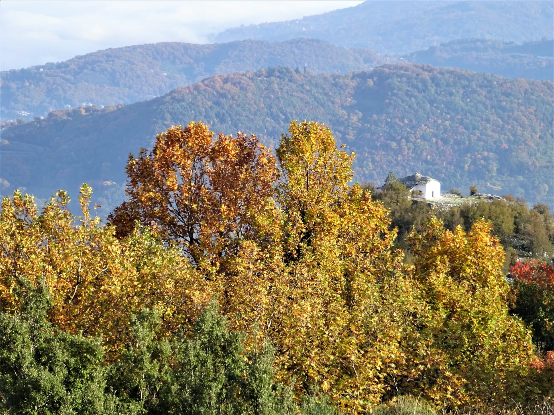
View to Horefto 

Distance: 18,5 km.

Time: 8 hours (with stops)

Altitude: from 620 m. (Makrinitsa) to 1480 m. (max) to 510 m. (Zagora)

Total elevation gain: 1075 m.

Total elevation loss: 950 m.

Signing: red paint, some metal signs

Drinking water on walk: Agia Paraskevi mon. near Makrinitsa

Start: Brani parking lot,  Makrinitsa (end of asphalt road) 

End: Agios Georgios square, Zagora

Download GPS file (.gpx): from Wikiloc


Powered by Wikiloc

        In his book ''History of the Provinces of Volos and Agia'' (published in 1960) Yiannis Kordatos, a renowned scholar of Zagora,  mentions an alternative, higher way used by locals to go from Zagora to Makrinitsa-Volos: (sic) starting to climb from ''Kordateika'' or Platanovrisi, passing by the ''middle Kotroni'', reaching ''Schizopetras'', turn west, get past ''Machera fountain''  and from the peak ''Plesidi'' go down to Makrinitsa. We tried to unearth this forgotten route, and after some research came up with this 8-hour walk. 

 After having some rest and refreshments at Agios Georgios square in Zagora,  we may wish to  continue descending for an hour or so to get down to Horefto beach  for a refreshing swim to the sea.


          As we come to the higher parking lot at Makrinitsa, at the end of the asphalt road, we see on the right a kalderimi (cobblestone path) heading uphill. A red handmade sign indicating to ''Πουρί'' (Pouri village)) is nailed to a tree. This was made, along with  many others, by the late local hiker Dimitris Kottalis. One can also start from the drinking water fountain in the parking. On our way from Makrinitsa to Pliasidi, in addition to the usual plain red marks, there also are red-on-white  marks that belong to a mountain running race (Ultra Pelion Trail, UPT).

Makrinitsa

    The kalderimi winds uphill among the village houses, passing by a lone pine tree next to a bench and two fountains and eventually opens to a narrow dirt road, which leads us to the old monastery of Agia Paraskevi. 
Agia Paraskevi chapel

        Having enjoyed a refreshing stop at that tranquil spot and filling our water supplies from the fountain (no other fountain is on our way), we continue uphill on dirt road. After a right turn we find the path on our left. It soon opens to another dirt road, which then turns right and comes to an end. We continue on a path with sections of cobblestone, climbing into chestnut forest.

Path in chestnut forest

         We cross an earth road and further up turn left on another road. Watching on our right side, after about 30 m. we find the path again, climbing between chestnut trees. Further up, we walk parallel to a water ditch, noticing another handmade sign to “Pouri”. From a certain spot, we can see lake Karla at a distance to the west.

Agios Augoustinos chapel at Trano Isoma

         On our way is also the newly built chapel of Agios Augoustinos, where we can have a stop. We continue on dirt road and come to a signed road junction. We continue straight ahead on a northeasterly direction, next to a concrete irrigation ditch. The road ahead leads  to Flabouro springs and Pourianos Stavros peak. After 50 meters we turn right (attention!) on another dirt road that climbs steeply uphill. On a tree a small round sign indicates the direction to ''Pliasidi'' to the right. The red-on-white marks are still with us on this way.


        We pass by the Tzanopoulos estate, where there is a hut. On our left we see a square building, probably a water tank. Immediately after the estate the road makes a slight left turn downhill goeing to Flambouro. At this point we leave it and go straight ahead uphill in an easterly direction on a path, which eventually takes us to the asphalt that goes to the military radars. We are close to the peak of Pliasidi (1547 m.), which is on our right, but getting to the fenced  top is prohibited.


        Reaching the asphalt, the red-on-white marks turn to the right and we leave them (attention). Here we turn left and walk on the asphalt for about 2.3 km, going towards the radars. At the second junction with a dirt road on the right, we leave the asphalt and take the road, which descends northeast into the beech forest.  We pass by a large rock, which the locals call "Machera". From some points we have a very nice view to the south, seeing three large wooded ridges descending to the sea one behind the other.


       Further down, at an altitude of 1180 meters, as we join another dirt road (which comes from the asphalt just below Hania), we reach a small shelter hut for hunters and firewatchers that has the inscription "ΘΗΡΟΦΥΛΑΚEΙΟ ΠΥΡΟΦΥΛΑΚEΙΟ'' (in Greek). On the day we passed (7/11/21) it was being renovated by a group of hunters. 

At the hunters shelter

        We walk on the road to the left for two hundred meters and go right at the junction (straight ahead, the road goes to Xeforti and Agia Marina). The area here is called "Schizopetra". Descending, we find successive sections of path that alternate with sections of road and we need to pay attention to the red marks. Οur general direction is to the northeast.

Path in beech forest

        Further down, we cross an apple grove (as the path on the side of the grove is very overgrown), and join a dirt road again turning right. Going downhill, the road below is paved with cement as it passes between cherry and apple groves. From one point we have a nice view to the chapel of Agios Athonas, built on a hill above Zagora. 
Agios Athonas chapel

         A little further north we see another hill with antennas at the top, which on the map is referred to as "Lefko Kotroni" (732 m.).

        Going down the concrete road and watching for the red signs at the intersections, we pass by the church of St. Magdalene. Further down we find a section of the original kalderimi as we descend next to the fence of a cottage. We continue on  kalderimi covered by cement. Further down, as we get into the village and cement paving ceases,  the original kalderimi reappears and leads us straight to the central square of Agios Georgios.

Agios Georgios (Zagora main square)


Sunday, December 30, 2018

Makrinitsa-Stagiates-Portaria (circular)

Distance: 8,8 km
Time: 4,5 hours (walking time 3h20')
Altitude: max 888 m., min 394 m.
Total elevation gain/loss: 635 m.
Signed with various signs and red paint
Start/finish: Makrinitsa (end of bus line) or Portaria (Adamena fountain) or Stagiates (square)
Drinking water on walk: yes (Makrinitsa, Stagiates, Mana spring)
Download GPS track (.gpx): from Wikiloc

Powered by Wikiloc

   UPDATE  11/2023: THE ROUTE IS IMPASSABLE  DUE TO THE TERRIBLE FLOODING OF SEPTEMBER 2023.   
  After a new path was opened in 2018, which connects Mana spring of Portaria to Makrinitsa at a level higher than the asphalt road, we now have the opportunity to create a circular walk Portaria to Makrinitsa, avoiding the asphalt as much as possible. Caution is required after heavy rain, or when the snow melts in spring, causing the stream to flow enough water to make crossing difficult (usually it is dry). The walk is best avoided in such circumstances. 
      The walk may start either from Makrinitsa (end of bus line), or Portaria (Adamena fountain), or Stagiates village square. On this occasion, we elected to start from Makrinitsa.
Makrinitsa
      Starting from the bus U-turn at the entrance of Makrinitsa, we walk down on the narrow road going to the underage refugees' Hostel (ex-Preventorium), to find in a few meters the start of a kalderimi (cobblestone path) on our left. Going steadily downhill -the view from certain points is fabulous- we come to cross the Mega rema stream over a wooden bridge, built by local volunteers of the Association of Stagiates, at a beautiful spot with running water under the shadow of plane trees. After a little while, the path opens on a sharp turn of an earth road, which we follow on a straight line. Entering the village of Stagiates, the road becomes asphalt paved and leads to the main church and to the square next to it.  
Stagiates square

             Νext to the drinking water fountain at the square, the main  kalderimi goes uphill and we follow it. We cross the asphalt and continue climbing among houses. Higher up, as we exit the village, the kalderimi becomes road paved with cement. Ιn a few meters, we leave it at an angle to the right and keep climbing on earth path. Road sections and path-kalderimi sections alternate on our way up, until we come το join the main asphalt, just under the cemetery of Portaria. Walking on the main asphalt to the right (towards Portaria), after 400 m. we reach Adamena fountain and a cafe which is nearby. Here we leave the asphalt and start climbing on a path following the course of Mana`s stream. Several wooden pedestrian bridges make crossing the streambed easier, as water is running for the most part of the year (not in summer). We can easily imagine Centaurs strolling up and down in this fabulous scenery.
The path at Mana stream

         The path opens to a small plateau, next to a building of the water system collecting the water of Mana spring and a drinking water fountain. We continue uphill, following the plain red marks (attention!) and ignoring the red-on-white marks pointing downhill, which belong to a mountain running race (Ultra Trail Pelion, UTP).
Having a short break at Mana spring
          

      The path opens to an area where a few goats and other animals are kept and a stationary caravan is on our left, and we continue uphill on an earth road, ignoring signs in Greek to ''ΞΕΝΩΝΕΣ ΠΟΡΤΑΡΙΑΣ'' (a closed summer camp). In seven hundred meters we come to an earth road junction and take the left branch uphill. After another three hundred meters, as the road takes a right turn, we leave it on a straight line (the signpost we put here has sadly been removed by an unknown person), cross a small stream and continue on a narrow path traversing a rocky slope. 
Approaching the stream Mega rema. The path runs above the cliff 

         We come to cross the stream of Mega rema, an easy task as the stream usually is dry, but can be more difficult in case of recent heavy rain or melting snow in spring.  
Crossing the Mega rema (in spring)


      On the other bank the path, cleaned by volunteer work in 2018 and again in 2022, is half decent  and long trousers are still recommended. At some point there is a balcony offering truly magnificent view to Portaria, Makrinitsa, Volos and the Pagasitic Gulf below. 
View to Portaria


  In a little while the path seemingly disappears, as we come to a small plateau that used to be a vineyard previously, according to its owner who came to see what we were doing on his land. The path actually continues descending on the left edge of the plateau, but this section is deserted long ago and is totally blocked by overgrown vegetation. So, for the time present, we climb down to a second small plateau and turn right, finding at the edge a narrow path into oak forest.
A section of the path (we couldn`t lift the fallen stones, too heavy)

           Eventually we come down to an earth road,  on which we walk for one hundred meters. At that point we notice a kalderimi joining in at an angle from the left. Here we have the option to walk another hundred meters on the road to visit the small and quiet monastery of Agia Paraskevi and drink water from its fountain. Otherwise, we follow the kalderimi downhill. This gets us to the parking at the end of the asphalt road, on which we walk to return back to the end of the bus line, where our walk had started.   
  

Monday, November 12, 2018

Makrinitsa-Kapsales-West Refuge-Lagonika (circular)

Elatorema stream
Distance: 20,4 km
Time: 9 hours with stops
Altitude: from 630 m. (Makrinitsa) to 1434 m. (max)
Total elevation gain/loss: 1130 m.
Signing: plain red paint marks, metal signs
Drinking water on walk: yes (Agia Paraskevi, Elatorema, Krio Nero)
Srart/Finish: Parking of Makrinitsa at the end of asphalt road
Download GPS track: from Wikiloc

Powered by Wikiloc

              The path climbing from Karias bridge on the ridge Kapsales towards Pourianos Stavros was researched, cleared and signed in 2017/18. Now there are four alternative routes from Makrinitsa towards the mountaintop and ultimately to Pouri. In order from west to east, from Lagonika, from Glistri-West Refuge, from Kapsales-West Refuge (as in the present walk) and from Flambouro-Pourianos Stavros.
              In the present walk, we combined the first and third route to create a circular walk: we climbed from Kapsales to the West Refuge, continued to Lagonika peak via a connecting path and then returned to Makrinitsa via Chamorigani-Elatorema-Karias bridge-Trano Isoma-Agia Paraskevi. 
Our intention was to return to Makrinitsa via Profitis Elias (this used to be the main route to go from Makrinitsa to the mountain) but, as a path section just above the church used to be overgrown with vegetation (got cleaned in spring 2019), we passed again from Agia Paraskevi on our way back.
The path as seen on a map from 1938
               Another similar circular walk from Makrinitsa, combining the second and the fourth route, can be found here (in Greek). Of course, any combination is possible as we wish.  
             As we come to the parking lot at Makrinitsa, at the end of the asphalt road, we see on the right a kalderimi (cobblestone path) heading uphill. A red handmade sign indicating to ''Πουρί'' (Pouri village)) is nailed to a tree. This was made, along with  many others, by the late local hiker Dimitris Kotalis. One can also start from the fountain in the parking. The kalderimi winds uphill among the village houses, passing by a lone pine tree next to a bench and two fountains and eventually opens to a narrow dirt road, which leads us to the old monastery of Agia Paraskevi.
Agia Paraskevi

          Having enjoyed a refreshing stop at that tranquil spot and filling our water supplies from the fountain, we continue uphill on dirt road. After a right turn we find the path on our left. It soon opens to another dirt road, which then turns right and comes to an end. We continue on a path with sections of cobblestone, climbing into chestnut forest.
                                                               We cross an earth road and further up turn left on another road. Watching on our right side, after about 30 m. we find the path again, climbing between chestnut trees. Further up, we walk parallel to a water ditch, noticing another handmade sign to “Pouri”. From a certain spot, we can see lake Karla at a distance to the west.
          Passing next to a water tank, we  enter a secondary dirt road, which after a few meters joins the main dirt road coming from Makrinitsa. The location here is called Trano Isoma. We continue to the left and in twenty meters reach a junction next to a concrete ditch. The road to the right leads to Flambouro and Pourianos Stavros. We take the downhill road to the left, initially heading north, then turning west. We soon come to another junction. There is a shrine here at the junction. We take the road to the right on a north-northeasterly direction. This has replaced the old path (we can notice two small surviving sections of it at some point on our left) and eventually leads to the stone bridge of Karias, built in 1934 over the stream of Kaliakouda (Xerias).  
Karias bridge
          Just after the bridge, we leave the main road and take the narrow uphill earth road to the right. We pass easily through a closed metal door meant to stop cars, and higher up we find the path, signed with red paint, watching on our right. Climbing constantly in a northeasterly general direction, we shortly join higher up an abandoned earth road, pass through several clearings and finally, at 1430 m of altitude, the path opens to the earth road coming from the military area of Pourianos Stavros (and from the fourth route as described above). 
         Following the road downhill to the left, we soon reach the West Refuge. Built to an altitude of 1400 m, it can house 8-10 people and remains always open, unattended. A few meters before arriving to the Refuge, we notice the path on our right that continues towards Pouri.   
West Refuge
          After the refuge, we continue on the earth road going north. We notice on the left the signed path junction towards Glistri -Makrinitsa (second route as described above). We keep on the road, which eventually ends. Just a few meters before the end, looking for it on our left, we find the path that continues downhill into the beech forest. Further down, we come to a T-junction with another path, which we follow uphill to the left (in the other direction it leads downhill towards Pouri). 
View from Lagonika peak

         Reaching Lagonika peak at 1295 m. (the concrete pole can`t be seen, hidden by vegetation), we now turn southwest, having Pourianos Stavros peak and the beginning of Elatorema stream on our left. Descending steadily, we come to a rocky plateau called Chamorigani. Here another path branches to the right (north), going towards Antovitos and Sourvia monastery.  We don`t take that but continue downhill to the south, cross an earth road and come down to the bed of Elatorema stream. Here spring water is running from a plastic tube. 
Elatorema

                                                            On the other bank we climb on the slope until our path opens to the earth road. Keeping on the road going south we pass from Krio Nero (here is another spring with running water and a small deserted hut), Karias bridge and come back to Trano Isoma. From here we continue on the road to the right (west) towards Profitis Elias. As the road takes a right turn, we continue straight ahead finding the old path. Reaching an orchard, we take the earth road to the left, thus avoiding the overgrown path section to Profitis Elias which is on the right (cleaned in spring 2019).
Returning to Makrinitsa

       The road we are walking on meets the path-kalderimi of Agia Paraskevi and we follow this downhill to return back to Makrinitsa.
PS. Many thanks to Alekos Kayias, Akis Michalopoulos and Ian Allright who helped to research and clear the path at Kapsales.  

Friday, October 16, 2015

Makrinitsa-Lagonika-Pouri

Τhe ravine of Lagonika, opening to the Aegean Sea
Distance: 19 km
Time: 8 hours (walking time 6.25')
Altitude: from 620 m. (Makrinitsa) to 1290 m. (Lagonika) to 480 m. (Pouri)
Total elevation gain: 951 m.  Total elevation loss: 1076 m.
Signed with: red paint marks, some metal signs
Start: end of asphalt at Makrinitsa  End: Pouri square
Drinking water on walk; yes (Krio Nero)
Download GPS track (gpx):  from Everytrail   from Wikiloc

           This is the more westerly one of the three alternative routes from Makrinitsa to Pouri, the other two being Makrinitsa-West Refuge-Pouri and Makrinitsa-Pourianos Stavros-Pouri (the latter requires a permission from the Air Force authorities, because it is passing through the military installations at Pourianos Stavros).

                As we come to the parking lot at Makrinitsa, at the end of the asphalt road, we see on the right a kalderimi (cobblestone path) heading uphill. A handmade sign indicating to “Pouri”(Πουρί) is nailed to a tree. This was made, along with  many others, by a local volunteer hiker, Dimitris Kottalis. One can also start from the fountain in the parking.
Climbing from Makrinitsa

             The kalderimi winds uphill among the village houses, passing by a lone pine tree next to a bench and two fountains and eventually opens to a narrow dirt road, which leads us to the old monastery of Agia Paraskevi.
Agia Paraskevi church
           After a refreshing stop at that tranquil spot and filling our water supplies from the fountain, we continue uphill on dirt road. After a right turn we find the path on our left. It soon opens to another dirt road, which then turns right and comes to an end. We continue on path with cobblestone sections, climbing into chestnut forest.
           We cross an earth road and further up turn left on another road. Watching on our right side, after about 30 m. we find the path again, climbing between chestnut trees. Further up, we walk parallel to a water ditch, noticing another handmade sign to “Pouri”. From a certain spot, we can see lake Karla at a distance to the west.
View to lake Karla
                Passing next to a water tank, we  enter a secondary dirt road, which after a few meters joins the main dirt road coming from Makrinitsa. The location here is called Trano Isoma. We continue to the left and in twenty meters reach a junction next to a concrete ditch. The road to the right leads to Flambouro and Pourianos Stavros. We take the downhill road to the left, initially heading north, then turning west. We soon come to another junction with a shrine. 
             Here we take the road to the right on a north-northeasterly direction. This has replaced the old path (we can notice two small surviving sections of it on our left) and eventually leads to the stone bridge of Karias, built in 1934 over the stream of Kaliakouda (Xerias).  
Karias stone bridge
          After the bridge, the earth road continues uphill to the north and we pass next to a hut at location Krio Nero (means cold water). Here we can fill our bottles with drinking water, as there is no other fountain on our way. Heading on, the road  takes a northeasterly direction. On our left is the large ravine of Elatorema stream. The firs that grow there are the only evergreen trees in winter, in an otherwise gray scenery of deciduous beech forest. 
              We come to a V-junction where we take the road to the left going downhill. Watching for it on the left side of the road, we soon find the path which initially runs parallel to the road. Eventually we come down to cross the stream of Elatorema. 
Elatorema stream bed

              The path continues on the other bank, initially in a westerly direction, but then changes course to the north (attention to  the right!) and climbs on the slope. It crosses a road and continues to climb. Further up, it opens to an open area with stony ground, which is called Chamorigani and offers nice view to the west. Here is a path junction. One path continues downhill to the north heading to Sourvia monastery and Andovitos (attention!). The other path, which we follow, continues uphill northeast through a forest with low beech trees, having on the right the ravine of  Elatorema and the overgrown peak of Pourianos Stavros (1624 m.). The radars at the top are not visible from here. Wherever we turn our heads to, we see slopes overgrown with thick beech forest.
Descending from Lagonika peak

               We come to pass just under the peak of Lagonika (1295 m.), reaching the highest point of our walk. Another path comes to join from the left, coming from Andovitos (see the route Fitoko-Lagonika-Pouri). Our path now begins to descend. From a certain spot we have an excellent view of the large ravine of Lagonika opening to the Aegean sea. We come to cross the stream bed (normally dry at that level) and continue ascending gently on the other bank.
Thick beech forest on the slopes of the ravine of Lagonika

           Coming to a hut used by the hunters of Zagora, we  ignore a downhill path (also marked with red marks) and elect to continue on the same easterly direction slightly uphill, to join an earth road just above the hut.
          After about two kilometers on the road, watching for the red marks (attention) we notice the path coming from Pourianos Stavros crossing the road and we follow it downhill. Our direction is steadily northeast. We pass through a clearing with a cement pole (1103 m.), we cross two earth roads and finally the path opens out just above the chapel of Agia Marina, next to a  cistern. The church was built over a century ago, after permission to use water from Lagonika spring was allowed by its owner to the people of Pouri in 1891, a highly significant event for the village at the time. Water from the spring arrived at the cistern on the nameday of St. (Agia) Marina, on the 17th of July.
Agia Marina chapel

          We continue following the concrete ditch on the right side of the church and  reach another cistern.  We walk now on a dirt road northeast and we come to a signpost where the main path to Pouri branches off to the left. It`s a wide downhill path heading northeast. Following the red marks, we descend through beech and chestnut forest. Reaching a concrete water tank further down, we go to the right over a concrete ditch and immediately find kalderimi, leading to the upper square of Pouri and the main church of Agios Dimitrios.
Pouri


Wednesday, October 14, 2015

Μakrinitsa-West Refuge-Pouri

Distance: 21,4 km
Time: 8,5 hours (walking time 7 hours)
Altitude: from 620 m. (Makrinitsa) to 1415 m. (refuge) to 475 m. (Pouri)
Total elevation gain: 974 m.  Total elevation loss: 1088 m.
Signed with red paint marks, some metal signs
Start: end of asphalt at Makrinitsa  End: Pouri square
Drinking water on walk: yes (Krio Nero)
Download GPS track (gpx):  from Everytrail   from Wikiloc
         A well-worn classic trek in Pelion, most of which runs into beech and chestnut forest. This is the middle one of three alternative routes, the other two being Makrinitsa-Lagonika-Pouri (more westerly) and Makrinitsa-Pourianos Stavros-Pouri (more easterly, requires a permission from the Air Force authorities because it passes through the military installations at Pourianos Stavros).
              As we come to the parking lot at Makrinitsa, at the end of the asphalt road, we see on the right a kalderimi (cobblestone path) heading uphill. A red handmade sign indicating to “Pouri”(Πουρί) is nailed to a tree. This was made, along with  many others, by a local volunteer hiker, Dimitris Kottalis. One can also start from the fountain in the parking.
Ascending from Makrinitsa, view over Volos
            The kalderimi winds uphill among the village houses, passing by a lone pine tree next to a bench and two fountains and eventually opens to a narrow dirt road, which leads us to the old monastery of Agia Paraskevi.  
Agia Paraskevi church
           Having enjoyed a refreshing stop at that tranquil spot and filling our water supplies from the fountain, we continue uphill on dirt road. After a right turn we find the path on our left. It soon opens to another dirt road, which then turns right and comes to an end. We continue on a path with sections of cobblestone, climbing into chestnut forest.
           We cross an earth road and further up turn left on another road. Watching on our right side, after about 30 m. we find the path again, climbing between chestnut trees. Further up, we walk parallel to a water ditch, noticing another handmade sign to “Pouri”. From a certain spot, we can see lake Karla at a distance to the west.
Seeing lake Karla at the distance

             Passing next to a water tank, we  enter a secondary dirt road, which after a few meters joins the main dirt road coming from Makrinitsa. The location here is called Trano Isoma. We continue to the left and in twenty meters reach a junction next to a concrete ditch. The road to the right leads to Flambouro and Pourianos Stavros. We take the downhill road to the left, initially heading north, then turning west. We soon come to another junction with a shrine. 
            Here we take the road to the right on a north-northeasterly direction. This has replaced the old path (we can notice two small surviving sections of it on our left) and eventually leads to the stone bridge of Karias, built in 1934 over the stream of Kaliakouda (Xerias).  
Karias stone bridge
          After the bridge, the earth road continues uphill to the north and we pass next to a hut at location Krio Nero (meaning ''cold water''). Here we can fill our bottles with drinking water, as there is no other proper fountain on our way. Heading on, the road  takes a northeasterly direction. On our left is the large ravine of Elatorema stream. The firs that grow there are the only evergreen trees in the winter, in an otherwise grey scenery of deciduous beech forest. 
Evergreen firs at Elatorema (early December)
       After a juction with a downhill road on the left (here goes the route to Lagonika), the uphill road we follow finally ends, we cross a wooden bridge and continue uphill on a path.   Higher up, this opens to a deserted earth road, where we notice another handmade sign by Kottalis. We walk on the road uphill for a few meters and find the continuity of the path at the turn, climbing on a southeastely direction. The path opens to another road, which we follow to the south (right), reaching the West Refuge (altitude 1415 m.). This hut was built in 1997, remains always open and can house up to ten people in case of need. Here we are at the highest point of our walk, under the peak of Pourianos Stavros (1624 m.), which lies to the east.
West Refuge
           After a necessary stop to rest, we continue on the road for a few meters and then enter the path on the left, descending to pass a stream. This is the beginning of the large ravine of Lagonika. The wooden pedestrian bridge is broken and we cross the stream with a little difficulty. 
          Descending into the beech forest, our path eventually opens to the beginning of an earth road. Here one option is to follow that road for about 2 km. and then take the downhill path (signed with red marks, see the walk Makrinitsa-Pourianos Stavros-Pouri) that leads to Agia Marina chapel. The other option, as followed in this recording (also leading to Agia Marina), is to turn immediately left downhill to reach a hunters` hut just below. 
Walking in the beech forest
       Two downhill paths with red marks continue from that hut (attention!). The left one goes northwest to Lagonika peak. We take the right one, initially heading north and then northeast. After a while, we come to cross a concrete ditch and an earth road. A few meters further down we meet a second earth road, which we follow to the right (east). We walk on this for about an hour, on a parallel course to the irrigation ditch that takes the water from the spring of Lagonika down to the groves of Pouri.         
Agia Marina chapel
          Eventually, we reach Agia Marina chapel, next to the open cistern that collects water by the ditch. The chapel was built over a century ago in 1891, when permission to use water from Lagonika spring was allowed by its owners to the people of Pouri, a very significant event for the village at the time. Water from the spring arrived at the cistern on the nameday of St. (Agia) Marina, on the 17th of July. 
Interior of Agia Marina

          Following the concrete ditch on the right (southern) side of the church, we reach another open cistern below.  We continue on a dirt road northeast and we meet a signpost where the main path to Pouri branches off to the left. It`s a wide downhill path heading northeast. At that point, instead of taking the path, we elected to continue on the road to visit Profitis Elias chapel, a minor detour well worth the trouble. So, we continue on the road, reach a junction and turn right following the red paint marks. From the end of that road we continue on a path descending in chestnut forest. This opens to an apple grove and becomes earth road. We follow the road downhill. At the signed junction we go left downhill and reach the small chapel of Profitis Elias, next to a kiosk.
Profitis Elias chapel

         That spot offers an excellent view to the east and south. We see Horefto beach and the villages of Zagora, Anilio and Mouresi lying on the overgrown slopes  descending from the peaks Kotroni and Pourianos Stavros. Rising from the deep blue Aegean sea, the Sporades islands (Skiathos, Skopelos, Alonnisos) are visible too.
View from Profitis Elias chapel
          We continue on the road and in a little while we easily find the continuity of the path descending on the right side in chestnut forest. This opens to another earth road further down. Reaching a concrete water tank at the end of the road, we go right crossing a concrete ditch and immediately find the kalderimi, which brings us down to the main church of Agios Dimitrios, just above the end of the asphalt road.
Agios Dimitrios church, Pouri