Wednesday, December 31, 2014

Louziniko-Kato Kerasia

Distance: 7,6 km
Duration: 3 hours (walking time 2.20')
Altitude: from 113 m. (start) to 305 m. (maximum) to 125 m. (end)
Total ascent: 267 m.  Total descent: 253 m.
Signed with red paint marks
Drinking water on walk: no
Download GPS track:  from Everytrail    from Wikiloc


         This walk, starting and ending at an arched stone bridge, is part of the old route used by the inhabitants of Kerasia and Veneto in order to go to Volos. It was in regular use until the early 60`s, when the asphalt road was constructed.  It is a pleasant walk, without much climbing, amongst shrub vegetation offering little shadow, so it is not recommended for hot summer days unless we start very early. Combined with the walks Louziniko-Kapourna and Kapourna-Kato Kerasia, that makes a 5,5-hour circular walk (best to start from Kerasia). At the square of Kato Kerasia there is a restaurant open all year round. There are regular bus lines connecting Volos to Kato Kerasia (www.ktelvolou.gr).
            Our walk starts at the stone bridge of Louziniko, that still remains in excellent condition. This is about 8 km away from the centre of Volos by car or taxi (no bus connection). Driving on Volos ring road (E92) we take the exit to Fitoko and after 1,5 km turn left at the junction on the narrow asphalt to Louziniko.
Louziniko stone bridge
            Just after crossing the main stream of Kserias over the bridge, we take the narrow road to the right, which incorporates twenty metres of the old cobblestone (kalderimi). At the road junction we go straight ahead, parallel to the stream on even ground, without gaining or losing altitude. Eventually the road ends reaching a pen, and we continue gently uphill on a path with some traces of kalderimi. We ignore a narrow uphill path to the left. Overgrown vegetation of kermes oaks (quercus coccifera) intrude and narrow the path at some places. At a V-junction downhill we take the path to the left (the right one going towards Agios Athanasios chapel and Leschiani).

            We come down to cross a  stream and, climbing on the other bank, we join another stream and follow its course to the north. Further on, as we are on the right bank, there is a path junction. We don`t take the uphill path on the right (going to Agios Athanasios and Leschiani) but keep walking next to the stream and shortly cross it and start climbing on the other side, changing direction to the west. Now we have another ravine on our left side. Looking to the right, we can see the rocky hill called Kokinovrachos (Red Rock).
The path near Kokinovrachos

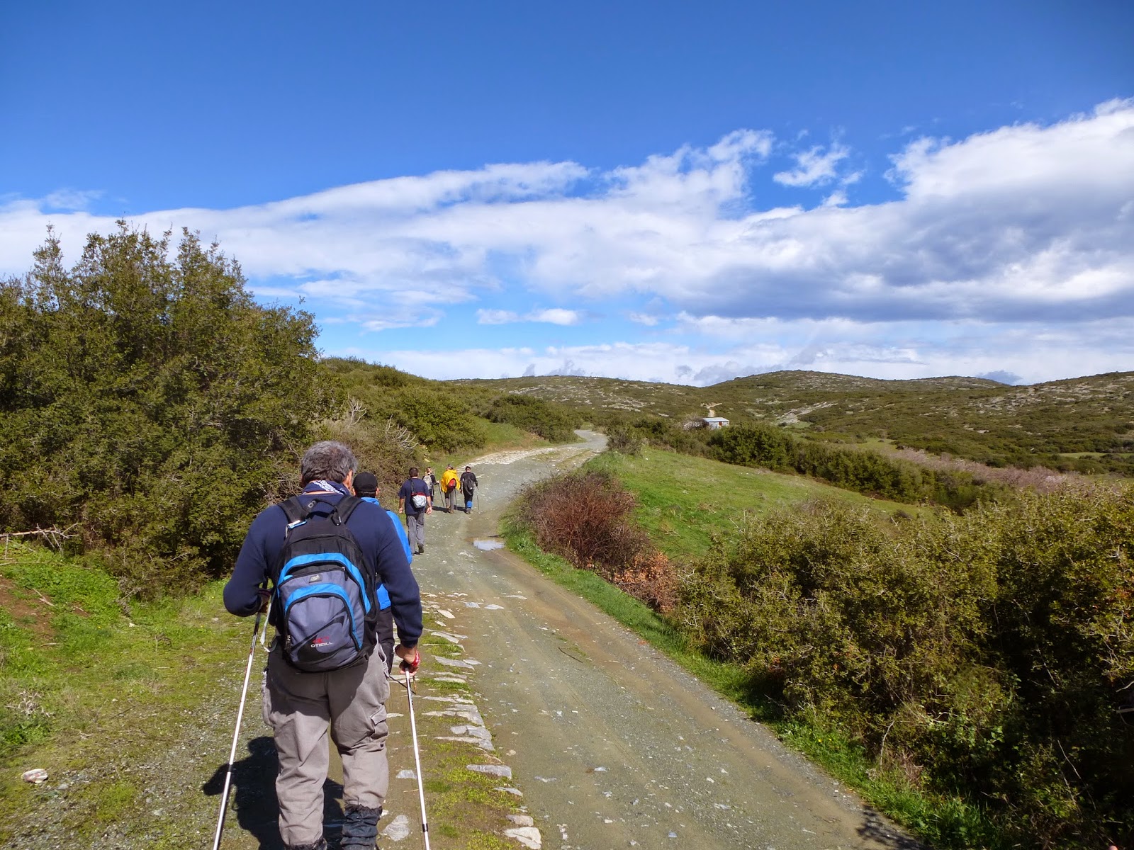
           At the ridge we join an earth road and follow it, passing next to a ruined stone building. There is a large field on our right side. As the road takes a gentle left bend, we leave it and walk on the left edge of that field on a northeasterly direction. In a short while, we continue on a wide downhill path, which follows the course of another shallow stream on our right. 
Walking at the edge of the field


           Walking on even ground amongst kermes oak vegetation, we reach a small clearing (called Lakka Psichikou). We join the earth road for twenty metres and then continue on the path on the same direction (attention to the red marks on the right side of the road).  
            The path opens out to an almond tree grove. We keep to the same northerly direction into the grove. On our left side we can see the main asphalt road. Reaching a small concrete building housing a water drilling, the short section of kalderimi that lies beyond is blocked by dumped soil, so we join the asphalt for 400 m., until we find the path again watching for it on the right side of the road, 20 meters before a road sign indicating a left turn. Further on, the path opens to an earth road and at the following junction we go left (northwest). Just before reaching the asphalt, we don`t walk on this but on the downhill earth track on the right, which becomes a path with traces of kalderimi.
Τhe stone bridge at Kato Kerasia


           Further down, we come to an earth road and walk over the old stone bridge behind the main church of the village. The kalderimi leads shortly to the square of Kato Kerasia.


Sunday, December 28, 2014

Kapourna (Glafira)-Kato Kerasia

View over Lake Karla and the village of Kanalia
Distance: 5,3 km
Duration: 1.45' (walking time 1.30')
Altitude: from 370 m. (Kapourna) to 430 m. (max) to 125 m. (Kato Kerasia)
Total ascent: 75 m.   Total descent: 340 m.
Signed with red paint marks and yellow signs
Drinking water on walk: no
Download GPS track:   from Everytrail   from Wikiloc


        This is an easy walk on the course of the old trail between the two villages. It is recommended for winter, not for summer (unless we start very early), as  there is no shade offered by the low vegetation of kermes oaks (quercus coccifera). On the positive side, we can enjoy nice views over lake Karla, Kanalia and Kato Kerasia. It can be combined to the walk Louziniko-Kapourna. If we add the walk Louziniko-Kato Kerasia to these, we can have a 5,5-hour circular walk. Both Kapourna and Kato Kerasia are connected by regular bus lines to Volos (www.ktelvolou.gr). At Kato Kerasia square, the restaurant is open all year round.
            We start walking on the asphalt from the square of Kapourna to the direction of Kato Kerasia (to the east). After 200 m., we take the uphill country road to the left, noticing the yellow sign. The beginning of that road is concrete paved, but then it becomes an earth road, incorporating stretches of kalderimi.
Near Kapourna, the road has stretches of kalderimi
             We reach a signed junction, where the route to Kanalia goes straight ahead. Here we turn right and continue on an earth road for about 700 m. climbing gently northeast. As the road takes a right bend, we notice the walker sign to the left and enter the path, which continues uphill for a little while to the north. Then we begin to descend gently, gradually changing direction to the east. On our right side is the hill of Metochi (475 m.).
Seeing Kanalia village up front at the distance
           Enjoying nice views of lake Karla and Kanalia village in front of us, we reach a large clearing and cross it, walking on an easterly direction, following the red marks. We ignore goat tracks that set off to the left, leading to other clearings we can see at the distance, and keep following the red marks on an easterly-northeasterly direction. We soon see the village of Kato Kerasia below at a distance.
View over Kato Kerasia
              Eventually, the path opens out to a seemingly deserted grove and we now walk on a downhill earth road. Later on, we cross a stream and another road joins in from the right. Then we join the asphalt at the point where it takes a sharp downhill right bend above Kato Kerasia. At the electricity pole on the left we find the final path section amongst bushy vegetation by kermes oaks, and lower down we come to join a road parallel to the stream.
Closing down to Kato Kerasia
        This takes us to the main church, next to the asphalt road bridge. The village square is above the parking lot and there is a restaurant open all seasons. 

Saturday, December 27, 2014

Louziniko-Kapourna (Glafira)

Seeing Kapourna at the distance
Distance: 4,8 km
Duration: 1.45' (walking time 1.30')
Altitude: from 95 m. (Louziniko) to 370 m. (Kapourna)
Total ascent: 315 m. Total descent: 50 m.
Signed with red paint marks and a few signs
Drinking water on walk: no
Download GPS track:   from Everytrail   from Wikiloc


        Τhis is an easy walk on the ancient trail that used to connect lake Karla to the sea. Pay attention to follow the red paint marks, because there are many goat tracks in the area that can cause confusion. Walking is not recommended in hot summer days, unless we start very early, because there is no shade. It is better to undertake this walk during the winter. Having arrived at Kapourna (officially called Glafira after the homonymous ancient settlement), we can either return or continue walking to Kato Kerasia or Kanalia. Combining the walks Louziniko-Kapourna, Kapourna-Kato Kerasia and Louziniko-Kato Kerasia, we can have a 5,5-hour circular walk. There is a regular bus line from Volos to Kapourna, Kerasia and Kanalia (www.ktelvolou.gr). At the squares of Kato Kerasia and Kanalia, there are restaurants open all year round. 
         We start our walk at the stone bridge of Louziniko, that still remains in excellent condition. This is about 8 km away from the centre of Volos by car or taxi (no bus connection). From Volos ring road (E92) we take the exit to Fitoko and after 1,5 km turn left at the junction on the narrow asphalt to Louziniko.
The stone bridge at Louziniko
         We pass over the large stream of Kserias (meaning ''dry stream'') and walk on the concrete paved uphill road. At the point where it takes a right bend, we continue straight ahead on a narrow earth road heading northwest. After 150 metres, we notice the red marks to the right just after the electricity pole, and enter the path that goes uphill on the slope.
Looking back over Volos
          Watching out for the red marks to secure our way, we walk on a steady northwesterly direction on a path that narrows or widens, depending on the dominant kermes oak vegetation. After abour three quarters of an hour, we can see the village of Kapourna ahead at the distance.
Fields near Kapourna
           Eventually, the path opens to a field and we walk initially on its left edge, then walk for a few metres on the edge of the adjacent field to the left and then find a short downhill section of the path. It opens to another field and we follow its left edge again. We can see a lone cypress tree in front of us which serves as a guide. From the cypress tree, we cross the field and find on the opposite side the final section of the path between the holm oak vegetation. It opens to the asphalt road, which we follow until the batch of cypress trees at thge entrance of the village, where we follow the concrete road to the right, until we get at the corner of the village square, just next to the bus stop.
.


Friday, December 26, 2014

Neochori-Siki

Distance: 6,8 km
Duration: 2,5 hours (walking time 2 hours)
Altitude: from 460 m. (Neochori) to 210 m. (Granitsa stream) to 310 m. (Siki)
Total ascent: 373 m.  Total descent: 401 m.
Signed with round yellow signs and red paint marks
Drinking water on walk: no
Download GPS track:  from Everytrail   from Wikiloc


                 This route, passing from the ruined chapel of Agios Efstathios,  was blocked for many years, until it was cleared by volunteers in 2013-2014. There is also another southerly route passing from Agios Georgios chapel at Lai, but this remains currently blocked.
             We can go to Neochori by bus (www.ktelvolou.gr) or walking from Milies or Niaou (Afetes). There is also a walking route from Siki to Xinovrisi. At the square of Neochori the restaurant is open all year round, whereas at Siki only during the summer season.
             Starting from the upper corner of the square of Neochori, we take the uphill stone paved track going east and walk between a church, which is on our right side, and the school on our left. A little further up at a junction we take the wide uphill kalderimi to the right, watching for the red marks. We join a paved road at an angle and head east, exiting the village. After crossing a stream, we notice the sign on the left and enter a section of the path that has been restored.
A restored section of the original path
           This opens to an earth road junction, where we head straight on to the east. Immediately there is a V-junction, where we take the road to the right, which has a section of kalderimi.
          A little further on, we have a grove on our left. Just as we reach its corner (attention to the left), we climb for a few metres on a path just next to the grove and then turn right to the east.  As we climb, we enjoy excellent views over Granitsa ravine, Siki village and the Aegean sea. That area was burnt a few years ago but is overgrown again.
          At the ridge, we pass by some pine trees that managed to escape the fire and  join a descending earth road. We reach a crossroads and continue in the same southeasterly direction on a seemingly abandoned uphill track. Reaching the ridge, as the track turns gently left, we  go right and find the path, descending for a while until it joins an earth road again. We soon reach the chapel of Agios Efstathios, the roof of which unfortunately has collapsed and lays in ruins.
Reaching Agios Efstathios chapel
         A little further down, we leave the road and go straight ahead onto the path, which descends on the north slope of Granitsa ravine. This word means ''border'' in slavic languages, and indeed used to be the border between the  land jurisdictions of Neochori and Siki. It opens to the sea at the beach called Pantazi Ammos.
Going down to cross Granitsa stream
       The path opens down to an earth road, which we follow to the right and pass next to a building of the water system. We cross the stream and continue on the concrete road uphill. At the first left bend, there is a section of the path climbing next to the road on the right, and joins it again higher up, so we can avoid a section of the cement road.
      On the ridge, we join the asphalt road going to Pantazi Ammos beach, and we follow it to the south (to the right) entering Siki. Watching for the round yellow sign at an electricity pole, we go left downhill on a stone paved track and pass by a parking lot and the main church οf Agios Georgios, ending up to the cosy square of Siki.
Siki village square


Thursday, December 25, 2014

Siki-Xinovrisi

Distance: 6,2 km
Duration: 2.20' (walking time 1.50')
Altitude: from 291 m. (Siki) to 47 m. (Bourboulithra) to 240 m. (Xinovrisi)
Total ascent: 241 m.  Total descent: 300 m.
Signed with round yellow signs and red paint dots
Drinking water on route: no
Download GPS track:   from Wikiloc

Powered by Wikiloc

         This route remained blocked for many years, until it was cleared by volunteers during the winters of 2014-17.  This walk can be combined with the walks Neochori-Siki, Argalasti-Xinovrisi and Xinovrisi-Potistika. At the square of Xinovrisi the restaurant is open all year round, whereas at Siki square only during the summer season.
      Starting from the square at Siki, we walk downhill on the concrete paved road (previously a kalderimi) going southeast. At the first junction we go right on a southerly direction. We exit the village, passing above the cemetery which is down on our left (we can see the cypress trees) and then join a wider asphalt road at an angle. This goes to Potoki beach. Shortly, as the asphalt takes a left bend, we continue straight ahead southeast on an earth road, which incorporates long stretches of kalderimi. 
Long stretches of kalderimi into the earth road
          After about one kilometre, a steep downhill section of the road is paved with cement. Just after the end of the paved section (attention!!), we leave the road to the right and find the path going downhill between two olive groves. It opens to an earth road below, on which we continue left downhill. After fifty meters, at the junction we take the downhill road to the right. This comes to end in an olive grove, and we continue on the path, which initially runs on the left (higher) side of the grove. Following the path, we come eventually  down to the bed of Megalo Rema (Grand Stream). This spot is called Bourboulithra (Βubble). At this peaceful place, where water runs gently under the dense shadow of the plane trees, we can have a refreshing short stop.
Crossing the Megalo Rema stream at Bourboulithra
        Crossing to the other bank of the stream, the path keeps climbing on the slope, until it opens to a road junction on the ridge and we continue straight ahead on the road, now going downhill.
        After fifty metres there is another junction, where we go right on a westerly direction (if we go left, we will come down to Potistika beach). Walking some distance on the earth road, parallel to a stream, we pass from a drinking water fountain with some water running only in winter. After that, we notice a small concrete bridge on our left. We may continue on the road and cross the stream to the left a little further on, or  pass over the bridge and then walk parallel to the stream to come out on the road again, and go uphill. Then we easily find the kalderimi again on the right, clinbing up the slope.
Entering Xinovrisi
        On the ridge we meet the asphalt road coming from Potistika beach. We walk on this uphill entering Xinovrisi and turn left to reach the peaceful village square with the two big plane trees offering plenty of cool shadow in summer. From Xinovrisi we can continue on footpath to Argalasti or to the beach of Potistika.
Xinovrisi square


Wednesday, December 24, 2014

Aidonofolies (Volos)-Portaria-Stagiates

Looking down to Volos 
Distance: 9 km (+1 km to visit Mana spring)
Duration: 4 hours with stops (+0,5 h to Mana spring)
Altitude: from 95 m. (Aidonofolies) to 630 m. (Portaria)
Total ascent/descent: 625 m.
Signed with red paint marks and some signs
Drinking water on walk: yes
Download GPS track:  from Everytrail   from Wikiloc

          In this nice circular walk, starting from the outskirts of Volos, we climb through the kalderimis of Anakasia up to the village of Portaria and then come back through Stagiates. Aidonofolies is located in Upper Volos, at the end of Iolkou street next to the Mega Rema stream. We can go there by taxi or by city bus nr.4 (end of line). In case we want to make it easier avoiding climbing up, we can still go to Portaria by bus and walk down to Aidonofolies in less than 2 hours.
              Starting from the parking lot at Aidonofolies, we walk up the stone paved track, which soon becomes concrete paved. On our left we go past the church of Timiou Prodromou (St. John the Baptist) and the local primary school. At two junctions we go right, keeping close to the main asphalt. Eventually, we reach the square of Anakasia, featuring a bronze statue of naive folk painter Theofilos who lived and worked there about a century ago (a visit to the Theofilos` museum that is nearby is recommended-open Mo-Fri 08.00-15.00, tel. 2421047340).
            We continue on the stone paved track next to the drinking water fountain and head east, enjoying excellent view over the city of Volos and the sea down below. For some twenty metres the old cobblestone appears under our feet, but then gets covered again by the flat stone paving. Keeping an eye for the red paint marks, a little further up we take the uphill kalderimi to the left. Reaching a wooden sign pointing to the right, we elect to go left instead, up the stairs opening to the small square with the church of Agia Triada (Holy Trinity).
Agia Triada church
              Above the church we cross the asphalt and after an initial stretch of kalderimi, walk on a road to an easterly direction. After 200 m., we take the wide uphill  kalderimi to the left. We pass under the main asphalt road, then next to Profitis Elias chapel and then join the asphalt road to Stagiates village, which we follow to the left uphill. After crossing a stream, we take the uphill earth road to the right. As we climb, we notice stretches of kalderimi in the road. Further up, it becomes stone paved and we go past a drinking water fountain. We cross the main asphalt and continue uphill on a track, entering the village of Portaria.
On the stone paved tracks of Portaria
          We cross the asphalt yet twice, walking now on stone paved track. At the corner of restaurant ''Geusokratoras'' we take the narrower kalderimi to the left, which opens to the main asphalt again, just above Naoumidi old mansion-guesthouse. We go downhill on the asphalt for a few metres and through the parking lot, then on the stone paved track opposite, which gets at the upper side of  the village square, next to the old hotel ''Theoxenia''. So far, we have walked 4,5 km in about one hour and 50 minutes, including stops.
Portaria village square
               After a refreshing stop at the quiet square of Portaria, under the shade of the plane trees, we go down on the asphalt and turn right to Makrinitsa. In a short while, as we reach the stream of Mana, a short deviation from our course is recommended, a 15-minute climb following the course of the overgrown ravine to the homonymous spring of Mana, In our course we pass over 9 small wooden bridges. Pelion`s nature is at its best here.
Walking into the ravine to Mana spring
        Coming back to the asphalt, we continue walking towards Makrinitsa and pass by the drinking water fountain of Adamena. As we reach the cemetery and a shrine on the right side of the road, we find a path ot the left side (there is a walking sign on a tree) that goes downhill and opens to a narrow asphalt road, which we follow for fifty metres. Then, seeing a basketball pitch on the right, we find the path again to the left on a southwesterly direction. It soon becomes a kalderimi, having a fence on the left side. Further down it opens to a concrete track and we keep on the same direction. We pass next to a tank of the water system, walking now through olive groves. At a junction we go left.
View over Makrinitsa
        In a while, our path opens to a concrete road at an angle as we come across the first houses of Stagiates. Soon it becomes a kalderimi again, descending through the village. Crossing the asphalt, we immediately reach the square. A stop is mandatory here, under the shade of the two big plane trees, to quench our thirst with the cool water running from the fountain of the square, as we try to read the old inscription in arabic letters, dating from the Ottoman era.
Stagiates village square
         The kalderimi continues downhill on the left side of the square. Reaching an earth road junction we go right, pass by the small chapel of Agios Serafim, and further down there is a sign on the left, which indicates the continuity of the kalderimi.
View over Volos 
           Enjoying great views over Makrinitsa and Volos, we pass by the quiet small chapel of Agios Panteleimon and then the path opens to an earth road. At the sharp right bend we go straight ahead to find a short final section of the kalderimi, opening to an earth road parallel to the Mega Rema stream on our right. Further down, we pass to the right bank of the stream over a concrete bridge and soon return to the starting point of our walk.