Showing posts with label East Pelion. Show all posts

Friday, August 25, 2023

Pouri-Megalovrachos waterfalls (circular)


Distance: 8,3 km.

Time: 5 hours with stops

Altitude: from 418 m. (Pouri parking lot) to 680 m. (Profitis Elias chapel)

Total elevation gain/loss: 503 m.

Signing: red paint

Drinking water on walk: Panagia Rasova church, Pouri

Last checked: June 2023

Download GPS file: from Wikiloc


Powered by Wikiloc

.       The waterfall of  Megalovrachos is located in the Kalokairinos stream, between Zagora and Pouri. It is the largest and most impressive of Pelion, with a height (estimated) of over 50 meters. There is plenty of water in the spring when the snow melts, but in the summer it dries up. It is located in a difficult place and visiting it has certain requirements (adequate `physical condition, suitable shoes). In order to enjoy the special experience, our visit should preferably take place in the months of March-May. In this particular case, before the visit to the waterfall we passed by the chapel Ilias Pouriou and the old monastery of Panagia Rasova, thus making a varied circular walk starting and ending in Pouri. One can go up to Rasova using a concrete road (for cars with increased ground clearance), that opens to the asphalt road between Zagora and Pouri (there is a sign to "Panagia Rasova"in Greek).


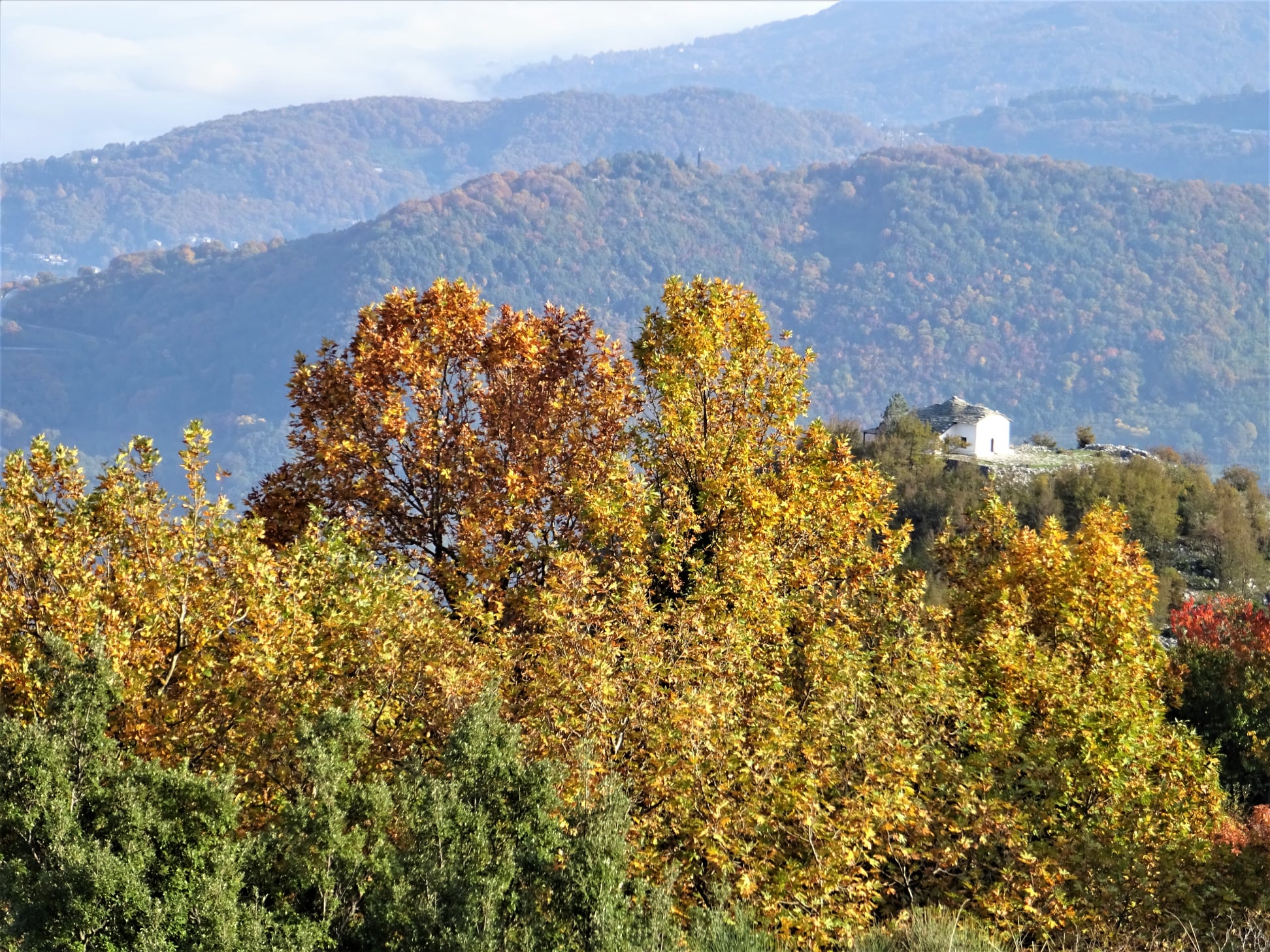
        Starting from the parking lot of Pouri, we climb to the central church of Agios Dimitrios and continue uphill, following the Makrinitsa-Pouri route in reverse, helped by the red signs. We pass by a building of the water system (for a few meters, if the path is overgrown, we are forced to walk next to it, through the adjacent grove) and continue on an uphill dirt road. Paying attention to the red signs on the left, we enter a path for a while and then again on a road that continues uphill to the small church of Prophitis Elias. Next to the church there is a kiosk and the view to the south and east is excellent. 

View from Profitis Elias

        We continue on the road, which is now descending, and below we turn right entering a grove. We cross a small stream and then join a rural road which, descending, brings us to the old monastery of Panagia Rasova. This is one of the oldest monasteries of Pelion and specifically among the five oldest on the mountain of the Centaurs. It was created around 1250 AD, maybe earlier. Evidence of the monastery exists since 1270 AD. It is a large monastery of old time with cells all around. Today only the church (the catholicon) is preserved, and not in a good condition. Many murals have also been damaged. Maintenance attempts were made from time to time with props and various repairs. As for the cells and other buildings, these have long since collapsed and destroyed. The monastery has been abandoned for many years, since the last monk passed away in 1885. Lately, after damages caused by poachers looking for golden pounds, the church door is always locked, except on its feast day on November 21 ( Entrances of the Virgin). 

Panagia Rasova

        We descend a little more on the road and then turn right through a grove. At the intersection there is a hut. The road below terminates and continues as a path that is difficult in some places, going parallel to a water pipe.

Crossing the first  stream

            We easily cross a first smaller stream and continue to reach the main stream. The waterfall is a little higher and cannot be seen from here. We cross the stream and on the other bank we climb steeply on a narrow and difficult path (attention!), helped by the red signs. Finally we reach the base of the great waterfall. The sight and feeling is fantastic, difficult to descrbe with words, especially when the stream brings down a lot of water. 

Congrats to Despina for researching and marking

        We return by the same path back to the hut below Rasova and continue on the downhill road. Further down, seeing the cedar tree, we go left into an estate, which we cross and on the other side we walk on a cement road. Meeting the first houses of Pouri we find a narrow downhill cobblestone that takes us down to the asphalt, at the entrance of the village.

Friday, October 14, 2022

Makrirachi-Aetofolia (circular)

Aetofolia


Distance: 3,3 km

Time: 1 hour 50'

Altitude: from 235 m. (Makrirachi square) to  420 m. (max)

Total elevation gain/loss: 274 m.

Signing: red paint, yellow round signs

Drinking water on walk: no

Start/finish: Makrirachi square

Last checked: Οctober 2022

Download  GPS file:  from Wikiloc

Powered by Wikiloc

             Starting and ending in the square of Makrirrachi, this relatively short circular route, which takes less than 2 hours, allows us to visit the excellent viewpoint of Aetofolia (meaning ''eagles nest'') through the wild gorge of Megalo Rema. The return to the square is made using the main kalderimi that comes from Chania via Prophitis Elias and Agii Anargiri chapels.


            Starting from the square of Makrirachi, we keep walking on the main asphalt towards Anilio village. Immediately after the last houses of the village, we take an uphill narrow road on the right. We pass a water reservoir and walk on the wild northern slope of the gorge, in a dense oak forest. Paying attention to our right, we notice a post with a sign, which points right to "Aetofolia". The uphill path we are walking on now is narrow and relatively difficult, however in 10 minutes we find ourselves at Aetofolia. From this point we have a magnificent view of the overgown gorge of Megalo Rema up to Agriolefkes peak. The Aegean sea can be seen on the opposite side. It is worth sitting quietly for a while to enjoy this unique viewpoint.

Aetofolia 

      In order to return, we continue in the same direction on the path, which immediately turns into a narrow earth road. At the point where there is a signpost on both sides of the road (ATTENTION) we meet the kalderimi coming from Agii Anargiri, which used to be the main connection of Makrirrachi to Chania and Volos. We follow it going downhill to the right (it is initially difficult due to soil that has fallen on the side of the road).

Anilio village on the opposite side of the stream

       The kalderimi continues to descend and we go through the first houses of Makrirachi. Finally we come out on a concrete road, where we go left. The road (formerly a kalderimi) descends and ends at the main road, immediately above the village square.

Mushroom tasting at Makrirachi square (October 2022)


Monday, May 30, 2022

Makrinitsa-Pliasidi-Zagora


View to Horefto 

Distance: 18,5 km.

Time: 8 hours (with stops)

Altitude: from 620 m. (Makrinitsa) to 1480 m. (max) to 510 m. (Zagora)

Total elevation gain: 1075 m.

Total elevation loss: 950 m.

Signing: red paint, some metal signs

Drinking water on walk: Agia Paraskevi mon. near Makrinitsa

Start: Brani parking lot,  Makrinitsa (end of asphalt road) 

End: Agios Georgios square, Zagora

Download GPS file (.gpx): from Wikiloc


Powered by Wikiloc

        In his book ''History of the Provinces of Volos and Agia'' (published in 1960) Yiannis Kordatos, a renowned scholar of Zagora,  mentions an alternative, higher way used by locals to go from Zagora to Makrinitsa-Volos: (sic) starting to climb from ''Kordateika'' or Platanovrisi, passing by the ''middle Kotroni'', reaching ''Schizopetras'', turn west, get past ''Machera fountain''  and from the peak ''Plesidi'' go down to Makrinitsa. We tried to unearth this forgotten route, and after some research came up with this 8-hour walk. 

 After having some rest and refreshments at Agios Georgios square in Zagora,  we may wish to  continue descending for an hour or so to get down to Horefto beach  for a refreshing swim to the sea.


          As we come to the higher parking lot at Makrinitsa, at the end of the asphalt road, we see on the right a kalderimi (cobblestone path) heading uphill. A red handmade sign indicating to ''Πουρί'' (Pouri village)) is nailed to a tree. This was made, along with  many others, by the late local hiker Dimitris Kottalis. One can also start from the drinking water fountain in the parking. On our way from Makrinitsa to Pliasidi, in addition to the usual plain red marks, there also are red-on-white  marks that belong to a mountain running race (Ultra Pelion Trail, UPT).

Makrinitsa

    The kalderimi winds uphill among the village houses, passing by a lone pine tree next to a bench and two fountains and eventually opens to a narrow dirt road, which leads us to the old monastery of Agia Paraskevi. 
Agia Paraskevi chapel

        Having enjoyed a refreshing stop at that tranquil spot and filling our water supplies from the fountain (no other fountain is on our way), we continue uphill on dirt road. After a right turn we find the path on our left. It soon opens to another dirt road, which then turns right and comes to an end. We continue on a path with sections of cobblestone, climbing into chestnut forest.

Path in chestnut forest

         We cross an earth road and further up turn left on another road. Watching on our right side, after about 30 m. we find the path again, climbing between chestnut trees. Further up, we walk parallel to a water ditch, noticing another handmade sign to “Pouri”. From a certain spot, we can see lake Karla at a distance to the west.

Agios Augoustinos chapel at Trano Isoma

         On our way is also the newly built chapel of Agios Augoustinos, where we can have a stop. We continue on dirt road and come to a signed road junction. We continue straight ahead on a northeasterly direction, next to a concrete irrigation ditch. The road ahead leads  to Flabouro springs and Pourianos Stavros peak. After 50 meters we turn right (attention!) on another dirt road that climbs steeply uphill. On a tree a small round sign indicates the direction to ''Pliasidi'' to the right. The red-on-white marks are still with us on this way.


        We pass by the Tzanopoulos estate, where there is a hut. On our left we see a square building, probably a water tank. Immediately after the estate the road makes a slight left turn downhill goeing to Flambouro. At this point we leave it and go straight ahead uphill in an easterly direction on a path, which eventually takes us to the asphalt that goes to the military radars. We are close to the peak of Pliasidi (1547 m.), which is on our right, but getting to the fenced  top is prohibited.


        Reaching the asphalt, the red-on-white marks turn to the right and we leave them (attention). Here we turn left and walk on the asphalt for about 2.3 km, going towards the radars. At the second junction with a dirt road on the right, we leave the asphalt and take the road, which descends northeast into the beech forest.  We pass by a large rock, which the locals call "Machera". From some points we have a very nice view to the south, seeing three large wooded ridges descending to the sea one behind the other.


       Further down, at an altitude of 1180 meters, as we join another dirt road (which comes from the asphalt just below Hania), we reach a small shelter hut for hunters and firewatchers that has the inscription "ΘΗΡΟΦΥΛΑΚEΙΟ ΠΥΡΟΦΥΛΑΚEΙΟ'' (in Greek). On the day we passed (7/11/21) it was being renovated by a group of hunters. 

At the hunters shelter

        We walk on the road to the left for two hundred meters and go right at the junction (straight ahead, the road goes to Xeforti and Agia Marina). The area here is called "Schizopetra". Descending, we find successive sections of path that alternate with sections of road and we need to pay attention to the red marks. Οur general direction is to the northeast.

Path in beech forest

        Further down, we cross an apple grove (as the path on the side of the grove is very overgrown), and join a dirt road again turning right. Going downhill, the road below is paved with cement as it passes between cherry and apple groves. From one point we have a nice view to the chapel of Agios Athonas, built on a hill above Zagora. 
Agios Athonas chapel

         A little further north we see another hill with antennas at the top, which on the map is referred to as "Lefko Kotroni" (732 m.).

        Going down the concrete road and watching for the red signs at the intersections, we pass by the church of St. Magdalene. Further down we find a section of the original kalderimi as we descend next to the fence of a cottage. We continue on  kalderimi covered by cement. Further down, as we get into the village and cement paving ceases,  the original kalderimi reappears and leads us straight to the central square of Agios Georgios.

Agios Georgios (Zagora main square)


Monday, April 18, 2022

Propan-Labinou-Labidona monastery-Lithos (circular)


Lithos

Distance: 9,7 km

Time: 4,5 hours (with stops)

Altitude: from 310 m. (Propan) to 377 m. (max) to 0 m. (Lithos)

Total elevation gain/loss: 460 m.

Signing: red paint marks

Drinking water on walk: yes (Labinou, Labidona mon.-if open)

Start/end: Propan village square (or Labinou beach)

last checked: October 2023, open with minor problems

Download GPS file(.gpx) :from Wikiloc


Powered by Wikiloc
    This circular walk passes by some interesting and beautiful spots. It may start either from Propan village square, as described here, or from Labinou beach. In the latter case, we have the advantage of being able to finish our walk with a swim at the sea, near a summer taverna, not having to climb uphill at the end of the walk. At  Propan, there also is a taverna-cafe operating at the square.

    A few words about the names: It was decided by State officials in 1954 to rename the village as "Kalamaki" after its beach at the Aegean sea, because the old name Propan (which is of unknown origin, probably non-Greek) was considered undesirable. However, in 2014 at the locals request, the original name was officially reinstated. All the road signs and most of the maps however, are slow to change.

Propan, view to the sea

    Starting from the square of Propan, we walk on the kalderimi going  gently uphill in a northwesterly direction, passing just under the main church of Agios Athanasios. Keeping on the same direction, we walk on a cement road and then kalderimi again. This brings us to ''Kakli'' water fountain at the edge of the village. On our right is a gully and a quarry (Propan is famous for the stones its quarries produce, used in traditional Pelion-style  roofs and floors).

Kakli water fountain

    We continue climbing up a steep earth path that joins a cement road, and we go left uphill to reach the asphalt road. On our left is the church of Profitis Elias. We walk now on the asphalt to the right for about 1 km and then we leave it to the right, taking an earth road. At the two next earth road junctions we take the left branch. The earth road brings us to Labinou, where we walk on the main asphalt uphill for a few meters and then on the stone paved track at an angle to the right to the village square, which sadly remains deserted, its cafe-restaurant closed for a long time now (last checked October 2023). 

Labinou, at the deserted square

    We descend a few steps from the square onto a concrete road, and walk down on this, ignoring a narrow kalderimi on the right. After 50 m. on the road, we notice a wide kalderimi branching off to the right and follow it, going through the village houses.

The path-kalderimi to Labidona monastery

    Further down, we reach an old spring water fountain (Kria Vrisi) on the bed of a stream, next to an old olive press turned into a cottage. We follow this stream downhill. A little further down we get to the asphalt and walk on it downhill  to reach the entrance of the old monastery of Labidona, after which the village was named. It was built in 1796 by craftsmen from Zoupani village, North Greece. Dedicated to the Dormition of Virgin Mary, its annual feast is on August 23rd. For a long period it used to be deserted and unfenced, vulnerable to thieves, but nowadays it operates as a nunnery, open to visitors Thursday to Sunday (see the timetable here ). 

Labidona monastery

    Leaving the monastery, we walk back uphill on the asphalt and, as it takes a right turn, we leave it to the left, taking  a narrow cement road going roughly parallel to the coastline. Further on, he road is unpaved and then becomes a path-kalderimi. Coming to a path junction, we take first the left branch that goes down to the sea, at the location called ''Lithos''. An impressive rock formation coming out from the sea that even gives the opportunity of a swim if the sea is calm. A spot of intense natural beauty. 

View from Lithos to the south

    Coming back to the path junction, this time we take the other branch and walk near the lower edge of an olive grove. We come to cross a stream in an impressive wild scenery, and continue  on the other side through another olive grove, crossing a fallen fence that should never have been there in the first place.. 

Crossing the stream near Lithos, impressive scenery

    The path becomes an earth road on which we walk to the south. There is a summer cottage on our left. At the junction we don`t take the uphill right branch. Instead, we go straight ahead in a southerly direction. Another cottage is on our right. If we look carefully, we will noice at some point on our left a section of the original kalderimi coming from the sea shore, where trading goods carried by boats were taxed. Nowadays the old tax building has become a summer cottage and is indeed private property, so we keep ahead on the earth road which now climbs up steeply. A ravine  is on our left and the road goes down to cross the streambed (called Galanina stream). Then there is an earth road junction, where we take the right branch. We now walk parallel to the stream uphill. At another junction we take again the right branch that goes downhill, then becomes path and crosses the stream, passing to the right bank of the ravine. 

    Climbing constantly on kalderimi on the right bank of the overgrown ravine, we reach the first houses of Propan. We cross a narrow road at an angle to the right, and continue uphill on kalderimi that leads finally to the village square.    

Propan


Sunday, April 17, 2022

Chorefto-Zagora-Panagia Rasova-Pouri (circular)


Parisena beach


Distance: 16,7 km

Time: 8 hours (with stops)

Altitude: from 0 m. (Chorefto) to 700 m. (max)

Total elevation gain/loss: 906 m.

Signing: red paint, metal and wooden signs

Drinking water on walk: yes (Zagora, Rasova, Pouri, Chorefto)

Start/end: Chorefto beach, at the turn of the asphalt to Zagora

Download GPS file (.gpx): from Wikiloc


Powered by Wikiloc
    This is a long circular walk in East Pelion, connecting Zagora and Pouri by a mountainous and a coastal way as well. If we do the walk in spring, we will get the bonus to admire at a distance the waterfall of Megalovrachos, the biggest in Pelion, that remains dry in summer.

    Starting from the beach of Chorefto, we walk on the asphalt as it takes an uphill turn heading to Zagora, and then leave it to the right, taking an uphill cement road going to Aegeus hotel. The road  has a central stone paved lane, and is obviously a former kalderimi. Higher up, cement paving ends and the stones of the kalderimi appear. This section suffers from a landslide and a fallen tree, but we manage to keep on the track and eventually join an earth road. 

On the kalderimi to Sotira -or into the jungle?

    Here there are two options. We either walk on the earth road to the right, as in this recording, only taking attention at the road junctions (1st junction-to the left, 2nd junction-right, 3rd junction-left), or we take the path signed by rsctangular metal signs and red paint. Both routes meet higher up, becoming a wide, well-preserved kalderimi, that however soon becomes cement paved. 

View to Chorefto from above

    Following this uphill, we have to deal higher up with another kalderimi section affected by landslide and fallen trees. With some difficulty we can get through crawling on our knees. Then we get past a mule stable, trying not to scare the mules, and finally get to Metamorphosis (Sotira) church in Zagora. The building is relatively new, built in 1889 to replace the old church dating from 1168, that was unfortunately destroyed by devastating landslides and fire. Near the church is a drinking water fountain, highly appreciated after all this uphill walking. 

At the church of Metamorphosis (Sotira)

     Leaving the fountain, we continue uphill on a cement road (ΒΟΛΤΟΥ street) that again has a central stone lane. This opens on the main asphalt road of Zagora. We turn left and then leave it at an angle to the right. We keep climbing up in zigzags through the houses of Zagora, walking on kalderimi, paved or unpaved. At some point we pass near a characteristic old drinking water fountain, Platanovrisi.

Platanovrisi fountain

    Leaving the last houses of Zagora, we keep climbing on earth or cement roads in a generally westerly direction.

The waterfall of Megalovrachos


    From a certain point we can see a a distance the waterfall of Megalovrachos, an impressive sight as it is the biggest and highest waterfall in Pelion. It only has water in the spring when the snow is melting, and gets dry in summer. We will have to take our shoes off to cross the stream of Kalokerinou.

Crossing Kalokerinou stream

    The road crosses the stream of Kalokerinou above the waterfall, then two more smaller streams and then we start going downhill, eventually reaching the old church of Panagia Rasova, one of the oldest in Pelion.

Panagia Rasova church

    Built around 1250, it is the only remnant of a fortress-like monastery, whose last monk died in 1885. The surrounding cells and other buildings have collapsed and been removed over the years. It  is open only on its celebration day on November 21st, the Entrance (or Presentation) of Virgin Mary.


    We continue on the road downhill, keeping attention on the left for the cedar tree. When we reach this, we turn left and traverse an apple grove. On the other side of the grove we continue on a downhill road that gets us to the upper quarter of Pouri.  We take a kalderimi on the right, that opens to the main asphalt road at the entrance of Pouri. Here also is a drinking  water fountain. We walk a short distance on the asphalt and, just as we reach the parking lot and the taverna of Makis, which is on our left, we take the narrow cement paved road on the right, descending through the houses. Shortly, cement paving ceases and we now walk on proper kalderimi. 

Pouri

    This brings us down to the villages graveyard, a good place to have a stop with the Aegean sea in sight, and then continue downhill. Eventually we join an earth road and then a narrow asphalt. As it takes a sharp left turn to end at Elitsa beach and the picturesque little church of Agii Pantes (All Saints), We continue on a straight line southbound, cross again Kalokerinou stream over a bridge, get past the church and reach the pebbly beach of Analipsi. 

Analipsi beach

    An earth road branches off to the right, going to Chorefto. Walking on the beach we pass a summer taverna (Plimari) and, at the last house we climb a few steps, then walk on an earth path having a cottage on our right. An uphill path (not visible from distance) marked with red paint leads us to the small chapel of Agios Nikolaos, a nice place to have a stop under the shade of the trees.

Agios Nikolaos chapel

     We continue on a cement road downhill, walking along fenced property. This section of the path suffered heavily from a landslide some years ago, forcing us to take the detour via Agios Nikolaos as the original path has disappeared. Anyway, the last fence is soon left behind and we find ourselves walking on a beautiful path-kalderimi a few meters above the sea. 

The shrine between Parisena and Tourkou beaches

    A large shrine is built on the side of the path inbetween the beaches of Tourkou and Parisena. These two beaches carry a ''hippie'' style due to nudism and free camping practiced  by its summer visitors.

Parisena beach

     The kalderimi eventually takes us down to the large sandy beach of Parisena. After walking along it, we climb on kalderimi past the rocks and reach the northern end of Chorefto beach, coming to the point where our walk had started from.          

Chorefto beach