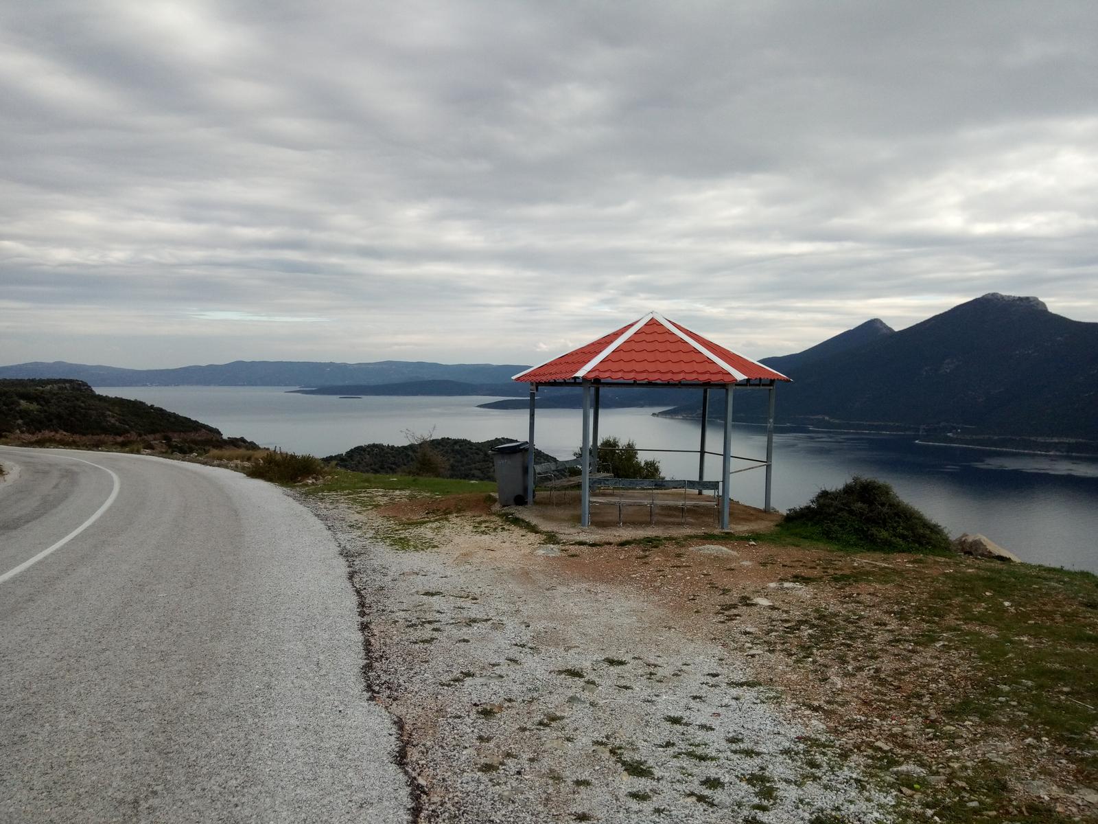
Sunday, April 17, 2022

Chorefto-Zagora-Panagia Rasova-Pouri (circular)


Parisena beach


Distance: 16,7 km

Time: 8 hours (with stops)

Altitude: from 0 m. (Chorefto) to 700 m. (max)

Total elevation gain/loss: 906 m.

Signing: red paint, metal and wooden signs

Drinking water on walk: yes (Zagora, Rasova, Pouri, Chorefto)

Start/end: Chorefto beach, at the turn of the asphalt to Zagora

Download GPS file (.gpx): from Wikiloc


Powered by Wikiloc
    This is a long circular walk in East Pelion, connecting Zagora and Pouri by a mountainous and a coastal way as well. If we do the walk in spring, we will get the bonus to admire at a distance the waterfall of Megalovrachos, the biggest in Pelion, that remains dry in summer.

    Starting from the beach of Chorefto, we walk on the asphalt as it takes an uphill turn heading to Zagora, and then leave it to the right, taking an uphill cement road going to Aegeus hotel. The road  has a central stone paved lane, and is obviously a former kalderimi. Higher up, cement paving ends and the stones of the kalderimi appear. This section suffers from a landslide and a fallen tree, but we manage to keep on the track and eventually join an earth road. 

On the kalderimi to Sotira -or into the jungle?

    Here there are two options. We either walk on the earth road to the right, as in this recording, only taking attention at the road junctions (1st junction-to the left, 2nd junction-right, 3rd junction-left), or we take the path signed by rsctangular metal signs and red paint. Both routes meet higher up, becoming a wide, well-preserved kalderimi, that however soon becomes cement paved. 

View to Chorefto from above

    Following this uphill, we have to deal higher up with another kalderimi section affected by landslide and fallen trees. With some difficulty we can get through crawling on our knees. Then we get past a mule stable, trying not to scare the mules, and finally get to Metamorphosis (Sotira) church in Zagora. The building is relatively new, built in 1889 to replace the old church dating from 1168, that was unfortunately destroyed by devastating landslides and fire. Near the church is a drinking water fountain, highly appreciated after all this uphill walking. 
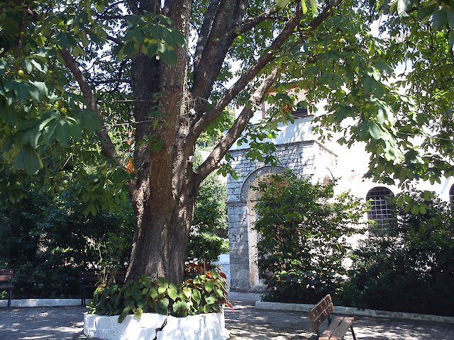
At the church of Metamorphosis (Sotira)

     Leaving the fountain, we continue uphill on a cement road (ΒΟΛΤΟΥ street) that again has a central stone lane. This opens on the main asphalt road of Zagora. We turn left and then leave it at an angle to the right. We keep climbing up in zigzags through the houses of Zagora, walking on kalderimi, paved or unpaved. At some point we pass near a characteristic old drinking water fountain, Platanovrisi.

Platanovrisi fountain

    Leaving the last houses of Zagora, we keep climbing on earth or cement roads in a generally westerly direction.

The waterfall of Megalovrachos


    From a certain point we can see a a distance the waterfall of Megalovrachos, an impressive sight as it is the biggest and highest waterfall in Pelion. It only has water in the spring when the snow is melting, and gets dry in summer. We will have to take our shoes off to cross the stream of Kalokerinou.

Crossing Kalokerinou stream

    The road crosses the stream of Kalokerinou above the waterfall, then two more smaller streams and then we start going downhill, eventually reaching the old church of Panagia Rasova, one of the oldest in Pelion.

Panagia Rasova church

    Built around 1250, it is the only remnant of a fortress-like monastery, whose last monk died in 1885. The surrounding cells and other buildings have collapsed and been removed over the years. It  is open only on its celebration day on November 21st, the Entrance (or Presentation) of Virgin Mary.


    We continue on the road downhill, keeping attention on the left for the cedar tree. When we reach this, we turn left and traverse an apple grove. On the other side of the grove we continue on a downhill road that gets us to the upper quarter of Pouri.  We take a kalderimi on the right, that opens to the main asphalt road at the entrance of Pouri. Here also is a drinking  water fountain. We walk a short distance on the asphalt and, just as we reach the parking lot and the taverna of Makis, which is on our left, we take the narrow cement paved road on the right, descending through the houses. Shortly, cement paving ceases and we now walk on proper kalderimi. 

Pouri

    This brings us down to the villages graveyard, a good place to have a stop with the Aegean sea in sight, and then continue downhill. Eventually we join an earth road and then a narrow asphalt. As it takes a sharp left turn to end at Elitsa beach and the picturesque little church of Agii Pantes (All Saints), We continue on a straight line southbound, cross again Kalokerinou stream over a bridge, get past the church and reach the pebbly beach of Analipsi. 

Analipsi beach

    An earth road branches off to the right, going to Chorefto. Walking on the beach we pass a summer taverna (Plimari) and, at the last house we climb a few steps, then walk on an earth path having a cottage on our right. An uphill path (not visible from distance) marked with red paint leads us to the small chapel of Agios Nikolaos, a nice place to have a stop under the shade of the trees.

Agios Nikolaos chapel

     We continue on a cement road downhill, walking along fenced property. This section of the path suffered heavily from a landslide some years ago, forcing us to take the detour via Agios Nikolaos as the original path has disappeared. Anyway, the last fence is soon left behind and we find ourselves walking on a beautiful path-kalderimi a few meters above the sea. 

The shrine between Parisena and Tourkou beaches

    A large shrine is built on the side of the path inbetween the beaches of Tourkou and Parisena. These two beaches carry a ''hippie'' style due to nudism and free camping practiced  by its summer visitors.

Parisena beach

     The kalderimi eventually takes us down to the large sandy beach of Parisena. After walking along it, we climb on kalderimi past the rocks and reach the northern end of Chorefto beach, coming to the point where our walk had started from.          

Chorefto beach


Friday, April 15, 2022

Τrikeri-Theriakontas-Trachili (circular)


Trachili -the cottage in the olive grove

Distance: 14,6 km

Time: 6 hours with stops; walking time 4.45'

Altitude: from 307 m. (Trikeri) to 0 m. (Theriakontas) to 230 m. (kiosk)

Total elevation gain: 285 m. Total elevation loss: 336 m.

Signing: round yellow signs, red paint

Drinking water on walk: no

Start: parking lot next to Trikeri square  

End: kiosk on the main asphalt, 2,5 km before Trikeri

Download GPS file (.gpx): from Wikiloc


Powered by Wikiloc
 
        The beach of Theriakontas lies next to Alogoporos on the east.  The walking route is initially common for both, and then splits. In this almost circular walk, after reaching Theriakontas we continue on a coastal path to get to cape Trachili. Τhen we return back via an earth road. 

        As we approach Trikeri, there is a kiosk on the side of the asphalt road, 2,5 km before reaching the village. This marks the end of the recorded walk. We start walking from the parking lot, which lies close to the village square. We initially walk on the asphalt that goes to Agia Kyriaki, but shortly, as the asphalt takes a left turn, we leave it to the right and take an uphill stone paved  track. Further on, there are sections where the old kalderimi is preserved. 
On the path to Theriakontas

      We cross an earth road and continue on the path amid  kernes oak vegetation (quercus coccifera). Τhe path approaches the asphalt road,  eventually crosses it at an angle and continues on the other side. We walk next to a fence. Further on, we join an earth road that opens to the asphalt, on which we walk fo r 100 meters and then turn right onto another earth road, close to a pen. Soon the earth road becomes earth path heading north. 

On the path to Theriakontas

      Bushy vegetation is annoyingly overgrown at places, in need of cleaning, but the path remains open anyway.  Gradually a ravine is formed on our left and we walk parallel to it. On our right is an old cottage. As we approach to the sea, we join an earth road, then walk next to a pen fence on our right. Finally we come to the beach of Theriakontas close to its left (west) end.

Theriakontas

     An earth road continues towards Alogoporos. We don`t take that, but walk to the opposite end instead and find a narrow path marked with red paint, that goes roughly parallel to the coastline, a few meters above the sea.


      Further on, we come to join an earth road that goes around the cape Trachili. The Trikeri Island is close to us to the north and we can also see Volos at the distance. Α cottage is built here into an olive grove.

At Trachili

The earth road passes next to the cottage and we take it, walking constantly uphill on a southerly direction. After 5 km on that road, we  come to join the main asphalt near the kiosk, 2,5 km away from the village of Trikeri.


The kiosk


Sunday, December 13, 2020

Potistika-Xinovrisi (circular)

                                                                              Potistika
 Distance: 8,6 km. (+1 km to visit Bourboulithra)

Time: 3,5 h with stops (+1/2 hour to visit Bourboulithra)

Altitude: from 0 m. (Potistika) to 218 m. (Xinovrisi square)

Total elevation gain/loss: 354 m. (including visit to Bourboulithra)

Signed with round yellow signs and red paint

Drinking water on walk: no

Start/end: Potistika beach

Download GPS track:  from Wikiloc

Powered by Wikiloc

    This is a suggested circular walk between  Potistika beach and Xinovrisi village. On our way up from Potistika, we have the option to visit the location Bourboulithra at the bed of the stream that lies between Xinovrisi and Siki. Other walks in the area include Siki to Xinovrisi and Argalasti to Xinovrisi.

    Starting from the beach of  Potistika, we initially walk on the asphalt to the north (to the left as we face the sea). In a few meters we come to a road junction, where there is a sign to Volos pointing left. We take the right branch climbing sharply and keep climbing on the main road, ignoring branches to the right or left. Further on, it becomes an earth road, with sections of kalderimi in it. After two kilometers from the start, there is a signed Τ-junction with a road on the right. Here we have the option to make a detour to visit the location Bourboulithra down at the bed of the stream. This detour will take half an hour with return. In order to visit Bourboulithra we turn right, in the direction towards Siki (to the north). In a few metres up the road there is another T-junction and we go straight ahead on the path to reach the streambed, overgrown with vegetation as water is running constantly. 


    Returning back from Bourboulithra, we continue on the road in a westerly direction, parallel to a stream. We pass by a drinking water fountain with some water running only in winter. After that, we notice a small concrete bridge on our left. It is better to continue on the road and cross the stream to the left a little further on, or alternatively pass over the bridge and then walk parallel to the stream to come out on the road again, and go uphill. Then we easily find the kalderimi again on the right, climbing up the slope.


   Reaching the ridge, we meet the asphalt road coming from Potistika beach. We walk on this uphill entering Xinovrisi and turn left to reach the peaceful village square with the two big plane trees offering plenty of cool shadow in summer. Here at the square is a good place to have a stop for refreshment. 

  Χinovrisi

    Now it`s time to start walking back to Potistika. From the big plane tree at the square of Xinovrisi, we walk down the stone paved kalderimi, which soon opens to a concrete paved road at the lower edge of the village, and we take it to the left. After twenty meters we find the kalderimi on the right, hidden by grass and soil, descending just below the last house of the village. A little further down, it joins an earth road for a short distance, but soon emerges again, descending towards a large stream. 

                                                               The path next to the stream

    Crossing the (normally dry) stream bed, we continue for some distance at the opposite bank. Then we start to climb on the slope, the kalderimi eventually becomes an earth road and opens to the asphalt, on the outside of a bend. If we look back, we can see Xinovrisi. To the north, Siki and Neochori are visible too. 

    We walk on the asphalt for fifty meters and then leave it to the right, descending to find the kalderimi again. We go past a small fountain on the right and a cottage on the left, then cross a field overgrown with canes and then come to an earth road junction. 


  We continue on the road straight ahead in a north-easterly direction and we do the same at the next junction with an uphill road to the right. After a little while, our road heads uphill and takes a right bend, where we notice a short section of kalderimi. Here we leave the road to the left, following the fence on our left side and descend on a path, which shows some traces of kalderimi here and there. Eventually it joins an earth road, which we follow downhill and turn left at the junction. We keep walking on the road, passing by olive groves and summer cottages. On our way, we can see the beaches of Potistika to the left and Melani to the right.

                                                                   View to Melani beach

    Further on, the road becomes concrete paved and then joins the asphalt. We can avoid the last piece of asphalt down to the beach, if we take the earth track from the chapel we meet on the left.

                                                                               Potistika


Friday, November 13, 2020

Damouchari-Mouresi-Kissos-Agios Ioannis (circular)


 Distance: 13,9 km

Time: 6 hours with stops

Altitude: from 18 m. (parking at Damouchari) to 539 m. (Kissos)

Total elevation gain/loss: 806 m.

Signing: red paint marks, metal signs

Drinking water on walk: yes (Damouchari,Mouresi, Mavroutsa, Kissos) 

Start/finish: Parking lot at Damouchari

Download GPS track:  from Wikiloc

    This is a suggested circular walk in East Pelion, in which we climb from Damouchari to the squares of Mouresi and Kissos, and then descend to the beach of Agios Ioannis to finally return to our starting point. Most of the walk takes place on kalderimi (cobbled stone path), but there also are sections on asphalt, earth road and earth path.


    Starting to climb from the drinking water fountain at the parking lot of Damouchari (end of asphalt road), we turn immediately left on a concrere road with a central stone-paved lane. In fifty meters we see on our right the beginning of a kalderimi and follow it, climbing sharply. It joins a stone-paved road that soon becomes earth road.  Watching out for the red marks on the left as we climb the earth road, we find again the kalderimi, which was abruptly cut by the road and is not readily visible (attention). Further up, it opens to another earth road and we find it again on the left side of the road. This procedure is repeated one more time and we find ourselves walking through a virtual tunnel of vegetation around us.

A tunnel of vegetation

    The kalderimi opens to a concrete road climbing steadily and we reach a junction, where it becomes again visible through the concrete. If we take here the road to the left, in five minutes we will reach an excellent viewpoint called Tsouka. 

View from Tsouka (looking to the north)

    Back to the junction, we continue up the road-kalderimi having a line of cypress trees at the side. We cross the asphalt twice as we climb up. Third time we meet the asphalt on a sharp turn, we follow it uphill and pass by the church of Agia Paraskevi on our left. At a V-junction we take the right branch, walking now on even ground. In a little while we reach the square of Mouresi with the church of Agia Triada (Holy Trinity). This is a good place to have a stop for refreshment. 

The square of Mouresi

    Resuming our walk, we continue on the same asphalt road through the village. After about half a kilometer, watching for the red marks on our left (attention), we take a cement-paved track going uphill. Soon the paving stops and the kalderimi appears. We pass just below a small church, then cross a concrete road at an angle and finally the kalderimi opens to the main asphalt, on which we walk exiting the village.  After 150 m. watching on our right (attention) we find a downhill path-kalderimi. 


    Τhis  joins an earth road crossing apple and chestnut orchards. Reaching a kiosk, we find the continuity of the kalderimi, which later joins another earth road. After crossing a stream, we leave the earth road (which continues uphill) taking the path on the right. This takes us down to cross the large Kissotiko ravine over a modern metal bridge that lays on the old stone built bases. High  plane trees cast their shade on the large rocks scattered over the riverbed as water is running constantly, creating a magnificent scenery. 


    After crossing the stream, we climb on the other side on kalderimi, then joining an earth road. Higher up we pass by the church of Agios Konstantinos at the settlement of Mavroutsa. 

Agios Konstantinos church at Mavroutsa

     We cross the main asphalt and coninue uphill on road-kalderimi, watching for the red marks at junctions, eventually reach ing the square of Kissos at 519 m. of altitude, the highest point of our walk. At the square lies the notable main church of Agia Marina, built at 1745 AD. This is another place recommended for a stop. 

Interior of Agia Marina church 

    Now it is time to start descending towards the sea. Just below the tavern ''Klimataria'' we descend a few steps and continue on kalderimi that goes parallel to the asphalt road, passing under the parking lot. Further on we join the asphalt and walk on it downhill exiting the village.

Kissos

    At the junction with the main asphalt road we take this to the left. After 400 m. on the main road (attention), we find the kalderimi watching on our right. On our way down through the settlement of Agios Dimitrios there are sections of cement road, we pass by two water fountains and the church of  Metamorphosi, and eventually join the asphalt road, just under the large church of Agios Dimitrios. We walk on it downhill. As the asphalt takes a left turn, we take a cement road that has a central lane of kalderimi. 

Agios Dimitrios settlement

    Further down, we come to join the asphalt again. As it takes a left turn,  we take a cement road straight ahead. We come to a junction where the cement road turns right and another road heads straight (attention). Here we turn left to find the continuity of the kalderimi. Again we join the asphalt and again as it takes a left turn we find the kalderimi. We cross the asphalt three more times on our way down. The third time we descend sharply on steps, then take the cement road to the right, that opens on the left side of the river where we can cross it over a wooden pedestrial bridge. Left to the river lies the touristical settlement of Agios Ioannis. On the right lies the old church of Agios Ioannis Prodromos (St. John the Baptist), the camping and the excellent sandy beach of Papa Nero. 

Old picture of Agios Ioannis

    From the south end of Papa Nero beach we continue on path-kalderimi, which joins a narrow asphalt road and we go left. In a few minutes we come back to the parking lot at Damouchari, from where our walk had started. 

Damouchari


Tuesday, November 3, 2020

Κottes-Trikeri-Lighthouse-Agia Kyriaki (circular)


Shrine near Kottes

Distance: 15,5 km

Time: 5-5,5 hours (with stops)

Altitude: from 0 m. to 311 m. (Trikeri, Agia Triada church)

Total elevation gain/loss: 625 m.

Signing: round yellow signs 

Drinking water on walk: no

Start/finish: seaside at  Kottes

Download GPS track:  from Wikiloc


Powered by Wikiloc
 This is a 5-hour circular walk around Trikeri (time including stops), starting from the seaside settlement of Kottes. Τhe best season for it is spring and autumn, due to the lack of shade. There is also an option for a shorter 3-hour walk (see below).

    From the middle of the seaside of Kottes, we follow the stone paved track going uphill. Τhe climb to Trikeri will take about an hour. Reaching the village, we climb the steps to get to the square, where we can have a stop for coffee or refreshment. We continue in a southerly direction through the village`s narrow alleys to the highest point where lies the church of Agia Triada (Holy trinity). Descending steadily in the same direction, we get to join a narrow asphalt road, and i a few meters we reach the location ''Vigla'', offering a spectacular viewpoint.

View from Vigla

    We continue on the narrow asphalt, eventually joining a wider asphalt and walk on it downhill. At the sharp left turn we continue straight ahead on an earth road. At the V-junction we go left downhill and i9n a few minutes reach the lighthouse built just above the sea at the location ''Kavoulia''. A guard  is staying there permanently.

The lighthouse at Kavoulia

    Leaving the lighthouse, we walk on a path following the coastline.

On the coastal path

    Going through the beach ''Geroplina'' (with the option of taking a swim) and through the shipyard, we come to the seaside settlement of Agia Kyriaki. 
Agia Kyriaki

    With the fish taverns on our right, we walk away from the sea on a kalderimi climbing sharply and constantly. Higher up we cross the narrow asphalt and continue straight ahead to reach the square of Trikeri and continue downhill to return to Kottes, where we can have a swim and lunch at the seaside tavernas.

On the way down to Kottes

    Now, as some people may find the idea of a 5-hour walk distressing, there is the option of a smaller, 3-hour circular walk if we skip Kottes altogether. In that case, it is best to start from Agia Kyriaki, climb the kalderimi up to Trikeri square, then descend as described via Vigla to the Lighthouse and return to Agia Kyriaki and its taverns by the coastal path. 

Trikeri square

Friday, June 26, 2020

Kissos-Tympanos springs

Distance: 2,9 km
Time: 45 min.
Altitude: from 500 m. (Kissos square) to 536 m. (Tympanos)
Total elevation gain: 167 m. Total elevation loss: 108 m.
Signing: red paint on the path
Start: Kissos square
Download GPS track: from Wikiloc
Powered by Wikiloc

        
     Α visit to the springs of Tympanos near Kissos is an absolute must, an unforgettable experience. Double waterfalls, water pond for an icy swim, huge rocks at the overgrown ravine, water coming from above, from the sides, from everywhere -a wild paradise, just 45 minutes from the square of Kissos.
Swimming in the ice cold water of the pond
       
Double waterfalls
         Starting from the drinking water fountain at Kissos square, we walk to the south on a generally downhill paved road, that later becomes unpaved. Just before we reach the streambed (where there is a large pond worthy of a visit), at the sharp left turn of the road we find an uphill path marked with red paint and follow it. A little higher up we meet an irrigation ditch and follow it uphill.
                      Near Tympanos, there are two short sections where we have to walk along the waterway with a drop beneath. With encouragement, everybody can do it, unless they suffer from severe acrophobia. Then we have to crawl for a few meters through a tunnel dug in the rock, along the waterway. In our experience, walking on the ditch and through he tunnel is much easier if we do it barefoot, taking our shoes off.
The tunnel dug in the rock
         After the tunnel there is a safety rope on the side. You`re likely to get your feet wet, so as we`ve said it pays either to take your shoes off, or carry a second pair.
        In spring, excessive water flow due to melting snow can render the passage quite difficult, so the best period for visit is in June. In August water flow is markedly diminished.