Monday, January 5, 2015

Αno Lechonia-Agios Georgios

Agios Georgios
Distance: 4,9 km
Duration: 2 hours (walking time 1.35')
Altitude: from 51 m. (start) to 610 m. (Agios Georgios)
Total ascent: 576 m.  Total descent: 17 m.
Signed with red paint marks and some signs
Drinking water on walk: no
Download GPS track:  from Everytrail   from Wikiloc


Powered by Wikiloc

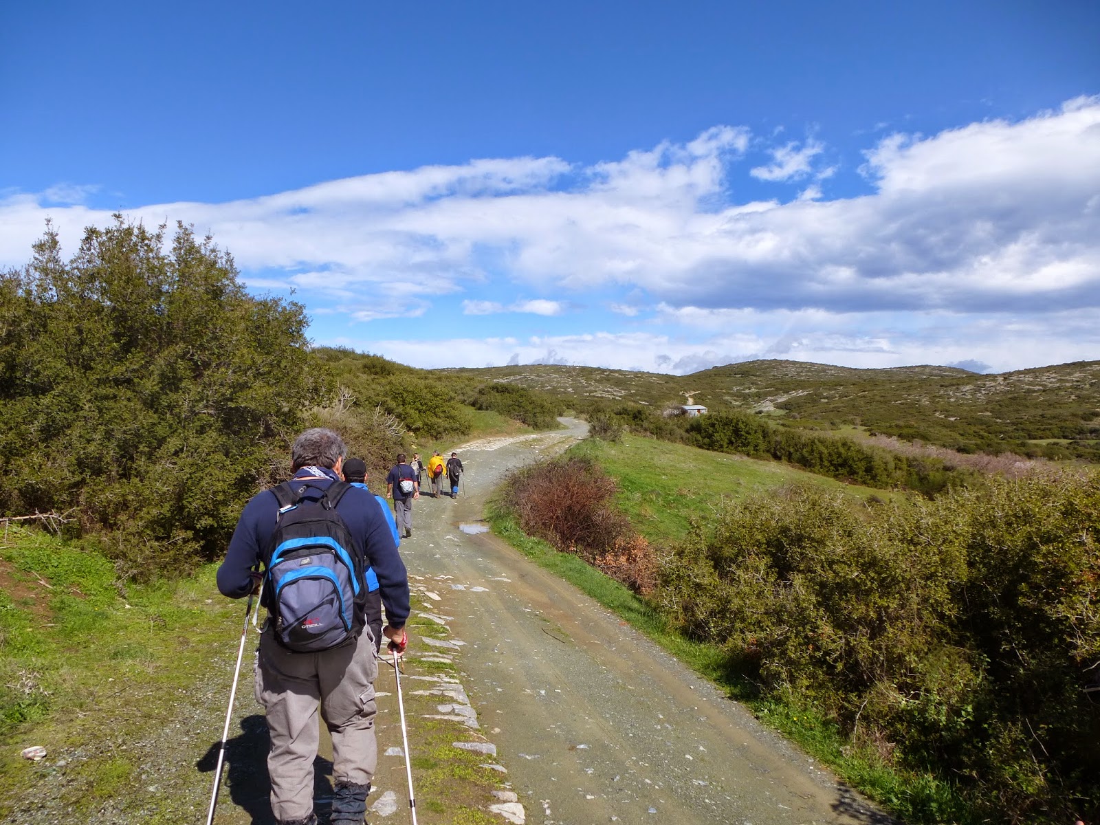
       Τhis walk follows the course of the old kalderimi, most of which still remains in good condition, climbing constantly to Agios Georgios. From there, we can come down to Kato Gatzea or go to Agios Lavrentios, Hania, Tsagarada or Mouresi (see the appropriate walks). At all these destinations, we will find an open restaurant for food and drink all year round.

         From the main road junction at Ano Lechonia, we follow the asphalt uphill, crossing the train rails (we can park our car at the train station parking). After 100 m. there is a V-junction and we take the right branch. We pass by the old square, cross the asphalt and continue straight ahead on a narrow concrete road. At the end of it we join the asphalt again which is on our right. After a short while, we notice a small concrete bridge on the right crossing the stream of Koufala.
The stream of Koufala
           We cross to the right bank of the stream and climb past the old cemetery. Αt the opposite slope, we can see the houses of Paliokastro and higher up Agios Vlasios.
View to Agios Vlasios
          Further up, the kalderimi is covered by concrete. Reaching a junction at a dry water fountain, we don`t go straight ahead but take the sharp uphill turn to the right.  We join the asphalt at the beginning of a sharp left turn and after 100 m. the kalderimi takes off to the right, just after a junction with an earth road. We go past the small chapel of Agios Achilios, join an earth road for a short distance and then continue to the right on kalderimi again (the track on the left goes to Agios Vlasios). This section  is now in better shape after cleaning work by the Friends of the Kalderimi Association. We cross the asphalt, go past another cottage on οur right side and cross the asphalt again. Here we are at the settlement of Strofilos, which lies between Agios Vlasios and Agios Georgios.
The church of Agios Nikoaos in Strofilos settlement
          The church of Agios Nikolaos, which is on our way, is a suitable spot for a stop. According to the inscription, it was restored in 1879. A little further up, where the concrete road turns left, we go straight ahead on the kalderimi, only to join a concrete road again in 50 m. and continue climbing. Further up, where it takes a right turn (attention) we notice the red marks to the left and find the kalderimi again.
View to the sea
          Following the red marks, in a short while we come to an earth track, go left for a few meters and again on the uphill kalderimi to the right. We now climb steadily on a northeasterly direction, almost on a straight line (ignore a path branching off to the left). On our way we pass below a cottage, then join an earth track for a short distance and find again the kalderimi at an angle to the left.
Closing to Agios Georgios
         We walk next to a fence on our left side and eventually join the main asphalt, entering the village of Agios Georgios. We keep on the asphalt, as it has covered the old kalderimi and go past a marble drinking water fountain where water comes out from a lion`s mouth.
The main church of Agios Georgios
           We go past the main church of Agios Georgios (St. George) and finally reach the village square, opposite the museum of sculptor Nikolas.
The square of Agios Georgios on a sunny winter day


Friday, January 2, 2015

Ano Kerasia-Alfons memorial-Flamouri monastery (circular)

Distance: 18 km
Duration: 7 hours (walking time 5.40')
Altitude: from 660 m. (Ano Kerasia) to 965 m. (maximum)
Total ascent/descent: 834 m.
Signed with red paint marks
Drinking water on walk: at Flamouri monastery
Download GPS track: from Everytrail   from Wikiloc

        On January 15th 1981, 75-year old Alfons Hochhauser arrived at snow-covered Kato Koromilia peak at about noon, equipped with a bottle of brandy and some raisins. Shortly before dying from cold as he intended,  he wrote a note advising the team that would come searching for him, saying: ''Don`t come to search for me from Veneto, but rather (come) from Kerasia''. Οf course, his rescuers could not possibly get this advice, as the note would remain in his pocket until he was discovered in two months` time, when the snow started to melt. The note ends with these words: ''Unless some miracle happens, I will soon be frozen. Yes, I`m happy, happy to be on my way. Enough is enough...''
            In this circular walk, taking Alfons` advice, we set off from the end of the asphalt road at Ano Kerasia, to visit the memorial at the site of his death at Kato Koromilia peak and the monastery of Flamouri that is nearby. In comparison to the other similar circular walk in the area (Flamouri monastery-Kato Koromilia (Alfons memorial)),  this walk here suits those who do not want to stress their car (or do not have a 4X4) driving on the rough earth road to go near Flamouri. On the other hand, it is 1,5 hour longer in duration. After the walk, one can have lunch at the square of Kato Kerasia, where there is a restaurant open all year round.
            Leaving our car at the end of the asphalt, we continue on the earth road which leads to the square of Ano Kerasia, where lies the restored main church of Agii Apostoli. The village was burnt down by the German occupation army in 1944 and still remains in ruins, with only a handful of houses restored.
Agii Apostoli church before restoration
         A downhill cobblestone path (kalderimi) starts from the drinking water fountain at the entrance of the square and leads down to the old main drinking water fountain of the village. From there, we continue slightly uphill for a short distance on the slope, having on our right a deserted half-ruined stone hut, and soon come to cross a dry stream, next to the ruins of the old arched stone bridge that survived severely wounded until the early `80s.
The damaged stone bridge of Ano Kerasia in 1980, shortly before its collapse
        Climbing on the opposite slope on  kalderimi, we come to the end of an earth road and to a fenced grove on our right. In front of us is a path junction (attention). The path to the left leads to Flamouri monastery, following the course of the stream on a northerly direction. We take the path to the right going northeast and in a few metres (attention to the marks) turn right and start climbing on the rocky slope. There are two parallel paths, the one on the right has blue and red marks and is direct and sharp, while the other one on the left has red marks and climbs more gently taking turns, in order to help the mules that were carrying heavy loads. Further up the paths merge  and we come to a clearing, now for the most part overgrown with low cedar trees. We walk amongst the cedars to the east and at the upper side of the clearing find the continuity of he path, entering a beautiful beech forest. This area is called Kosta Rachi. From a certain point, we can see at the distance the overgrown peak of Pourianos Stavros (1624 m.).
            We cross an earth road and continue on the uphill path which opens to a road junction and we take the road to the left on an easterly direction. Further on, there is another junction and we again take the left road going northeast. After 50 m, we notice to the left the signed path to Flamouri monastery. We don`t take that, but continue on the road. After about one kilometre, as we are now heading north, we find the path again on the right, next to a pen (watch for the red marks). We climb uphill on a naked slope, crossing the earth road a couple of times and then join the road for a short distance. At the junction we turn left and immediately find the continuity of the path on the right entering the beech forest.
Beech forest  near Koromilia
             After a while, we come to a rocky area where trees grow scarce. Here we are at the site of Alfons` memorial, an engraved bronze piece of his boat ''Thetis'' prepared in advance by himself, fixed onto a rock by his friends.
Alfons` memorial at Kato Koromilia
         Alfons Hochhauser (1906-1981) was born in Styria, Austria but spent most of his life in Pelion, becoming a kind of a local legend. He left his home at the age of 16 and began wandering around the Mediterranean sea. After coming to Pelion in 1926, he lived as a shepherd and a fisherman and was involved in numerous sea diving expeditions. Returning back after the war, he created with his wife Chariklia a hostel for tourists wishing to spend their vacations close to nature, initially at Trikeri island and later at Koulouri beach near Veneto. Being diagnosed with cancer at the age of 75, he decided to climb to Koromilia peak on a snowy winter day and remain there, deliberately freezing to death. The story of this extraordinary man can be found in Kostas Akrivos` book ''Ποιος θυμάται τον Αλφόνς'' (''Who remembers of Alfons'', in Greek) and at the website www.alfons-hochhauser.de (in German). Read also Werner Helwig`s book ''Raubfisher in Hellas'' in German (Greek edition: Οι ληστές του βυθού, εκδόσεις iWrite).
Descending on the rocky ridge
           From the nearby concrete pole marking the peak of Kato Koromilia (827 m.), we start descending on the rocky ridge on a northerly direction, enjoying excellent view to the Aegean sea. If the sky is clear, we can see Athos mountain at the distance. Further down we change direction to the west.We come to a signpost, where we ignore a path with blue marks on the right which goes to Veneto`s Paliokastro and keep following the red marks.
          We cross the stream of Vathoulomeni and climb on the opposite slope, until we reach a yellow signpost at the ridge. Here we take the wide uphill path-kalderimi, which leads us to the monastery of Flamouri.
Flamouri monastery
       Built in the second half of 16th century, it still follows the athonite rules, so entrance is not allowed for women, who must remain outside. Male visitors, however, are welcome inside and can also stay overnight upon arrangement. Restauration works are ongoing. It currently has four monks and celebrates on the 6th of August (Transfiguration of Christ the Saviour). The monastery still operates without electricity, inaccessible by cars, keeping a unique, authentic feeling.
The entrance of  the monastery
         After filling our bottles from the drinking water fountain, we continue uphill initially in chestnut forest and then in beech forest again. A narrow path goes off to the left but we keep on the main path and cross a stream in a spectacular scenery, with water running through large rocks and tall beech trees.
Crossing the stream on the way to Stavros
           Further up, at the location called Stavros, we come to a parking lot where an earth road comes to end (the nearest you can get to the monastery by car), and walk on this downhill. At a junction we go left. After about half an hour, we reach the flat area of Kato Goura. Here is a junction, where an earth road goes uphill towards Ovrios beach and Pouri. We continue straight ahead for 150 m. and notice on the left a water pond and a watering trout for cattle. Now, we could return to Ano Kerasia by walking on the road, but it is preferable to take the path instead. So, we turn left and follow the red marks, passing near the spring of Kato Goura, located under a large beech tree (nowadays connected to the water system).
On the return path to Ano Kerasia
       Our path follows the course of the stream on our right side, on a southwesterly direction. Eventually, we come to the familiar path junction near the fenced grove and follow the route backwards to the start of our walk.
Restored Agii Apostoli church at the square of Ano Kerasia


Thursday, January 1, 2015

Agios Vlasios-Agios Lavrentios (circular)

Agios Vlasios
Distance: 10,5 km
Duration: 4 hours (walking time 3 hours)
Altitude: from 281 m. (Agios Vlasios) to 615 m. (maximum)
Total ascent/descent: 504 m.
Signed with red paint marks and a few signs
Drinking water on walk: yes (Agios Lavrentios, Ai Giannis chapel)
Start/finish: Agios Vlassios village square
Download GPS track:    from Wikiloc

Powered by Wikiloc
 Between the villages of Agios Vlasios and Agios Lavrentios lies the large and overgrown ravine of Koufala. There are two routes to cross the ravine, passing from the chapels  of Agia Irini and Ai Giannis respectively, so we can make a circular walk, as presented here.  Of course, we can walk one way in half the time.  There is a bus connection to Volos at both villages (www.ktelvolou.gr), as well as restaurants open all year round.  


              Starting from the main church of Agios Vlasios (the village used to be called Karabasi in the past), we descend to the adjacent square and walk on the uphill kalderimi heading to the north. Immediately there is a junction, where we take the kalderimi to the left. It soon gets covered by cement and we pass by a dry drinking water fountain built in 2003, according to the inscription. Heading north, we pass by the cemetery, then at two consecutive signed junctions we take the left road at both. The narrow earth road comes to an end at the chapel of Agia Irini, below a watermill (dristela) that was used for cleaning carpets and fabrics.
Αgia Irini chapel
         We cross the stream of Koufala over a concrete bridge and climb to the slope on a path with sections of kalderimi.  The path opens to an earth road, which we follow uphill until we get to the asphalt.  At the outer edge of  the subsequent sharp left turn of the asphalt, we find an uphill path that leads to the chapel of Profitis Elias, a suitable place for a stop.
Climbing the slope to Profitis Elias (in spring)
         We continue on the earth road downhill and in 100 meters at the junction head right on a narrow dirt road. At a right turn we  go straight ahead and find a downhill  path/kalderimi that soon goes parallel to the asphalt, which lies a little lower. Eventually we join the asphalt and after 100 m. we go left at an angle on an earth road that soon joins the main kalderimi coming from Agria-Servanates, which leads to the village square. This is a good place to have a stop for refreshment.
Agios Lavrentios` square
          At the lower corner of the square,  there is a marble memorial and a spring water drinking fountain and next to this begins an uphill kalderimi, which we follow. Further up we come to a dry water fountain and notice a cement road going to the left. However, we continue to the right on the uphill kalderimi which soon takes us to the monastery of Agios Lavrentios, which gave its name to the village. It is one of the oldest monasteries in Pilion, built in 1378 by the Athonite monk Laurentius on the foundations of an even older building (perhaps from the beginning of the 11th century) built by monks from Amalfi, Italy. At present it has three nuns and celebrates on March 10th.
Monastery of Agios Lavrentios

           An asphalt road runs along the top side of the monastery and we walk along this downhill. Further down, at a hairpin bend to the right, we find the path which descends straight into the Koufala ravine. Along the way we encounter increasingly common sections of kalderimi.

        We cross the stream and then come across the chapel of Ai Giannis, next to a spring from which the water is led away by a cement channel. This cool, shady spot, equipped with benches and an open air grill, is especially suitable for summer recreation.
Ai Giannis chapel

        We continue walking on a path along the water channel, ignoring an earth road that sets off to the left (attention, this goes to Agios Geogios!). The path meets a stone hut, which features a watermill wheel at its north wall. Here we join a downhill earth road.
The old watermill

          After 50 m. watching for the red marks on the left side, we find the continuity of the path next to the water channel. After a section of kalderimi, we join the earth road and again find the path on the left side after 100 m. (attention to the red marks).
Path next to the water channel

        
         Further down, we join the road again as it becomes concrete paved and eventually joins the asphalt at a sharp bend.  Walking on the asphalt downhill, we go past a junction with a concrete road, and then we find the path on the right, marked with red marks. Going sharply downhill, it becomes a kalderimi and later is concrete paved. When we reach the drinking water fountain built in 2003, we turn left to return to the starting point at the main church of Agios Vlasios.

Wednesday, December 31, 2014

Louziniko-Kato Kerasia

Distance: 7,6 km
Duration: 3 hours (walking time 2.20')
Altitude: from 113 m. (start) to 305 m. (maximum) to 125 m. (end)
Total ascent: 267 m.  Total descent: 253 m.
Signed with red paint marks
Drinking water on walk: no
Download GPS track:  from Everytrail    from Wikiloc


         This walk, starting and ending at an arched stone bridge, is part of the old route used by the inhabitants of Kerasia and Veneto in order to go to Volos. It was in regular use until the early 60`s, when the asphalt road was constructed.  It is a pleasant walk, without much climbing, amongst shrub vegetation offering little shadow, so it is not recommended for hot summer days unless we start very early. Combined with the walks Louziniko-Kapourna and Kapourna-Kato Kerasia, that makes a 5,5-hour circular walk (best to start from Kerasia). At the square of Kato Kerasia there is a restaurant open all year round. There are regular bus lines connecting Volos to Kato Kerasia (www.ktelvolou.gr).
            Our walk starts at the stone bridge of Louziniko, that still remains in excellent condition. This is about 8 km away from the centre of Volos by car or taxi (no bus connection). Driving on Volos ring road (E92) we take the exit to Fitoko and after 1,5 km turn left at the junction on the narrow asphalt to Louziniko.
Louziniko stone bridge
            Just after crossing the main stream of Kserias over the bridge, we take the narrow road to the right, which incorporates twenty metres of the old cobblestone (kalderimi). At the road junction we go straight ahead, parallel to the stream on even ground, without gaining or losing altitude. Eventually the road ends reaching a pen, and we continue gently uphill on a path with some traces of kalderimi. We ignore a narrow uphill path to the left. Overgrown vegetation of kermes oaks (quercus coccifera) intrude and narrow the path at some places. At a V-junction downhill we take the path to the left (the right one going towards Agios Athanasios chapel and Leschiani).

            We come down to cross a  stream and, climbing on the other bank, we join another stream and follow its course to the north. Further on, as we are on the right bank, there is a path junction. We don`t take the uphill path on the right (going to Agios Athanasios and Leschiani) but keep walking next to the stream and shortly cross it and start climbing on the other side, changing direction to the west. Now we have another ravine on our left side. Looking to the right, we can see the rocky hill called Kokinovrachos (Red Rock).
The path near Kokinovrachos

           At the ridge we join an earth road and follow it, passing next to a ruined stone building. There is a large field on our right side. As the road takes a gentle left bend, we leave it and walk on the left edge of that field on a northeasterly direction. In a short while, we continue on a wide downhill path, which follows the course of another shallow stream on our right. 
Walking at the edge of the field


           Walking on even ground amongst kermes oak vegetation, we reach a small clearing (called Lakka Psichikou). We join the earth road for twenty metres and then continue on the path on the same direction (attention to the red marks on the right side of the road).  
            The path opens out to an almond tree grove. We keep to the same northerly direction into the grove. On our left side we can see the main asphalt road. Reaching a small concrete building housing a water drilling, the short section of kalderimi that lies beyond is blocked by dumped soil, so we join the asphalt for 400 m., until we find the path again watching for it on the right side of the road, 20 meters before a road sign indicating a left turn. Further on, the path opens to an earth road and at the following junction we go left (northwest). Just before reaching the asphalt, we don`t walk on this but on the downhill earth track on the right, which becomes a path with traces of kalderimi.
Τhe stone bridge at Kato Kerasia


           Further down, we come to an earth road and walk over the old stone bridge behind the main church of the village. The kalderimi leads shortly to the square of Kato Kerasia.


Sunday, December 28, 2014

Kapourna (Glafira)-Kato Kerasia

View over Lake Karla and the village of Kanalia
Distance: 5,3 km
Duration: 1.45' (walking time 1.30')
Altitude: from 370 m. (Kapourna) to 430 m. (max) to 125 m. (Kato Kerasia)
Total ascent: 75 m.   Total descent: 340 m.
Signed with red paint marks and yellow signs
Drinking water on walk: no
Download GPS track:   from Everytrail   from Wikiloc


        This is an easy walk on the course of the old trail between the two villages. It is recommended for winter, not for summer (unless we start very early), as  there is no shade offered by the low vegetation of kermes oaks (quercus coccifera). On the positive side, we can enjoy nice views over lake Karla, Kanalia and Kato Kerasia. It can be combined to the walk Louziniko-Kapourna. If we add the walk Louziniko-Kato Kerasia to these, we can have a 5,5-hour circular walk. Both Kapourna and Kato Kerasia are connected by regular bus lines to Volos (www.ktelvolou.gr). At Kato Kerasia square, the restaurant is open all year round.
            We start walking on the asphalt from the square of Kapourna to the direction of Kato Kerasia (to the east). After 200 m., we take the uphill country road to the left, noticing the yellow sign. The beginning of that road is concrete paved, but then it becomes an earth road, incorporating stretches of kalderimi.
Near Kapourna, the road has stretches of kalderimi
             We reach a signed junction, where the route to Kanalia goes straight ahead. Here we turn right and continue on an earth road for about 700 m. climbing gently northeast. As the road takes a right bend, we notice the walker sign to the left and enter the path, which continues uphill for a little while to the north. Then we begin to descend gently, gradually changing direction to the east. On our right side is the hill of Metochi (475 m.).
Seeing Kanalia village up front at the distance
           Enjoying nice views of lake Karla and Kanalia village in front of us, we reach a large clearing and cross it, walking on an easterly direction, following the red marks. We ignore goat tracks that set off to the left, leading to other clearings we can see at the distance, and keep following the red marks on an easterly-northeasterly direction. We soon see the village of Kato Kerasia below at a distance.
View over Kato Kerasia
              Eventually, the path opens out to a seemingly deserted grove and we now walk on a downhill earth road. Later on, we cross a stream and another road joins in from the right. Then we join the asphalt at the point where it takes a sharp downhill right bend above Kato Kerasia. At the electricity pole on the left we find the final path section amongst bushy vegetation by kermes oaks, and lower down we come to join a road parallel to the stream.
Closing down to Kato Kerasia
        This takes us to the main church, next to the asphalt road bridge. The village square is above the parking lot and there is a restaurant open all seasons. 

Saturday, December 27, 2014

Louziniko-Kapourna (Glafira)

Seeing Kapourna at the distance
Distance: 4,8 km
Duration: 1.45' (walking time 1.30')
Altitude: from 95 m. (Louziniko) to 370 m. (Kapourna)
Total ascent: 315 m. Total descent: 50 m.
Signed with red paint marks and a few signs
Drinking water on walk: no
Download GPS track:   from Everytrail   from Wikiloc


        Τhis is an easy walk on the ancient trail that used to connect lake Karla to the sea. Pay attention to follow the red paint marks, because there are many goat tracks in the area that can cause confusion. Walking is not recommended in hot summer days, unless we start very early, because there is no shade. It is better to undertake this walk during the winter. Having arrived at Kapourna (officially called Glafira after the homonymous ancient settlement), we can either return or continue walking to Kato Kerasia or Kanalia. Combining the walks Louziniko-Kapourna, Kapourna-Kato Kerasia and Louziniko-Kato Kerasia, we can have a 5,5-hour circular walk. There is a regular bus line from Volos to Kapourna, Kerasia and Kanalia (www.ktelvolou.gr). At the squares of Kato Kerasia and Kanalia, there are restaurants open all year round. 
         We start our walk at the stone bridge of Louziniko, that still remains in excellent condition. This is about 8 km away from the centre of Volos by car or taxi (no bus connection). From Volos ring road (E92) we take the exit to Fitoko and after 1,5 km turn left at the junction on the narrow asphalt to Louziniko.
The stone bridge at Louziniko
         We pass over the large stream of Kserias (meaning ''dry stream'') and walk on the concrete paved uphill road. At the point where it takes a right bend, we continue straight ahead on a narrow earth road heading northwest. After 150 metres, we notice the red marks to the right just after the electricity pole, and enter the path that goes uphill on the slope.
Looking back over Volos
          Watching out for the red marks to secure our way, we walk on a steady northwesterly direction on a path that narrows or widens, depending on the dominant kermes oak vegetation. After abour three quarters of an hour, we can see the village of Kapourna ahead at the distance.
Fields near Kapourna
           Eventually, the path opens to a field and we walk initially on its left edge, then walk for a few metres on the edge of the adjacent field to the left and then find a short downhill section of the path. It opens to another field and we follow its left edge again. We can see a lone cypress tree in front of us which serves as a guide. From the cypress tree, we cross the field and find on the opposite side the final section of the path between the holm oak vegetation. It opens to the asphalt road, which we follow until the batch of cypress trees at thge entrance of the village, where we follow the concrete road to the right, until we get at the corner of the village square, just next to the bus stop.
.


Friday, December 26, 2014

Neochori-Siki

Distance: 6,8 km
Duration: 2,5 hours (walking time 2 hours)
Altitude: from 460 m. (Neochori) to 210 m. (Granitsa stream) to 310 m. (Siki)
Total ascent: 373 m.  Total descent: 401 m.
Signed with round yellow signs and red paint marks
Drinking water on walk: no
Download GPS track:  from Everytrail   from Wikiloc


                 This route, passing from the ruined chapel of Agios Efstathios,  was blocked for many years, until it was cleared by volunteers in 2013-2014. There is also another southerly route passing from Agios Georgios chapel at Lai, but this remains currently blocked.
             We can go to Neochori by bus (www.ktelvolou.gr) or walking from Milies or Niaou (Afetes). There is also a walking route from Siki to Xinovrisi. At the square of Neochori the restaurant is open all year round, whereas at Siki only during the summer season.
             Starting from the upper corner of the square of Neochori, we take the uphill stone paved track going east and walk between a church, which is on our right side, and the school on our left. A little further up at a junction we take the wide uphill kalderimi to the right, watching for the red marks. We join a paved road at an angle and head east, exiting the village. After crossing a stream, we notice the sign on the left and enter a section of the path that has been restored.
A restored section of the original path
           This opens to an earth road junction, where we head straight on to the east. Immediately there is a V-junction, where we take the road to the right, which has a section of kalderimi.
          A little further on, we have a grove on our left. Just as we reach its corner (attention to the left), we climb for a few metres on a path just next to the grove and then turn right to the east.  As we climb, we enjoy excellent views over Granitsa ravine, Siki village and the Aegean sea. That area was burnt a few years ago but is overgrown again.
          At the ridge, we pass by some pine trees that managed to escape the fire and  join a descending earth road. We reach a crossroads and continue in the same southeasterly direction on a seemingly abandoned uphill track. Reaching the ridge, as the track turns gently left, we  go right and find the path, descending for a while until it joins an earth road again. We soon reach the chapel of Agios Efstathios, the roof of which unfortunately has collapsed and lays in ruins.
Reaching Agios Efstathios chapel
         A little further down, we leave the road and go straight ahead onto the path, which descends on the north slope of Granitsa ravine. This word means ''border'' in slavic languages, and indeed used to be the border between the  land jurisdictions of Neochori and Siki. It opens to the sea at the beach called Pantazi Ammos.
Going down to cross Granitsa stream
       The path opens down to an earth road, which we follow to the right and pass next to a building of the water system. We cross the stream and continue on the concrete road uphill. At the first left bend, there is a section of the path climbing next to the road on the right, and joins it again higher up, so we can avoid a section of the cement road.
      On the ridge, we join the asphalt road going to Pantazi Ammos beach, and we follow it to the south (to the right) entering Siki. Watching for the round yellow sign at an electricity pole, we go left downhill on a stone paved track and pass by a parking lot and the main church οf Agios Georgios, ending up to the cosy square of Siki.
Siki village square