Monday, May 26, 2014

Agios Lavrentios-Agios Georgios

Agios Georgios
Distance: 5,9 km
Duration: walking time 1.35', total time 2 hours
Altitude: from 560 m. (Agios Lavrentios) to 500 m. (min.) to 630 m. (Agios Georgios)
Total ascent: 251 m. Total descent: 174 m.
Signing: red marks, signs
Drinking water on walk: yes (Ai Giannis chapel)
Download GPS track:   from Everytrail    from Wikiloc


        Setting off downhill from the square in Agios Lavrentios, we immediately come to a neoclassical marble spring water drinking fountain on our left and next to this begins an uphill kalderimi, which we follow. Further up we come to another dry water fountain and notice a cement road going to the left. However, we continue to the right on the uphill kalderimi which soon takes us to the monastery of Agios Lavrentios, which gave its name to the village. It is one of the oldest monasteries in Pilion, built in 1378 by the Athonite monk Laurentius on the foundations of an even older building (perhaps from the beginning of the 11th century) built by monks from Amalfi, Italy. At present it has three nuns and celebrates on March 10th.
Agios Lavrentios monastery

      An asphalt road runs along the top side of the monastery and we walk along this downhill. Further down, at a hairpin bend to the right, we find the path which descends straight into the Koufala ravine. Along the way we encounter increasingly common sections of kalderimi.
         We cross the stream stepping from stone to stone and arrive at the chapel of Ai Giannis next to a spring from which the water is led away by a cement channel. This cool, shady spot, equipped with benches and an open air grill, is especially suitable for summer recreation.
Ai Giannis chapel

     We continue walking along an earth road and further on there is a junction from which the road on the right descends towards Agios Vlasios. We take the left branch and climb slightly uphill. After a short distance, another road joins from the left and a bit further up the hill we see the monastery of the Taksiarchon (Archangels). The path should pass by the monastery, and at the end of the uphill section we can see where it continues if we look on the left bank of the road. Initially it is passable, but near the monastery it becomes difficult because of soil that has been dumped on the path there.
Monastery of Taksiarchon near Agios Georgios

     So, we prefer to continue on the road, coming out onto a narrow asphalt, which we follow uphill. As we near the monastery after a left turn in the road, we turn right onto a narrow earth road that immediately brings us to the open air theatre “Aloni”.
Theatre ''Aloni''


      We walk on for a few metres and, with the cement road on our left, we walk straight ahead through an opening in the fence onto a path. We pass a second fence after which the path descends onto a cement road and we meet the first houses of Agios Georgios.
Reaching Agios Georgios

                                                              At the end of the road, we continue on a path which later becomes a kalderimi. This descends to the main road through the village. We immediately pass a spring water drinking fountain with a marble lion’s head. Walking on the road, which has covered the kalderimi that used to be there originally, we go past the church of Agios Georgios and arrive at the square, next to the museum exhibiting the works of sculptor Nikolas.

Sunday, April 20, 2014

Chorefto-Agios Ioannis (Αi Giannis)

Agii Saranda beach, view from the south

Distance: 7,5 km
Duration: 3,5 hours (walking time 3 h)
Altitude: from 0 m. (Ηorefto) to 190 m. to 0 m. (Ai Giannis)
Total ascent/descent: 420 m. 
Signing: red marks, a few round yellow signs
Drinking water on walk: Panagia Faneromeni chapel
Download GPS track:  from Everytrail   from Wikiloc


       Τhis route connects the two main tourist beaches of Pelion`s eastern coast, Chorefto and Ai Giannis, passing from another three beaches that lie in between (Agii Saranda, Banikas, Plaka). It is not entirely coastal though, as it reaches a maximum altitude of 190 meters. 
Route B
           Starting from the camping at the south end of Chorefto beach, we walk uphill on the asphalt.  The original path`s course followed the earth road on the left, that eventually ends at a fenced grove.  Unfortunately, because of a landslide, the path section at that spot now has collapsed and disappeared, so we have to pass through the fence, but the owner objects and does not permit passing through his property. So, to avoid any trouble, we prefer to follow the asphalt uphill.
Agii Saranda, view from the north
          At the third turn of the asphalt, we head straight to guesthouse ''ENASTRON''. Walking on the right side of the building, we continue straight ahead on a path which soon joins an earth road. We head left and then to the right, and pass just under a small hut on our left side. After that hut, the path is obvious and goes downhill to reach the narrow asphalt road leading to the beach of  Agii Saranda.
Agii Saranda beach (in February)
          Having reached the large sandy beach of Agii Saranda, we walk to the other end and just after the statue on the rock, next to the taverna on the right, we start walking on an earth road going uphill. An earth road coming from the beach bar Monk joins in from the left.
          After about seven hundred meters, we reach a junction where we head left downhill. Further down, at a sharp right bend of the road (attention!), we go straight ahead to find the only surviving section of the old path and we soon get down to the quiet pebbly beach of Banikas.
On the surviving section of the old path to Banikas beach
          We cross the stream (called Mega Rema). To our left is a deserted house next to the sea and to the right a renovated cottage.
Banikas beach
         At the end of the beach is a third cottage and we take the earth road starting from there going uphill.
Renovated cottage at Banikas
             At a short distance there is a junction, and we take the narrow road to the left, passing just above the cottage leading to a grove. We keep climbing up steeply and at the upper edge of the grove we notice an unused concrete irrigation ditch. Following this, a few meters higher up we find the continuity of the path which ascends steeply in holm oak (quercus ilex) forest. The path may be overgrown at some spots, so it is advisable to wear long trousers. Eventually we come to an olive grove and continue straight ahead uphill to the chapel of Agios Charalambos.
Agios Charalambos chapel
             Next to the chapel lies a wooden kiosk. We continue on the earth road and, after 150 meters at a right uphill turn of the road, watching on the left side (attention!), we find the continuity of the path. It goes down through jungle-like vegetation, crosses a small stream and then opens to another earth road, on which we walk to the left. After another 100 meters, at a left downhill turn of the road (attention!) we find the path on the right and keep going downhill.
       Further down, we join another earth road at a junction. Here it is highly recommended to continue on the road downhill for ten minutes, to reach the quiet  chapel of Panagia Faneromeni. Built on a rock just above the Aegean sea, this is an excellent and beautiful example of Pelion`s hidden treasures, an absolute gem. Take some time to relax in quiet and refresh drinking the cool water that comes from a spring through the rock.
Panagia Faneromeni chapel
       Retracing our steps  back to the road junction, we now head left (south) on the road and after 500 meters we reach the fence of Hotel Eden. At that point we head left towards the sea (to the east), walking downhill on a path/kalderimi. Some sections of the old kalderimi have survived and others have been rebuilt, but unfortunately not to the best standard (the flat stones that were used can be slippery when wet-attention!).
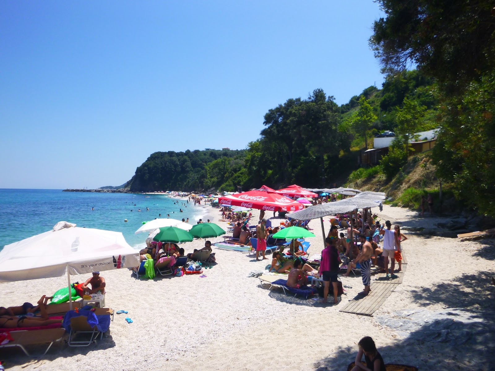
Plaka beach in summer
         We walk next to a kiosk with a fallen pole and soon end down to the excellent sandy beach Plaka, which, like Banikas, belong to the village Anilio. In the past this used to be a quiet, remote place (fortunately it remains unaccessible by cars), but nowadays the bar-restaurant of Eden hotel from above makes it more lively, by virtue of the loud dance music played all day in summer (thankfully not heard at the other end of the beach).
Plaka beach (in February)
       We continue along the beach to the south, pass over the rocks at the end of it and arrive finally to the tourist seaside settlement of Ai Giannis (Agios Ioannis).

Tuesday, April 8, 2014

Veneto-Pouri (O2 trail)

Distance: 21,5 km
Duration: 8-9 hours (walking time 6.45')
Altitude: from 240 m. (Veneto) to 0 m. (Limnionas beach) to 450 m. (Pouri)
Total ascent: 1083 m. Total descent: 881 m.
Signing: O2 signs, red paint marks
Drinking water on walk: yes (Pirgakia, Kserorema -dry in summer and autumn)
Download GPS track:   from Everytrail    from Wikiloc


          This is a magnificent walk. Part of the national trail O2, a long trek in one of the few virgin areas still left in Pelion.  On our way, we pass from the isolated beach of Limnionas, two old stone bridges and by the ruins of the deserted village of Palia Mitzela. In short, this walk epitomises the best of Pelion mountain`s wild natural beauty and be sure, if you have the chance to undertake it, that its memory will not fade away.
          The most practical way to move is by tourist bus or taxi. Veneto lacks public bus service, but we can take the bus from Volos to Keramidi (www.ktelvolou.gr), and then either walk to Veneto in 5 hours (two routes, one direct and the other via Kamari) or take the taxi from Keramidi, tel. 6977893576. From Pouri there are two buses daily to Zagora. If we elect to start from Veneto, we have the advantage of walking in proximity to earth roads for the second half of the walk, so if a hiker develops a problem then, it is relatively easy to get help.  There is a restaurant open in Veneto (tel. 6989612016) and Pouri (tel. 6909454491) for food and drink. At Pouri there are two guesthouses to stay (Alisachne and Panorama). Recently, accomodation in Veneto is also available (Apartments Veneto), as well as in Kamari.  From Pouri, one can continue walking down to Horefto beach or up the mountain to Makrinitsa.
Heading down to cross Kakorema stream
          Starting from the parking lot of Veneto, we climb to the square nearby and then to the steps that open to a concrete road, on which we walk to the left (east). We pass by the chapel of Agios Nikolaos (there is a spring water fountain down below to the left) and exit the village, leaving on the right two crossings that go to Ano Kerasia and Flamouri monastery respectively. At the second pen on our way (now deserted), about half an hour from the start, there is a sign to the right to enter the path, which is going down to cross the large stream Kakorema. Bear in mind that from now on, more than four hours will pass until we meet an earth road again.
             After crossing another stream, we climb to a rocky plateau and reach anοther pen. Here the path is unclear, but if we walk uphill for a few meters above the pen`s hedge, we will notice the red marks and find the proper path, which continues downhill to cross yet another stream, called Vathoulomeni. After this, we walk parallel to the coastline, thirty to fifty meters above the sea. On the left is a crossing to the ruined dock of Flamouri monastery (Agios Nikolaos). From a certain point, if we look back we can see the sea caves at the rocky coast, called Ipnoi in ancient times. At that coast, a considerable part of Xerxes` fleet sank in 480 b.C. during the Persian invasion to Greece.
The sea caves

          Leaving two more crossings with blue marks on the right, leading to Paliokastro and Ano Kerasia respectively, the main path eventually takes us down to the bed of a large stream, called Agralexi. Walking a short distance into the streambed, we come to the isolated small pebble beach of Limnionas. Here we notice the existence of some ruins and an old well, remains from the times when this place was used as a dock for transporting wood and various goods (legal or illegal) by boats. Three hours have already passed since our start from Veneto.
Limnionas beach
           The path continues from the end of the beach, climbing up onto the wild wooded slope, heading gradually away from the sea.  Eventually, it opens to an earth road, on which we walk. It crosses a stream and then approaches a second larger ravine, called Kapnoutsi. Watching to the left as we walk down the road, we notice the O2 signs and find the path (cleared in November 2013, previously unpassable), which takes us down to cross the stream over the old stone bridge of Pirgakia. Built probably during the Ottoman era, it still remains in good condition, surrounded by lush vegetation and high plane trees into the virgin ravine.
Pirgakia stone bridge

            After a while, our path opens out again to the earth road. In twenty meters we have a small spring water fountain on the right, a welcome sight (but will be dry in summer and autumn). After another fifty meters, watching out for it on the right, we find the path again, that leads us through the ruins of the village of Palia (Old) Mitzela. Destroyed by the Turkish Ottoman army in 1828 during the Greek revolution, it lays abandoned ever since. The remains of the main church of Panagia (Virgin Mary) were recently destroyed by illegal excavators searching for gold -an awful shame and disgrace.
A pile of stones, what is now left from Panagia church at Palia Mitzela
           After the institution of the Greek independent state, the village`s refugees were granted land near the state borders of the time, at Pagasitic gulf, were they built the New Mitzela (or Amaliapolis).
         Leaving Palia Mitzela, we reach the large ravine of Lagonika and the path becomes stone paved (kalderimi) as it winds down the slope. We cross the stream over the excellent stone bridge of Diakoumi, also built in the Ottoman era by craftsmen coming from Zagori of Epirus, northwestern Greece - a testimony of the Pelion villages` thriving at the time. For more information on that subject, see Nikos Haratsis` photographic book ''ΠΕΤΡΙΝΑ ΤΟΞΩΤΑ ΓΕΦΥΡΙΑ ΣΤΟ ΠΗΛΙΟ'' -Stone arched bridges in Pelion (in Greek). Read also Werner Helwig`s book ''Raubfisher in Hellas'' (in German), based on the life and adventures of Alfons Hochhauser in that area of Pelion.
Diakoumi stone bridge over Lagonika stream
        The path opens out to an earth road (which to the left goes down to Ovrios beach) and we walk on this to the right (east). After about two kilometres, as the main road takes a sharp left bend downhill, we head right to a narrow earth road and follow it, finding the path-kalderimi going straight ahead and cross  Kserorema stream, the last one to come in our way. Climbing up on the opposite slope, we meet a fountain, where spring water emerges from the rock, under a big plane tree.
Kalderimi near Kserorema stream
        We come to an earth road and follow it uphill for a short bit, then walk on even ground. At an angle to the right, an uphill concrete paved road also leads to Pouri. We prefer to head straight on, and soon reach a narrow asphalt on a sharp bend and follow it uphill.
Pouri
           Reaching the lower quarter of Pouri, we notice a spring water fountain on the right. From there we take the uphill stone paved path (kalderimi), leading us to the corner of the parking lot, which is located at the upper (main) quarter of the village, at the end of the bus line, close to the taverna.


Monday, March 24, 2014

Milies-Tsagarada

Distance: 11,4 km
Duration: 4 h (walking time 3.30)
Altitude: from 380 m.(Milies square) to 790 m. (max) to 510 m. (Taksiarchon square, Tsagarada)
Total ascent: 529 m.  Total descent: 419 m.
Signing: red marks, signs
Drinking water on walk: no
Download GPS track:   from Wikiloc    from Everytrail


             This is a classic, well-worn and beautiful route in Pelion. A large part of it is on kalderimi (stone paved path) through the forest and at the end we pass over the river bed of Milopotamos on the wonderful old stone bridge. We can get to Milies and return from Tsagarada by bus (www.ktelvolou.gr). The route can also be combined with others (for example Kala Nera-Milies and Tsagarada-Damouhari-Ai Yiannis) to create a long trek across Pelion lasting 7-8 hours, starting on the Pagasitic coast at Kala Nera and ending on the Aegean coast.
             The library building, inscripted with the words ''ΨΥΧΗΣ ΑΚΟΣ'' (psychis akos, “therapy for the soul”) is found just above the square in Milies and immediately to its right begins the kalderimi towards Labinou-Xourihti-Tsagarada. We start up this and immediately pass a covered spring water drinking fountain on our left. We continue straight ahead, climbing past the houses of the village in an easterly direction. The kalderimi zigzags next to a plane tree, diagonally crosses a cement road and continues uphill in the same direction. We keep following the red marks and ignore any downhill kalderimis or roads crossing our path.
Kalderimi at Milies
               A little further on, we continue on a cement road as we leave the last houses of the village behind us and walk between apple orchards. At the second left hand bend, we leave the road and turn right onto a kalderimi next to a concrete water channel and water pipe. On our right is a row of cypress trees. We pass a stream bed over a small concrete bridge and continue on a lovely kalderimi/path.
Chestnut forest above Milies
We soon come to a crossing, at which the signpost indicates that we should turn up to the left onto a wide path, which becomes a kalderimi a little further up. We come out at an angle onto a kalderimi/road and continue uphill. In a short while, we meet and cross a wide earth road and continue in the same direction between chestnut trees. Where a road comes in from the right, we continue ahead in a northerly direction and reach a wooden kiosk at the location called Kefalas. From here, to the right of the kiosk, a path leads down to Labinou (see the route Milies-Labinou beach).
Getting into the forest near Kefalas
                We walk a bit further on the road, which eventually ends and continues as a kalderimi that leads into a beautiful forest with evergreen holm oaks initially, then beech, plane and chestnut trees. Moving in a generally northerly direction we pass the Kerasorema stream bed and ascend gently for a bit until we reach the highest point at 790 meters. This part through the forest is beautiful and evocative and one wishes it could last forever!
         The kalderimi begins now to descend (we ignore two paths to our right) and we reach a wooden bridge over the Varsami river bed. After the bridge, we leave the forest and walk uphill on  an earth road in which sections of kalderimi are visible from time to time until it goes off to the right of the road. We are walking now in maquis vegetation and pass next to a couple of orchards. The kalderimi then opens to a crossroads. We take the middle road and in a few meters find the humble country chapel of Agios Dimitrios.
            We continue on the road for two hundred meters and, watching out for a path to our right at a left bend in the road, turn onto it. This descends slightly and has some sections of kalderimi. Following the red marks in a generally northerly direction, we again come out onto the road and walk on this downhill for a short distance before finding the continuation of the kalderimi diagonally off to our left. We pass a kiosk and a water tank before the kalderimi eventually brings us down to the asphalt road. We walk on this for about a hundred meters, watching out for the paved path on our right that zig-zags down to the bottom of the Milopotamos gorge, where we find waiting for us, stable in its position despite the ravages of time, the old stone bridge with the pointed arch.
Τhe bridge of Milopotamos (now ruined)

           Released now from the burden of loaded down mules, which in previous times continually passed over it, the old bridge rests quietly, patiently remembering times past in the company of the plane trees and the water that passes perpetually beneath it. And we, its present day visitors, always feel welcome as we cross over its grassy ridge. Let us hope that this creation of human artistry and craftsmanship will remain intact for many centuries more.
UPDATE 12/2/2021: Unfortunately, the old bridge fell to the ground yesterday, damaged by a plane tree that fell on it. Hoping there will be a plan to rebuild it in near future.
              After the bridge we climb a short way up the kalderimi and come out again onto the asphalt road, on which we walk for fifteen minutes to reach Taksiarchon square in Tsagarada with its characteristic drinking water fountain.
Taksiarchon square, Tsagarada


Tuesday, November 19, 2013

Fitoko-Makrinitsa


Approaching to Makrinitsa
Distance: 7,1 km
Duration: 3,5 hours with stops (walking time 3 h)
Altitude: from 195 m. (Fitoko) to 700 m. (max) to 620 m. (Makrinitsa square)
Signing: red marks, a few signs
Drinking water on walk: no

Download GPS track:    from Everytrail     from Wikiloc

        The area of Fitoko previously belonged to the community of Makrinitsa. Although this route passes over mostly stony ground with low vegetation, we are compensated by the panoramic views towards Makrinitsa, Portaria, Volos and Pagasitikos Gulf, as far as the villages of Sesklo and Kapourna. Walking is not recommended for hot summer days with strong sunshine, as there is hardly any shade, but is particularly suitable for winter (October to April). Vegetation near Fitoko and Klima in the first half of the route may be thick in places. We can go to Fitoko by taxi and return from Makrinitsa to Volos by bus (www.ktelvolou.gr), or walking down to Aidonofolies and then take city bus nr. 4.

       We can start out from the parking lot at the main church of Panagia (the Virgin Mary) at Fitoko. A narrow asphalt road leading to the houses of the village starts by a shrine near the entrance of the parking area and we immediately turn left off this on an earth road that leads down towards a small ravine. We pass by a spring water drinking fountain (without water) and turn left at the bottom into a narrower road with a chain across it (walk over the chain). A few metres before the road ends, there is an obvious and fairly wide path-kalderimi to our left that zigzags uphill. For a short distance, our progress is hindered by prickly pears before we reach an old spring water drinking fountain. A little further up, the path emerges onto an earth road which we follow uphill. That road also comes from the main church of Fitoko. A road goes off to the right, but we continue straight ahead. Further up at a triple junction we turn right, then right again at the next junction and to the left at the following junction (watch out for the red marks).
View to Fitoko (to the right)
        In a short while we see the path on the left of the road, but it is closed by vegetation and we walk next to it on a parallel path through an olive grove. Further on, just below a house, the path continues up to the right of this and comes out diagonally onto an earth road which we follow to the right (ignore the yellow paint marks). About a hundred metres further on, after passing a small hut, we see red marks on the left, which lead us uphill, on a path that runs next to a fence. The path, which was cleaned recently (autumn 2015), shows signs of kalderimi, and further on runs next to a water channel for a small distance.
View to Volos from Vathirema ravine
       We reach the ridge and the kalderimi/path begins to descend towards a fairly large ravine (Vathirema). Electric power lines and the road going to the Kaliakouda and Ksirakia springs can be seen along the opposite side. We cross the ravine, ascend to the other bank, cross the road and continue up a narrow track that leads shortly up to a cement building of the water system. We continue, walking now on path on the dry, stony ridge of Sarakinos with an unrestricted view to the city and sea below. From time to time we see signs of kalderimi.
      The ascent becomes less steep, we walk for a short distance on level ground and then begin to descend towards Makrinitsa, visible at the distance. On our course there is a cross in memory to those who died in the battle of Makrinitsa in 1878 during the Greek uprising against the Turks (Volos joined the state of Greece in 1881).
Patosia stone bridge at Makrinitsa
       Descending amongst some pine trees, we walk over the stone arched bridge of Patosia and then the path brings us to an old fountain with no water. We continue straight ahead entering the village and shortly turn left onto an uphill kalderimi that takes us past the beautiful restored mansion that houses the Environmental Education Centre. We come out into the main square of Makrinitsa, right next to the kalderimi that goes down to Volos.
Makrinitsa

Agios Georgios-Kourventeli-Tsagarada

View to Pagasitic gulf
Distance: 15 km
Duration: 6 hours (walking time 4.40')
Altitude: from 610 m (Agios Georgios) to 1070 m (Kourventeli) to 490 m (Taksiarches square, Tsagarada)
Total ascent: 570 m.  Total descent: 660 m.
Signed with red marks and metal signs
Drinking water on walk: Katsakari spring near Tsagarada
Download GPS track:    from Everytrail     from Wikiloc

         This is the lower route between Agios Georgios and Tsagarada, passing from Kourventeli ridge above the village of Vizitsa at 1070 m. (the other route reaches maximum altitude of 1460 m. at the plateau of Mega Isoma). During its second and third part, we walk into cool and shady beech and chestnut forest, so it is also suitable for hot summer days, provided we start early. Having arrived to Tsagarada, we can walk for another two hours on kalderimi, to reach the tourist beach of Ai Giannis (Agios Ioannis) and Damouchari (see the walks Tsagarada (Taxiarchon square-Agia Paraskevi square) and Tsagarada-Damouchari-Ai Giannis (Agios Ioannis)).   
         Starting off from the fountain at Agios Georgios village square, we climb on the cobbled stone path (kalderimi). We pass by the church of  Agios Athanasios and continue climbing steadily on kalderimi, which becomes an earth path after exiting the village. We cross a concrete irrigation ditch to the right, noticing the handmade signs (in Greek) posted here by a volunteer hiker (now deceased), just as in many other spots along our route.
Handmade signs by Dimitris Kottalis. Go right for Tsagarada, if you don`t get it
         Further on, the path joins an earth road and we reach a triple junction, where on the right lies the restaurant-horse farm ''Paliovigla''. We take the downhill road to the left and pass the stream of Lagoussa. Immediately after this, we find the path on the left. It passes next to a grove and a hut and enters an earth road, which we follow. Reaching a junction we go left uphill. As the road takes a sharp left turn, we find the path straight ahead amongst dense shrub vegetation. We find some kalderimi parts on our way and, after crossing Kakoskali stream, our path opens out to an earth road and we continue uphill. At a V-junction we take the road to the right and reach a round water tank collecting the water from Klidonari spring. After the tank we continue on path, cross the Vassilikis stream and then join another earth road heading uphill into beech forest. Another road joins in from the left (that route is coming from the Eastern Refuge).
Crossing  Vassilikis stream
          Walking now on the ridge called Kourventeli, located above the village of Vizitsa, and watching constantly on our left, at some point we notice the red marks that sign the path heading to an easterly direction into the forest.
Walking into beech forest
 After a while we come out on a downhill earth road and walk by a kiosk. We soon notice a sign to the left and enter the path again. We cross Miliotiko stream walking on a stretch of well preserved kalderimi, wishing it would never end. From  certain spots we enjoy a beautiful view over Pagasitic gulf.
A stretch of kalderimi close to Miliotiko stream
       This long stretch of path ends as it comes out to a downhill earth road next to a kiosk. This road ultimately comes from the village of Xourichti. We pass by a shrine on our way and further down, as the main road turns right (attention), we continue straight ahead on a narrow road in a northerly direction. We soon notice  the signed path on the left, with stretches of kalderimi, that leads down to the bed of the large stream of Milopotamos. Very close to the bed lies Katsakari spring. Water is led through pipes down to Tsagarada.
Katsakari spring at Milopotamos stream
       We cross the stream and continue on earth road  into chestnut forest. Further down we join a wider earth road and follow it downhill. On a sharp right turn (attention) we leave it to the left and find the path going downhill, then walk aside a cottage`s fence and come out again on the road. In a few meters, reaching a ruined stone hut, we go right on a road-kalderimi  and then left at a V-junction next to a concrete water tank, noticing the red arrow.
        The narrow road we are walking on, eventually turns into a proper kalderimi, opening to the main asphalt of Tsagarada. We cross this diagonally to the right to find the kalderimi again and soon reach Taksiarches square, with its characteristic quadruple drinking water fountain.
 Taksiarches square in Tsagarada