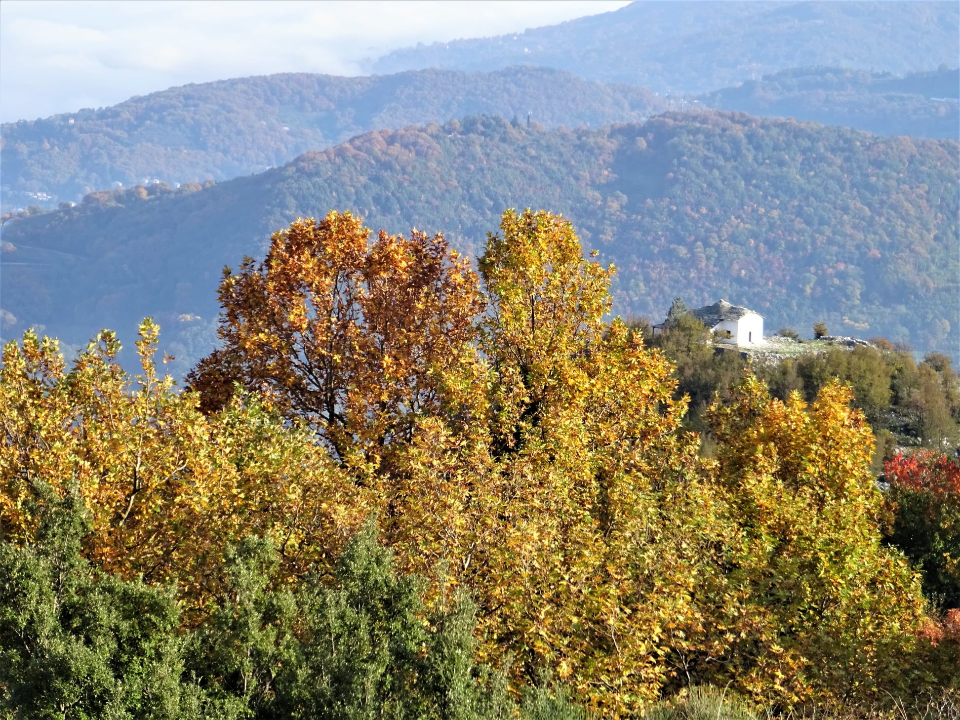
Thursday, September 29, 2022

Alogoporos-Anisvales-Theriakodas (circular)

Theriakodas


Distance: 6,9 km

Time: 3-3,5 hours with stops

Altitude: from 0 m. to 244 m. (max)

Total altitude gain/loss: 265 m. 

Signing: red paint, round metal signs

Drinking water on walk: no

Start/end: Alogoporos beach

Download GPS file: from Wikiloc

Powered by Wikiloc

       Centered around Alogoporos beach, we combine the Trikeri-Alogoporos and Trikeri-Theriakontas trails to create a three-hour circular walk. Long pants are recommended, as the path to Theriakodas is narrowed by overgrown vegetation, but still remains passable (and beautiful). 

        Starting from the beach of Alogoporos, we first walk on the asphalt. A little further up, the asphalt makes a right turn and we continue straight ahead through an olive grove. We cross a dirt road (it's the same one that goes to Theriakontas) and climb continuously on a clear path, from some parts of which you can see the sea.  


            We reach a small clearing, where the climbing ends. This location here is called ''Vlachi'', according to Nikos Haratsis. There used to be a pen here. We now begin to descend on the path heading south. Finally we reach a long and narrow pit with grass, called ''Anisvales'', again according to Haratsis. If we cross it transversely, we will find on the other side an uphill path that goes to Trikeri.   We do not do this, but turn left descending to the pit, and from its lower end we find a path on the right that descends smoothly to the east, crosses a small stream and, climbing a little, meets on the other side a path that runs parallel to the stream. This is the path that goes to Theriakontas and we follow it to the left (north). 


        The vegetation is quite overgrown, but the path remains passable, pending an initiative to clean it. In any case, long pants are recommended for the time present. 

The hut near Theriakodas

        Walking along the nice unpaved path, we pass by a hut and have the stream right next to us on the left. We follow a fence and finally come out on the pebbly and deserted beach of Theriakontas. There is no tourist development here, nothing to disturb the tranquility of the landscape.

Theriakodas

       At the left end of the beach begins a road that climbs roughly parallel to the coastline. We follow it, and after about 700 meters, paying attention to our right, we find a path that faithfully follows the coastline and takes us to the eastern end of Alogoporos beach.


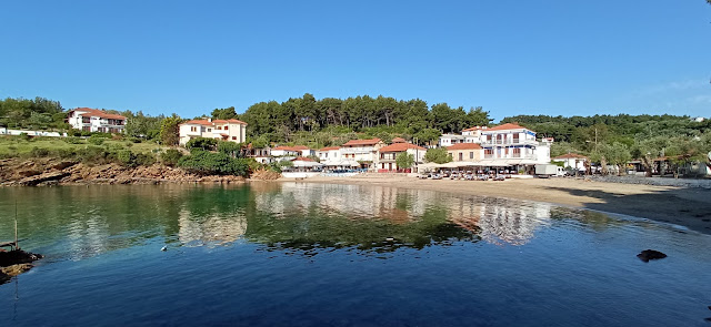
Seeing Alogoporos

       A cafe with rooms for rent operates here. From here you can also take the water taxi to go across to the island of Paleo Trikeri. Here lies the monastery of Evangelistria, as well as a few rooms for rent and two cafe-restaurants at the seaside.

The water taxi to the island

Τrikeri island


Tuesday, September 6, 2022

Hania -Profitis Elias chapel-Plakotoura waterfall (circular)


Distance: 7,3 km.

Time: walking time 3.10', total time 4 h. with stops

Altitude: from 1200 m. (max) to 754 m. (min)

Total altitude gain/loss: 437 m.

Signing: small yellow signs and red paint

Drinking water on walk: no

Start/end: 1st parking lot of Hania ski center

Download GPS file: from Wikiloc

Powered by Wikiloc

        This walk uses two new path sections, which give the opportunity to create a circular walk. One path connects the Plakotoura waterfall with the main road, at the level of Prophitis Elias chapel. The other one was used by those going from Zagora or Makrirrachi to Agios Lavrentios, making the route shorter, as they didn`t have to pass unnecessarily through the center of Hania.


        Starting from the lower left side of the first parking lot of the Hania ski Center, we walk on a downhill path with red markings, which at the beginning has twenty meters of cobblestone (kalderimi). On our left (attention!) another path marked with red markings on  a white background branches off. It  belongs to a mountain running race (UTP-we don`t take that). 


            Our path descends, crosses two small streams and comes a bit awkwardly to cross the main asphalt road. Climbing on the other bank, we soon come across the Zagora-Chania cobblestone kalderimi, at a point where there is a vandalized metal signpost. The cobblestone is in good condition and descends smoothly through the beech forest. 


On the old kalderimi to Zagora

        We cross the asphalt 9 times consecutively, always to the left, finding the continuity of the kalderimi, and on the tenth time we arrive at the chapel of Profitis Elias, which is a suitable place to have a stop. 

Arriving at Profitis Elias

        We continue our walk by returning to the main road and follow it downhill (to the left). Further down, at a sharp turn of the road, we leave it and go straight ahead on a dirt road, following the signs. At the first V-junction we take the left branch and at the second, where there is a signpost, the right one. Soon the road ends and continues as a downhill path, which brings us to the waterfall of Plakotoura. A place of intense natural beauty, with running water all year round from its two streams, which converge here. One forms a small pond, while the other falls from a high rock, creating a slim waterfall that you can't get enough of looking at. The magic of Pelion touches all the senses and the feeling is hard to describe with words.

The waterfall at Plakotoura in early September

         Leaving Plakotoura, we follow uphill the path of the Waterfalls and reach the Hunters' refuge hut at the location called Nisaki. 

Hunters hut at Nisaki

        Continuing to climb steeply on the path of the Waterfalls through a beautiful beech forest, we finally come out on the asphalt and in a few meters further down, we return to the 1st parking lot, from where our walk began.

Monday, May 30, 2022

Makrinitsa-Pliasidi-Zagora


View to Horefto 

Distance: 18,5 km.

Time: 8 hours (with stops)

Altitude: from 620 m. (Makrinitsa) to 1480 m. (max) to 510 m. (Zagora)

Total elevation gain: 1075 m.

Total elevation loss: 950 m.

Signing: red paint, some metal signs

Drinking water on walk: Agia Paraskevi mon. near Makrinitsa

Start: Brani parking lot,  Makrinitsa (end of asphalt road) 

End: Agios Georgios square, Zagora

Download GPS file (.gpx): from Wikiloc


Powered by Wikiloc

        In his book ''History of the Provinces of Volos and Agia'' (published in 1960) Yiannis Kordatos, a renowned scholar of Zagora,  mentions an alternative, higher way used by locals to go from Zagora to Makrinitsa-Volos: (sic) starting to climb from ''Kordateika'' or Platanovrisi, passing by the ''middle Kotroni'', reaching ''Schizopetras'', turn west, get past ''Machera fountain''  and from the peak ''Plesidi'' go down to Makrinitsa. We tried to unearth this forgotten route, and after some research came up with this 8-hour walk. 

 After having some rest and refreshments at Agios Georgios square in Zagora,  we may wish to  continue descending for an hour or so to get down to Horefto beach  for a refreshing swim to the sea.


          As we come to the higher parking lot at Makrinitsa, at the end of the asphalt road, we see on the right a kalderimi (cobblestone path) heading uphill. A red handmade sign indicating to ''Πουρί'' (Pouri village)) is nailed to a tree. This was made, along with  many others, by the late local hiker Dimitris Kottalis. One can also start from the drinking water fountain in the parking. On our way from Makrinitsa to Pliasidi, in addition to the usual plain red marks, there also are red-on-white  marks that belong to a mountain running race (Ultra Pelion Trail, UPT).

Makrinitsa

    The kalderimi winds uphill among the village houses, passing by a lone pine tree next to a bench and two fountains and eventually opens to a narrow dirt road, which leads us to the old monastery of Agia Paraskevi. 
Agia Paraskevi chapel

        Having enjoyed a refreshing stop at that tranquil spot and filling our water supplies from the fountain (no other fountain is on our way), we continue uphill on dirt road. After a right turn we find the path on our left. It soon opens to another dirt road, which then turns right and comes to an end. We continue on a path with sections of cobblestone, climbing into chestnut forest.

Path in chestnut forest

         We cross an earth road and further up turn left on another road. Watching on our right side, after about 30 m. we find the path again, climbing between chestnut trees. Further up, we walk parallel to a water ditch, noticing another handmade sign to “Pouri”. From a certain spot, we can see lake Karla at a distance to the west.

Agios Augoustinos chapel at Trano Isoma

         On our way is also the newly built chapel of Agios Augoustinos, where we can have a stop. We continue on dirt road and come to a signed road junction. We continue straight ahead on a northeasterly direction, next to a concrete irrigation ditch. The road ahead leads  to Flabouro springs and Pourianos Stavros peak. After 50 meters we turn right (attention!) on another dirt road that climbs steeply uphill. On a tree a small round sign indicates the direction to ''Pliasidi'' to the right. The red-on-white marks are still with us on this way.


        We pass by the Tzanopoulos estate, where there is a hut. On our left we see a square building, probably a water tank. Immediately after the estate the road makes a slight left turn downhill goeing to Flambouro. At this point we leave it and go straight ahead uphill in an easterly direction on a path, which eventually takes us to the asphalt that goes to the military radars. We are close to the peak of Pliasidi (1547 m.), which is on our right, but getting to the fenced  top is prohibited.


        Reaching the asphalt, the red-on-white marks turn to the right and we leave them (attention). Here we turn left and walk on the asphalt for about 2.3 km, going towards the radars. At the second junction with a dirt road on the right, we leave the asphalt and take the road, which descends northeast into the beech forest.  We pass by a large rock, which the locals call "Machera". From some points we have a very nice view to the south, seeing three large wooded ridges descending to the sea one behind the other.


       Further down, at an altitude of 1180 meters, as we join another dirt road (which comes from the asphalt just below Hania), we reach a small shelter hut for hunters and firewatchers that has the inscription "ΘΗΡΟΦΥΛΑΚEΙΟ ΠΥΡΟΦΥΛΑΚEΙΟ'' (in Greek). On the day we passed (7/11/21) it was being renovated by a group of hunters. 

At the hunters shelter

        We walk on the road to the left for two hundred meters and go right at the junction (straight ahead, the road goes to Xeforti and Agia Marina). The area here is called "Schizopetra". Descending, we find successive sections of path that alternate with sections of road and we need to pay attention to the red marks. Οur general direction is to the northeast.

Path in beech forest

        Further down, we cross an apple grove (as the path on the side of the grove is very overgrown), and join a dirt road again turning right. Going downhill, the road below is paved with cement as it passes between cherry and apple groves. From one point we have a nice view to the chapel of Agios Athonas, built on a hill above Zagora. 
Agios Athonas chapel

         A little further north we see another hill with antennas at the top, which on the map is referred to as "Lefko Kotroni" (732 m.).

        Going down the concrete road and watching for the red signs at the intersections, we pass by the church of St. Magdalene. Further down we find a section of the original kalderimi as we descend next to the fence of a cottage. We continue on  kalderimi covered by cement. Further down, as we get into the village and cement paving ceases,  the original kalderimi reappears and leads us straight to the central square of Agios Georgios.

Agios Georgios (Zagora main square)


Sunday, May 29, 2022

Katigiorgis-Promiri-Rodia (circular)


Promyri

Distance: 18.2 km.

Time: 7.5 hours with stops

Altitude: from 0 m. (Katigiorgis) to 234 m. (Promiri square) to 373 m. (maximum)

Total ascent / descent: 622 m.

Marking: red marks and round signs

Drinking water on walk: Promiri

Start / end: Katigiorgis beach

Download GPS file (.gpx): from Wikiloc

Powered by Wikiloc

UPDATE 1/2025: After the floods the path is cut off at the stream near Promiri and remains impassable. We are working on a bypass.    

         In the book of the late Nikos Haratsis "A Pelion Guide for Walkers", published in 1995, there is a description of the route Promiri-Rodia, noting that "the route has been completely abandoned for many years, and therefore is closed at many points''. After another 28 years of complete abandon, one can imagine how closed the kalderimi-path was.

The path before cleaning

        However, in the winter of 2022, with voluntary work and with a lot of patience and perseverance we managed to find and open the lost path. So now, restored and signed, it can be used either in combination with the other route via Lyri (Promyri-Lyri-Katigiorgis)  to create a circular walk, as we did here, or to walk only the new path section from Promiri to Katigiorgis (Promiri-Rodia-Vromoneri-Katigiorgis, a distance of ten kilometers). In the latter case, we must have arranged how to return to Promiri. One option is to take the bus that makes the route from Katigiorgis to Promiri-Volos (summer and winter schedules are different, check timetables of Katigiorgis-Volos route at www.ktelvolou.gr ).

Approaching Promiri via Lyri

        In the circular route presented here, we first climb from Katigiorgis to Promiri via Lyri and then return by the new path via Rodia-Vromoneri. 

Katigiorgis

        Starting from the beach of Katigiorgis, we go up on the main road. After 100 meters, as the road turns, we go straight ahead on a narrow uphill concrete road, which surely was a cobblestone path in the past. We cross the asphalt and continue on a dirt road in a pine forest. At the intersection we go right, paying attention to the red marks. Here this road section looks abandoned. Our course is generally to the north-northwest. Further on, walking on a dirt road, after a fence on our right, we leave the road to the right and find a path that goes down and crosses a small stream.


        We climb through an olive grove, having a kiosk on our right and reach the ridge, where we cross a dirt road and  continue on a straight line, in a pine tree forest. Descending, we find ourselves in an olive grove again, keeping the same (northern) direction  and cross another small stream.

Ο
Through the olive grove

      We climb again in an olive grove, just next to its border with wild vegetation, which is on our left.  Reaching the ridge, there is a crossing of dirt roads and we go straight downhill. A little further down we have an intersection, where we go straight. In front of us is the Laskos estate. The path is on the left side of the road. After it was cleaned in 2018, it is again today (May 2022) closed by vegetation and needs cleaning again. In any case, if it`s closed, we can follow it walking on the road along its side, until we see it becomes passable again. It becomes a kalderimi for a few meters.

At Laskos estate

         Further on it comes out on a dirt road, which in turn comes out on the asphalt, opposite a bus stop shelter. We walk on the asphalt to the left, through the settlement of Lyri. At the exit of the settlement we cross with a stream. This is the large stream by the name ''Gerogianni'' that comes from Promiri.  There is a metal bridge on the right side of the road. We turn left, walking on a vague path with red signs next to the stream. Further on, we cross the stream and pass to its left bank. When we did the walks (June 2019 and May 2022) the path was maintained and we had no problem. If this section is unmaintained and blocked by vegetation and brambles, we can always walk into the stream bed (the stream is normally dry, unless there is rain, in that case walking is not recommended).

Walking on the streambed

         At the end of this path section, we cross to the right bank of the stream and walk parallel to it, into an olive grove. We cross the stream a couple more times, until we come to a dirt road that also crosses the stream. We are now walking on this road, having the streambed on our left. In a little while, at a fork in the road, we take the left branch, which goes just next to the riverbed. As we ascend, we can make out sections of kalderimi in the road. Approaching Promiri, the road becomes asphalt and then stone paved.

Dormition of Theotokos church, Promiri

        We pass over the central church of the Dormition of the Theotokos, built in 1760. A little further up is the village square, where we will definitely have a longer stop for coffee or refreshments. So far we have walked for about three hours from Katigiorgis.

Promiri square

         Now it`s time to walk back. Keeping on the main street we come to exit the village. After the gas station there is an information board on the side of the road made by the Friends of the Kalderimi of South Pelion. A few meters on, the cobbled stone path branches off descending into the ravine, going to Platanias and we follow it. We cross a stream and in a few minutes we reach a crossroads signed with a pole (attention!) The path to Platanias continues straight ahead, but we go left, changing direction now towards Rodia. In a few meters we see on our left an old fountain without water.

At Kanalaki

        We are now at the location "Kanalaki", in an impressive setting with rocks, running water in the streams, large plane trees whose trunks take strange shapes, a magic forest. The old half-ruined cobbled path, after crossing two small streams, begins to climb with sharp turns. Here it is wide and in good condition.

        Leaving the wooded ravine, we continue uphill on a grassy unused dirt road and in a few meters we see the path on our left and follow it. We continue in the same direction at the right border of an olive grove and higher up we cross a dirt road. Here at the making of the road, the bulldozer dug the ground half a meter below he path level, and we have to climb this to continue on the path. We ascend parallel to the road, which is on our left, but after a while the path joins the road, on which we come to walk on. Further on, we find the continuity of the path on our left (a cairn marks that point along with red paint). We are at Mavron Oros (Black Mountain), which is really a hill and not a mountain (422 meters high), located south of Promιri. On our way we reach a maximum altitude of 373 meters. 

View to Skiathos and Aegean sea

        A dirt road passes on the ridge as we come and cross it, next to a pole with round signs. From this point we have a nice view to the Aegean and Skiathos. 

A pole with round signs by the Friends of the Kalderimi of South Pelion


      The path now descends steadily in a southeast direction. We cross the stream of Kriovrisi on a section of kalderimi and then we ascend in a wooded area, until we reach an olive grove.
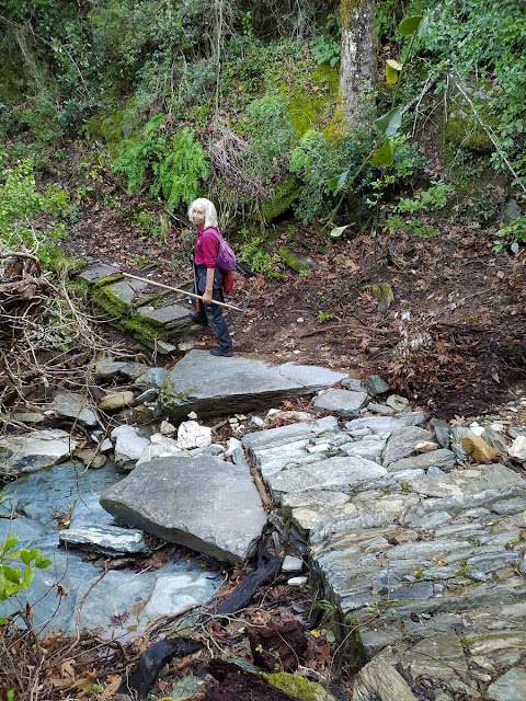
Crossing Kriovrisi stream

                 From now on, until we reach Vromoneri, we will be walking on rural earth roads. Reaching a  hut we go right and at a new intersection we go right again on the main (wider) road. We come to another intersection, where we go left on the wider road, noticing the round sign on the tree. Again at a new intersection we go left (to the right it goes into the settlement of Rodia, which is at close distance, but we do not need to go there). In a short while we see in front of us the chapel of Agios Ioannis the Theologian, a good place for a stop. 

Agios Ioannis Theologos chapel

        We continue on the dirt road to the east, then we take the asphalt for 500 meters and then we follow the road sign to Vromoneri beach.

Vromoneri beach

        A path continues from Vromoneri parallel to the coastline, through pine forest. Various signs help to guide us to Katigiorgis. On our way, we pass by the tiny beach of Vlachorema.

Vlachorema beach

Vlachorema


We go down through the yard of the '' Aura '' studios and finally reach the beach of Katigiorgis and the cafe-restaurants that operate there.  
Katigiorgis


Tuesday, April 19, 2022

Agios Georgios-Monastiraki-Profitis Elias (circular)


Distance: 14,3 km

Time|: 6,5-7 hours (with stops)

Altitude: from 630 m. (Agios Georgios) to 1315 m. (max)

Total elevation gain/loss: 910 m.

Signing: red paint, some metal signs

Drinking water on walk: yes (springs Petrostrouga, Mavromati, Kria Vrisi-Profitis Elias)

Start/end: Agios Georgios square

Download GPS file (.gpx): from Wikiloc


Powered by Wikiloc
         Τhis circular walk takes place in the beech forest above Agios Georgios.  Starting from the village square, we climb up the main kalderimi between the houses. We pass by the church of Agios Athanasios on our left and continue uphill on kalderimi, exiting the village.
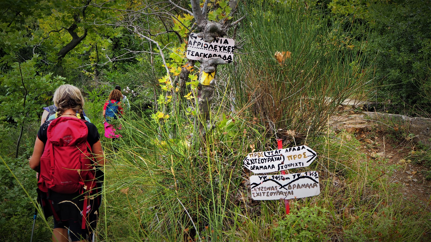
Handmade signs

        Coming to a path junction with handmade signs, we continue straight ahead following an irrigation ditch (the other branch turns right to Tsagarada). In front of us the peak Schidzouravli (1450 m.) can be seen.  
View to the Pagasitic gulf

        We cross a narrow earth road first and then we meet a second one, which we join  and walk on it. Further on there is a junction , where we go right uphill. At a right turn of the road lies the spring of Petrostrouga,  a source of drinking water on our way. A little higher up at the signpost, we leave the road to the left and follow the path going uphill towards ''Kissos'' and ''Hania''. 


This path brings us to Mavromati spring, another source of drinking water. After the spring, we continue on earth road and at the junction turn left. We keep climbing until we get to the junction at the col, a location called Monastiraki. Here we turn left to the path towards ''Hania''.

Path in beech forest towards Agios Lavrentios

        Reaching the next signed junction, we turn left to ''Agios Lavrentios'', descending on the earth path into beech forest. We reach another drinking water, ''Kria Vrisi'', which is located just under the path. We continue following the red paint and climb down to the small chapel of Taksiarches, built by the Greek Air Force in the memory of the four F-16 fighter pilots that died near this spot in a crash in 2004. 

Chapel of Taksiarches

        We cross the earth road and behind the chapel we find a path-kalderimi that continues downhill. 

        Reaching another earth road below, it is recommended to take a short deviation to visit the viewpoint of ''Psila Hagiatia'' (High Balconies). So, we turn right on the road keeping attention on our left for the red paint marks.

Drakia, as seen from Psila Hagiatia

        This location offers beautiful view to the village of Drakia that lies on the opposite side of a large ravine through which Vrichonas river runs. 
Psila Hagiatia viewpoint

        Retracing our steps back, we keep on the earth road until it joins a wider road on which we walk uphill to the left. In 50 meters there is a junction, where we take the narrow earth road to the right. Further on there is a V-junction and we take the left branch. We pass by a waterfall just next to the road.


    A section of the road is reduced to path because of extreme corrosion by flooding waters in a jungle-like scenery. We have no problem to follow it though, and further down the earth road reappears. At a junction we take the left uphill branch. Walking through apple groves, we reach the chapel of Profitis Elias, a  fine spot for a stop.  A drinking water fountain is nearby.

Profitis Elias chapel

        To get back to Agios Georgios, we take the narrow earth road in a southeasterly direction (attention, we don`t take the wider earth road! This comes from Taksiarches monastery and goes to Kremida springs). Further on there is a V-junction and we go right. Keeping attention on our right side, we leave the road taking a descending path. Reaching the door of a fenced grove, we turn left and find a descending path and soon enter the village. Walking now on kalderimi, we pass over an arched stone bridge, then the church of Agios Athanasios and take the kalderimi down to the village square.