Distance: 8.5 km.
Time: 4 hours with all the stops, walking time 3 hours
Altitude: from 240 m. (parking lot of Agia Triada) to 683 m. (Agios Georgios)
Total climbing up/down: 474 m.
Signing: red marks, some signs
Drinking water on walk: Agia Triada, Agios Georgios
Start/end: Agia Triada parking lot
Last checked: April 2023
Download GPS file: from Wikiloc
In the winter of 2023, two parallel kalderimis (cobblestone paths) connecting Agia Triada and Agios Georgios, one westerly and one easterly, were researched and opened with volunteer work. So, we now have the opportunity to create a circular route, going up from Agia Triada to Agios Georgios on the western kalderimi and returning by the eastern one (or vice versa). The two kalderimis join at the old olive press of Vainas, located just above Agia Triada.
Starting from the parking lot of Agia Triada (and from the drinking water fountain that lies there) we climb up on the asphalt. In thirty meters, an uphill concrete road branches off at an angle to the right and we follow it. This is the kalderimi, which fortunately a little further on, as the cement paving ceases, is revealed clean and unblemished, going up towards the old oil press of Vainas, which is also kept in relatively good condition. We walk a few meters on the rural road (to the left) and find the continuity of the western kalderimi (here it starts as an earth path, not very obvious-attention!)) next to a concrete irrigation ditch. In general, the western kalderimi follows the course of that ditch all the way up to Agios Georgios.
 |
| The irrigation ditch |
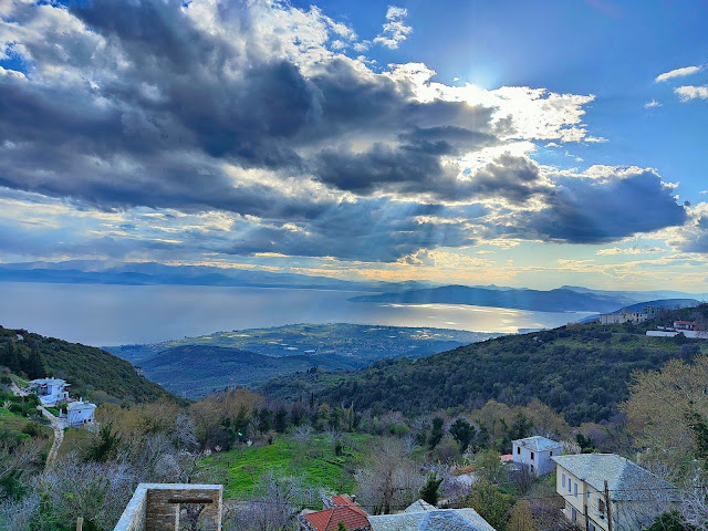
The cobblestone climbs smoothly between olive groves, having rom several points a beautiful view towards the sea of Pagasitic. Higher up there is a signed crossing. From below comes a path from the church of the Agii Apostoli (see the walk Kato Gatzea-Agii Apostoli-Agios Georgios ). We keep climbing on the path, paying attention to the left to see the continuity on of the cobblestone path, marked with red paint. If we fail to turn left at this junction and continue straight ahead uphill, we will eventually join the eastern kalderimi at a certain point.
Keeping on our way on the western kalderimi, we cross a stream and above that we cross a dirt road. The irrigation ditch, when we walked in April was bringing down a lot of water, some of it escaping on the path, creating a bit of difficulty in crossing it.
Eventually we come out on the asphalt, where we walk uphill for 200 meters and then, where it makes a left turn, we leave it straight ahead and walk over a small stone bridge. Here we join the main kalderimi Ano Gatzea-Agios Georgios. Higher up there is an intersection where a branch goes right to Pinakates and to the eastern cobblestone. (we don`t take that). We come to cross the asphalt, walking now on a a cement road and finally reach the square of Agios Georgios in about two hours since the beginning of our walk.
 |
| Agios Georgios village square (in early spring) |
On the way back now, to avoid walking on the tarmac, we climb the kalderimi from the square up to Agios Athanasios, a remarkable church. There we turn right and take a concrete road that brings us to the location "Rachi" at the exit of the village towards Pinakates, where there is a blacksmith shop and a fire station. We cross the asphalt diagonally (the view down is magical) and continue downhill on the eastern cobblestone.
 |
| View from ''Rachi'' at Agios Georgios |
The water of the concrete ditch flows rapidly below, creating small waterfalls. Reaching the large entrance at the fence of a cottage, we continue on the descending dirt road, which below becomes cobblestone. We continue on a beautiful kalderimi section into the forest. Further on, the cobblestone is cut twice by a dirt road. The third time we come to an earth road, the kalderimi ends and we continue downhill on dirt road, which brings us to the Vainas olive press.
 |
| Vainas olive press |
We follow now the well-known kalderimi to return to the beginning of our walk.


What a beautiful walk! A BIG 'Thank you!' to everyone who has contributed to the opening and the description of this trail!!
ReplyDeleteFortunately it has not suffered any significant damage from the thunderstorms and floods in September.