Friday, August 25, 2023

Pouri-Megalovrachos waterfalls (circular)


Distance: 8,3 km.

Time: 5 hours with stops

Altitude: from 418 m. (Pouri parking lot) to 680 m. (Profitis Elias chapel)

Total elevation gain/loss: 503 m.

Signing: red paint

Drinking water on walk: Panagia Rasova church, Pouri

Last checked: June 2023

Download GPS file: from Wikiloc


Powered by Wikiloc

.       The waterfall of  Megalovrachos is located in the Kalokairinos stream, between Zagora and Pouri. It is the largest and most impressive of Pelion, with a height (estimated) of over 50 meters. There is plenty of water in the spring when the snow melts, but in the summer it dries up. It is located in a difficult place and visiting it has certain requirements (adequate `physical condition, suitable shoes). In order to enjoy the special experience, our visit should preferably take place in the months of March-May. In this particular case, before the visit to the waterfall we passed by the chapel Ilias Pouriou and the old monastery of Panagia Rasova, thus making a varied circular walk starting and ending in Pouri. One can go up to Rasova using a concrete road (for cars with increased ground clearance), that opens to the asphalt road between Zagora and Pouri (there is a sign to "Panagia Rasova"in Greek).


        Starting from the parking lot of Pouri, we climb to the central church of Agios Dimitrios and continue uphill, following the Makrinitsa-Pouri route in reverse, helped by the red signs. We pass by a building of the water system (for a few meters, if the path is overgrown, we are forced to walk next to it, through the adjacent grove) and continue on an uphill dirt road. Paying attention to the red signs on the left, we enter a path for a while and then again on a road that continues uphill to the small church of Prophitis Elias. Next to the church there is a kiosk and the view to the south and east is excellent. 

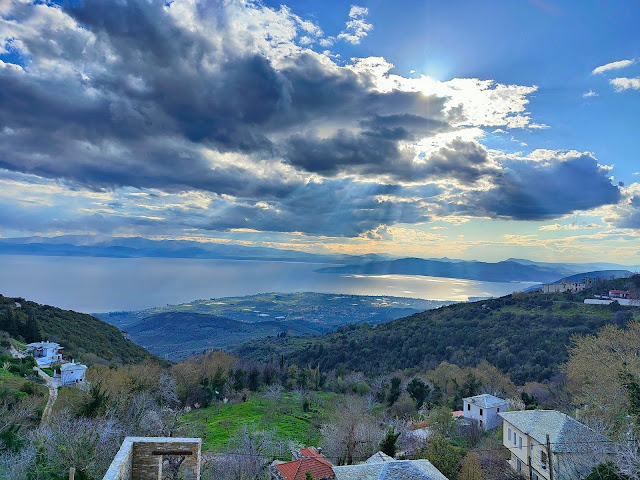
View from Profitis Elias

        We continue on the road, which is now descending, and below we turn right entering a grove. We cross a small stream and then join a rural road which, descending, brings us to the old monastery of Panagia Rasova. This is one of the oldest monasteries of Pelion and specifically among the five oldest on the mountain of the Centaurs. It was created around 1250 AD, maybe earlier. Evidence of the monastery exists since 1270 AD. It is a large monastery of old time with cells all around. Today only the church (the catholicon) is preserved, and not in a good condition. Many murals have also been damaged. Maintenance attempts were made from time to time with props and various repairs. As for the cells and other buildings, these have long since collapsed and destroyed. The monastery has been abandoned for many years, since the last monk passed away in 1885. Lately, after damages caused by poachers looking for golden pounds, the church door is always locked, except on its feast day on November 21 ( Entrances of the Virgin). 

Panagia Rasova

        We descend a little more on the road and then turn right through a grove. At the intersection there is a hut. The road below terminates and continues as a path that is difficult in some places, going parallel to a water pipe.

Crossing the first  stream

            We easily cross a first smaller stream and continue to reach the main stream. The waterfall is a little higher and cannot be seen from here. We cross the stream and on the other bank we climb steeply on a narrow and difficult path (attention!), helped by the red signs. Finally we reach the base of the great waterfall. The sight and feeling is fantastic, difficult to descrbe with words, especially when the stream brings down a lot of water. 

Congrats to Despina for researching and marking

        We return by the same path back to the hut below Rasova and continue on the downhill road. Further down, seeing the cedar tree, we go left into an estate, which we cross and on the other side we walk on a cement road. Meeting the first houses of Pouri we find a narrow downhill cobblestone that takes us down to the asphalt, at the entrance of the village.

Thursday, August 24, 2023

Κato Gatzea-Agii Apostoli church-Agios Georgios

View to Pagasitic sea


Distance: 12,4 km.

Time: 5,5 hours with stops

Altitude: from 0 m. (Kato Gatzea) to 698 m. (max)

Total climbing uphill/downhill: 704 m.

Signing; red paint, some small yellow round signs

Drinking water on walk: Agios Georgios, Agia Triada

Start/end: Kato Gatzea (mooring area)

Last checked: March 2023

Download GPS file: from Wikiloc

Powered by Wikiloc


      Our walk starts from the beach of Kato Gatzea, at the mooring point. We walk away from the sea, passing by the Croma Villas complex and come out onto the main asphalt near the pharmacy. We cross it and continue opposite on a narrow asphalt road towards the sports center (football field), Next to it lies the cemetery of Gatzea. Then, as the main road turns left, we continue straight ahead on a narrow dirt road,  in which a little further on we can make out sections of kalderimi (cobbled stone path). We cross the asphalt (it goes to Agia Triada) and climb steeply on a cement road. Here the cement has covered the kalderimi. 


        A  little further up, however, the cobblestone appears at the right side of the road, wide and clean and we follow it. We cross the train rails over the stone bridge by the name of Koudrias and continue climbing. Further up, another  kalderini joins in on our left, coming from the train station of Ano Gatzea and from the bridge that crosses the rails there. 

    Our kalderimi ends as it joins the asphalt, just above Agia Triada near the old olive press of Klimentopoulos which lies next to the road. We walk on the asphalt for five hundred meters, cross the stream and immediately after that, on the right side of the road we find a narrow  uphill path that brings us to the church of the Holy Apostles (Agii Apostoli). Seeing the ruined buildings, we understand that this is in fact an old deserted monastery (it belongs to the Taxiarchon monastery). 

Agii Apostoli

    A wide path ascends from the upper side of the ruins. We reach a small plateau where we go diagonally to the right and descend smoothly to cross the stream. The path then climbs with turns and we reach the lower limit of an olive grove. Going up into the grove, we meet the concrete irrigation ditch and along that, the western kalderimi coming from Agia Triada and going to Agios Georgios. At the junction there is a signpost. We continue straight ahead uphill, paying attention to our left not to miss the continuity of the path, which is marked with red paint. Attention, if we miss the junction and go straight ahead, we will end up joining the eastern kalderimi, thus missing Agios Georgios altogether.

        We cross a stream and further on we cross a dirt road. The irrigation ditch, when we passed in March, brought down enough water and it leaked on the path, making our life more difficult. Finally we come out on the asphalt, where we walk uphill for 200 meters and then, where it makes a left turn, we leave it straight and walk over a small stone bridge. We have now joined the main kalderimi from Ano Gatzea to Agios Georgios. Following its course, we pass an intersection where a branch goes to the right towards Pinakates and also  towards the eastern cobblestone (we don`t take that branch). Higher up, we cross the asphalt and continue on a cement road (ex-kalderimi) and join the asphalt near Vogiatzopoulos mansion,  finally reaching the square of Agios Georgios.

Agios Georgios village square

        On the way back now, to avoid walking on the main asphalt, we go up on the main kalderimi from the square. We can fill our bottles from the drinking water fountain. Reaching the remarkable church of Agios Athanasios higher up, we turn right and take a concrete, slightly downhill  road that brings us to the location "Rachi" at the exit of the village towards Pinakates, where there is a blacksmith shop and a fire station. We cross the asphalt diagonally (the view down below is extraordinary) and continue downhill on the eastern kalderimi heading  towards Agia Triada.

View from Rachi

        The water of the irrigation ditch flows rapidly, creating small waterfalls. Reaching the  door of the fence of a mansion, we take the dirt road downhill, becoming cobblestone. We move for a while in a pristine, very beautiful setting in the forest. Lower down, the kalderimi is cut by a dirt road twice. On the third time, it ends and we continue on a downhill dirt road. The road brings us to the old olive press of Vainas, from where we follow down the kalderimi to get to Agia Triada, at the parking lot with the drinking water fountain (we may open the tap on the side to drink and then close it). 

Old olive press of Vainas

      A kalderimi descends from the fountain and we follow it. Further down we cross the asphalt and continue in a straight line on a narrow cement-paved road that is actually the old kalderimi (there is a sign in Greek pointing to Kouvara`s house). We come out again on the asphalt, where we walk for about three hundred meters. Then we find the continuity of the cobblestone on the right (not obvious at the beginning, attention right!) we go down and cross the train tracks. Going steadily downhill, we take a concrete road to the left and in a few meters the kalderimi is again visible on our right. Below, it descends next to a house. Eventually the cobblestone disappears and we descend on a concrete road, which exits on the main asphalt near the gas station. To avoid the unpleasant walking on the main asphalt, we prefer to walk through olive groves parallel to the road, which is on our left at a small distance, and continue on a narrow road. Reaching a junction with the road to the cemetery, we turn left, on the route we took at the beginning of our walk, and finally reach the picturesque beach of Kato Gatzea with its cafes and restaurants.    

Kato Gatzea seaside


Monday, August 21, 2023

Agia Triada-Agios Georgios (circular)


Distance: 8.5 km.

Time: 4 hours with all the stops, walking time 3 hours

Altitude: from 240 m. (parking lot of Agia Triada) to 683 m. (Agios Georgios)

Total climbing up/down: 474 m.

Signing: red marks, some signs

Drinking water on walk: Agia Triada, Agios Georgios

Start/end: Agia Triada parking lot

Last checked: April 2023

Download GPS file: from Wikiloc


Powered by Wikiloc


        In the winter of 2023, two parallel kalderimis (cobblestone paths) connecting Agia Triada and Agios Georgios, one westerly and one easterly, were researched and opened with volunteer work. So,  we now have the opportunity to create a circular route, going up from Agia Triada to Agios Georgios on the western kalderimi and returning by the eastern one (or vice versa). The two kalderimis join at the old olive press of Vainas, located just above Agia Triada.


        Starting from the parking lot of Agia Triada (and from the drinking water fountain that lies there) we climb up on the asphalt. In thirty meters, an uphill concrete road branches off at an angle to the right and we follow it. This is the kalderimi, which fortunately a little further on, as the cement paving ceases,  is revealed clean and unblemished, going up towards the old oil press of Vainas, which is also kept in relatively good condition. We walk a few meters on the rural road (to the left) and find the continuity of the western kalderimi (here it starts as an earth path, not very obvious-attention!)) next to a concrete irrigation ditch. In general, the western kalderimi follows the  course of that ditch all the way up to Agios Georgios. 

The irrigation ditch

        The cobblestone climbs smoothly between olive groves, having rom several points a beautiful view towards the sea of Pagasitic. Higher up there is a signed crossing. From below comes a path from the church of the Agii Apostoli (see  the walk Kato Gatzea-Agii Apostoli-Agios Georgios ). We keep climbing on the path, paying attention to the left to see the continuity on of the cobblestone path, marked with red paint. If we fail to turn left at this junction and continue straight ahead uphill, we will eventually join the eastern kalderimi at a certain point. 


        Keeping on our way on the western kalderimi, we cross a stream and above that we cross a dirt road. The irrigation ditch, when we walked in April was bringing down a lot of water, some of it escaping on the path, creating a bit of difficulty in crossing it.

       Eventually we come out on the asphalt, where we walk uphill for 200 meters and then, where it makes a left turn, we leave it straight ahead and walk over a small stone bridge. Here we join the main kalderimi Ano Gatzea-Agios Georgios. Higher up there is an intersection where a branch goes right to Pinakates and to the eastern cobblestone. (we don`t take that). We come to cross the asphalt, walking now on a a cement road and finally reach the square of Agios Georgios in about two hours since the beginning of our walk.

Agios Georgios village square (in early spring)

        On the way back now, to avoid walking on the tarmac, we climb the kalderimi from the square up  to Agios Athanasios, a remarkable church. There we turn right and take a concrete road that brings us to the location "Rachi" at the exit of the village towards Pinakates, where there is a blacksmith shop and a fire station. We cross the asphalt diagonally (the view down is magical) and continue downhill on the eastern cobblestone. 

View from ''Rachi'' at Agios Georgios

        The water of the concrete ditch flows rapidly below, creating small waterfalls. Reaching the large entrance at the fence of a cottage, we continue on the descending dirt road, which below becomes cobblestone. We continue on a beautiful kalderimi section into the forest. Further on, the cobblestone is cut twice by a dirt road. The third time we come to an earth road, the kalderimi ends and we continue downhill on dirt road, which brings us to the Vainas olive press.    

Vainas olive press

We follow now the well-known kalderimi to return to the beginning of our walk.


Sunday, August 20, 2023

Around Vizitsa (circular)

Liturgy at Taksiarches chapel, 5/9/2015

Αpproaching the Taksiarches chapel on the cliff

 Distance: 5,8 km.

Time: 2h 40' with stops

Altitude; from 283 m. (min) to 525 m. (max)

Total climbing up/down; 386 m.

Signed with:red paint, several metal or wooden signs

Drinking water on walk: Vizitsa, Milies train station

Start: main asphalt, just above the main church

End: Vizitsa village square

Last checked:August 2023

Download GPS file: from Wikiloc


Powered by Wikiloc


      This beautiful circular route, which has the village square of Vizitsa at its highest point, gives us the opportunity to visit many attractions of the area: the monastery of Agios Ioannis Prodromos and the old fountain below it, the train station of Milies, the metal train bridge at Taxiarches chapel (or, as it is sometimes called, the De Chirico bridge), the small church of Taxiarches on the rock, the small stone-concrete bridge over the stream, the waterfall ''Katafidi'', and finally the central church of Zoodochos Pigi under the square. To see all that, it will take a little less than three hours, including stops as we please.   

    Srtarting from the main asphalt and walking on it downhill towards Milies, we pass above the shop of the Women's Cooperative "Esperides" (where we can buy quality local products), and find on our right the kalderimi (cobblestone path) that leads below to the old tiny monastery of Agios Ioannis Prodromos (St. John the Baptist), worthy of a stop. Leaving the monastery, we descend on a narrow cobblestone path next to the wall of the monastery, and immediately join a wide kalderimi below. On our left is an old (renovated) drinking water fountain. The cobblestone below is cut abruptly by a dirt road, on which we walk to the left.  

                       The kalderimi  below the monastery of St. John the Baptist, Vizitsa

        In a short while, we pass under the cemetery of Vιzitsa and come out on an asphalt road. We cross it and continue along the path, which quickly becomes a nice kalderimi. To our right we have the large Miliotiko ravine. We see high up opposite the white chapel of the Lifting of the Holy Cross and, if we pay attention, we will see below it, built in a recess of the steep rock on the cliff, the small chapel of Taxiarches. 

The metal bridge from above

    The cobblestone becomes a path again and we get to a path junction. We choose the right branch, intending to walk through the Milies train station, as that path crosses a stream and comes out just at the station's entrance.

Arriving to the train station of Milies

        We walk along the tracks and after ten minutes we reach the famous metal bridge, built in the early 1900s by the German engineer Schneider, a specialist in metal bridges, under the supervision of  chief engineer Evaristo de Chirico (father of the important surrealist painter Giorgio de Chirico , who was born in Volos). 


        We return by the same way and, reaching the intersection below, we go left. The path runs smoothly along the wooded slope, We pass by a cave that was used by a shepherd for his animals (now  abandoned) and we cross twice the large Miliotiko stream (there is usually no water here). The path becomes a dirt road and we come out on the asphalt road that goes to Argyreika. Here we walk uphill and at the second sharp turn that the asphalt makes, we leave it straight ahead onto a dirt road, which soon becomes cobblestone and we cross the stream again over a small concrete bridge.

      Shortly after the bridge, paying attention to our left, we find a narrow path which in a few meters brings us in front of the impressive "Katafidi" waterfall. It is a truly beautiful spot, especially in the spring when the stream brings down a lot of water as ths snow high on the mountain is melting, and we will definitely stay long enough to enjoy it. In the summer the water dries up, but the spot always remains impressive.

Katafidi waterfall at its best

    We return to the wide, expertly made cobblestone and climb up towards Vizitsa. A little further, the cobblestone is blocked by a landslide and we have to leave it to the right and make a detour walking on a dirt track. Further up we reach an intersection, where the cobblestone continues climbing diagonally to the left (attention!), next to a large shrine. Constantly climbing, we pass the central church of Zoodochos Pighi, cross the asphalt and finally reach the picturesque square of Vyzitsa at an altitude of 525 meters.

                                                                 Vizitsa square

Friday, August 11, 2023

Boufa (Koropi)-Panagiotiko Dam-Neochori

Just above the Panagiotiko reservoir


Distance: 9,5 km.

Time: 4,5 h    

Altitude:  from  7 m. (Boufa) to 462 m. (Neochori square)

Total climbing up:581 m. Total descent|: 128 m.

Signed with red paint and some round yellow signs

Drinking water on walk: Neochori

Start: east end of Boufa, at the point where the straight section of the asphalt road ends

End: Neochori village square

Last checked: June 2023

Download GPS file: from Wikiloc

Powered by Wikiloc

      Ιn the old days, this was the road of communication between Neohori, its settlement  Zervochia and the fertile valley of Boufa. Travelers would start from Neochori walking on the northern bank of the Platanorema ravine. They would cross the stream over the stone arched bridge of Taratsa (or Malamaki) and would continue on the southern bank, until they reached their destination. Today the stone bridge is lost, buried in the bottom of the Panagiotiko Dam, so we now cross over the dam. The span of the arch of the lost  bridge was 5.80 m and the height 4.60 m, measured by Nikos Haratsis in his book ''Stone arched bridges of Pelion'' (in Greek). 

The bridge of Malamaki, now lost forever (photo: Nikos Haratsis)

      In the rest of the route, the original path is preserved for quite some distance, incorporating short sections of cobblestone. Some parts of it have become rural roads. In general, this is a very nice route, best to walk in spring or autumn. It was researched and cleaned by volunteers in the winter and spring of 2023. We can leave our car in Boufa and  return  by the bus (depending on the bus schedule, see www.ktelvolou.gr). Another option for this path, is to make a circular route Neochori-Zervochia-Niaou (Afetes)-Neochori.  If we are walking Milies-Neochori, we can use the more pleasant section from the dam to Neochori, (see the route Milies-Panagiotiko dam-Neochori ),instead of walking on the standard route that is passing by Panagia Tourkogianni church.

The artificial lake of Panagiotiko

    I will describe the route starting from Boufa. The start, marked with a red paint arrow, is at the eastern edge of Boufa, at the end of the main asphalt straight section, where the uphill turns to Afissos begin. It should be noted here that at a distance of 700 meters from this point, there is the beach "Paradisos", where in the summer there is a refreshment bar and a tavern. To walk to Neohori we first take the narrow rural road that generally runs straight northeast. In 500 meters, there is a fork where the left road is cement paved. We take the right road and in thirty meters at another fork we take the left road that goes uphill with turns. Higher up there is another intersection, where we also go left. The road ends and a path continues next to low dry stone walls. Going gently uphill, we turn right (south) for a short while and we are happy to find elements of cobblestone on our way. Following the cobblestone path, we pass through olive groves, walking generally in  a northeastern direction. 


       A little further on, the path is closed for thirty meters by fallen branches from the pruning of olive trees, and we haved to bypass the closed part from below (the owner of the olive grove has promised to remove the branches). The path continues and comes to the end of a rural road, which we follow, always in a north-easterly direction. We reach a triple junction, where the road on the right goes to Zervohia, while we continue straight ahead in the same direction. Further on, we leave the intersection to Pavlakia-Milies on our left and continue straight,  ignoring the uphill road on the right. Our road ends smoothly in an olive grove and a slightly uphill path continues  in the same direction.

    Higher up, the path is abruptly cut off by a dirt track (a rural road). We follow it uphill and in twenty meters at the intersection we go left uphill. The road soon ends and we find the path again. In front of us we see the wild northern slope of the Platanorema ravine with its large tower-like rocks and hear the water flowing below- it is advisable to stop for a few minutes to enjoy the feeling. We cross a small stream and further on the path opens to a road that serves the dam and we have to climb down the rocky slope for a few meters.


        We walk on the road uphill for a short while to  reach the dam. and we cross over to the northern slope. At the first intersection we go right on a disused road, which runs a little above the water level. Paying attention to our left as we walk, we see the red sign marking the entrance to the path. We now walk again on the restored path, which initially goes uphill and we pass above a ruined hut, finding a couple of kalderimi sections.


       Further on, we cross a stream and continue steadily uphill on a dirt road. We ignore road intersections to the right as we climb uphill. Higher up, on a wide right turn of the road, a path leaves strairht ahead, and in a few meters we join the Milies-Neochori route, which comes from Panagia Tourkogianni church. We are now walking on the Milies-Neochori route. The path higher up opens to a dirt road, which leads to the asphalt, we cross the asphalt bridge and then follow the red signs to the square of Neochori.