|
| Kalderimi in beech forest |
Distance: 9,5 km
Duration: 3,5 h (walking time 2.50')
Altitude: from 1218 m.(Hania) to 477 m. (Zagora)
Total ascent: 108 m. Total descent: 818 m.
Signed with red paint marks and yellow metal signs
Drinking water on walk: yes (asphalt road near Zagora)
Download GPS track:
from Everytrail from Wikiloc
This used to be part of the main route connecting Zagora to Volos in the days before the construction of the asphalt road in the 1930`s, consisting entirely of kalderimi (cobblestone). The rest of the original kalderimi from Hania to Volos can be found in the walk
Alli Meria (Volos)-Hania.
In the first section of this walk from Hania to Profitis Elias chapel, we walk in beautiful beech forest (1,5 h). In the second section from Profitis Elias down to the asphalt road bridge (1 h), the kalderimi passes mainly between apple orchards (with a small part in chestnut forest). In the final section from the bridge to Zagora, we have to walk on the asphalt road, because this has covered the old kalderimi.
UPDATE 2022: The kalderimi is overgrown at places below Profitis Elias chapel and because of that, it is difficult to pass through.
From Zagora, we can continue descending for 1 h 15' to get to the tourist beach of Horefto and have a swim in the crystal clear Aegean sea (see Zagora-Horefto route). We can return from Horefto to Zagora and from Zagora to Hania and Volos by KTEL regional bus (www.ktelvolou.gr). Another option, if we have a rented taxi or bus, is to arrange to collect us from the asphalt road bridge and take us to Zagora or Pouri (to walk on the excellent Pouri-Horefto route), in order to avoid walking on the asphalt, which (walking) anyway takes place into an overgrown and attractive scenery, to compensate for the inconvenience.
 |
| The old kalderimi remains in good condition near Hania, a joy to walk on |
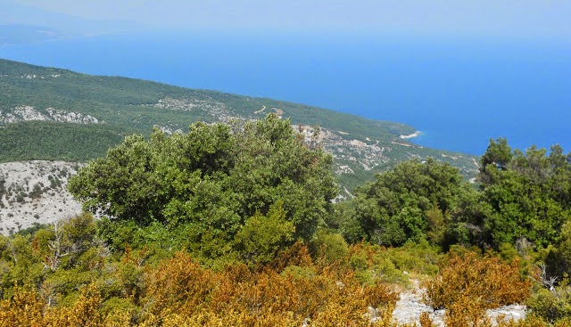
Starting from Kokkinis hotel-restaurant (To Hani tou Kokkini) on the main road at Hania, we initially ascend on the asphalt for a few meters to reach Pileas hotel. From the other end of Pileas` parking lot, two dirt roads continue northeast and we take the narrow one on the right, which ends in fifty meters and continues as kalderimi. In a short while we reach a small plateau, used for making charcoals in the past, to which a dirt road also comes from the left. At the other end we find again the kalderimi, clear and in good condition, descending nicely into the beech forest. We can see Agriolefkes peak with the ski slopes at the distance on our right.
 |
| Agriolefkes peak (1470 m.) with the ski center |
On our way down we cross the asphalt ten times, finding the kalderimi directly on the opposite side or after walking a short distance to the left. On the final (tenth) time on the asphalt, we walk on to the left and notice the entrance to the peaceful chapel of Profitis Elias (ΠΡΟΦΗΤΗΣ ΗΛΙΑΣ), a suitable place for a stop.
 |
| Profitis Elias chapel |
After just another five meters on the asphalt, we find the kalderimi again. From now on, it winds down between apple orchards and we must apply high caution not to lose it at certain spots. After crossing a dirt road, further down we come out to another narrow road and follow it, noticing the sign. A little further on, as the road starts to go slightly uphill, we leave it to the left to the overgrown kalderimi, which is not readily noticeable (attention to the red marks).
 |
| Invisible kalderimi through orchards |
Further down, the kalderimi takes a left turn through an apple orchard, we cross another dirt road (attention to the marks) and enter into chestnut forest. Unfortunately, this beautiful stretch soon ends joining a concrete road, which has replaced the kalderimi.
 |
| The kalderimi in chestnut forest |
Walking steadily downhill on the concrete road, we meet two junctions and go right. Eventually, we reach the main asphalt road and cross over the large Galanorema stream. According to Nikos Haratsis` book ''A hiker`s guide to mt.Pelion'', a few meters down below there used to be an arched stone bridge in the past, which was long ago destroyed.
From here on, we have to walk on the asphalt, because this has replaced the old cobblestone all the way to Zagora. Entering the village, we pass by the drinking water fountain Kamara on our left side, with a kalderimi-concrete road ascending to Agia Paraskevi church. Continuing on the main asphalt, we soon reach the Agia Kiriaki church square on the right, a good place for a refreshing stop.
 |
| Agia Kiriaki church square at Zagora |
The track of the recorded walk ends on the main asphalt road of Zagora, shortly before Agios Georgios church square, exactly at the spot where we meet the kalderimi going down to Horefto (see Zagora-Horefto walk).

 The road eventually ends at the location called Stavros. Here is the proper start of our walk. We take the wide downhill path-kalderimi to reach the impressive monastery of Flamouri after half an hour. Built in the second half of 16th century, it still follows the athonite rules, so entrance is not allowed for women. Male visitors, however, are welcome inside and can also eat and stay overnight. Restauration works are underway. It currently has four monks and celebrates on the 6th of August (Transfiguration of Christ the Saviour).