 |
| On the bed of Chalorema stream |
Distance: 5,7 km
Duration: 3 h (walking time 2.20')
Altitude: from 0 m. (Damouchari) to 350 m. (max)
Signing: red marks, a few signs
Drinking water on walk: yes (Vigla of Tsangarada, Damouchari)
Download GPS track:
from Everytrail from Wikiloc
This is a nice circular walk, starting off from the seaside settlement of Damouchari in East Pelion. First we climb to Mouresi village walking on cobbled stone path (kalderimi) and then cross the overgrown ravine of Chalorema on a recently reopened path, to reach the location called Vigla at Tsagarada village and return to Damouchari, walking again on spectacular kalderimi. At the end of our walk we can have a swim at the beach and lunch at one of the tavernas there. If we use public transport (KTEL bus), we can get off at nearby Ai Giannis (Agios Ioannis) and walk to Damouchari (a 15-minute walk from the south end of Papa Νero beach of Ai Giannis). Please wear long trousers as vegetation near the stream is usually overgrown, despite volunteer efforts to keep the path open and clear.

Starting off from the drinking water fountain at the parking at the end of asphalt road at Damouchari, we climb to the left on a concrete road which has a central stone paved lane. After 50 m. we find the signed kalderimi climbing up, opening to a stone paved road that soon becomes an earth road. Watching out for the red marks on the left as we climb the earth road, we find the kalderimi, which was abruptly cut by the road and is not readily visible (attention). Further up, it opens to another earth road and we find it again on the left side of the road. This procedure is repeated one more time and we find ourselves walking through a virtual tunnel of vegetation around us.
 |
| A virtual tunnel of vegetation |
The kalderimi opens to a concrete road climbing steadily and we reach a junction, where it becomes again visible through the concrete. If we take here the road to the left, in five minutes we will reach an excellent viewpoint peak called Tsouka. Back to the junction, continue up the road-kalderimi having a line of cypress trees at the side. As we reach the asphalt, we do not continue straight ahead towards Mouresi square (attention), but follow the asphalt to the left.
 |
| The overgrown Chalorema ravine |
As the asphalt takes a sharp right turn, we take the narrow concrete road to the left at the sign to ''Villa Glykas'' (ΒΙΛΑ ΓΛΥΚΑΣ) and then the earth road going straight on downhill. Watching on our left, we find the path which climbs down to cross the wide Chalorema stream (a good place to have a stop), and then continues on the other side among dense vegetation. Ignoring a path to the right going to Agios Stefanos of Tsagarada, we keep climbing following the red marks.
The path becomes an earth road and eventually joins the downhill asphalt that comes from Agios Stefanos church. We walk downhill and soon get to a junction with an asphalt road to the left and a sign to ''Vigla'' (''Βίγλα''). It is better to take that road and follow it straight on, until we get to location Vigla, a small plateau with a plane tree, a bench and a drinking water faucet. Here we join the route Tsagarada-Damouchari (coming from Agia Paraskevi church). We continue straight ahead on an earth road for a few meters, reach a fork and go left to find the kalderimi next to the fence.
 |
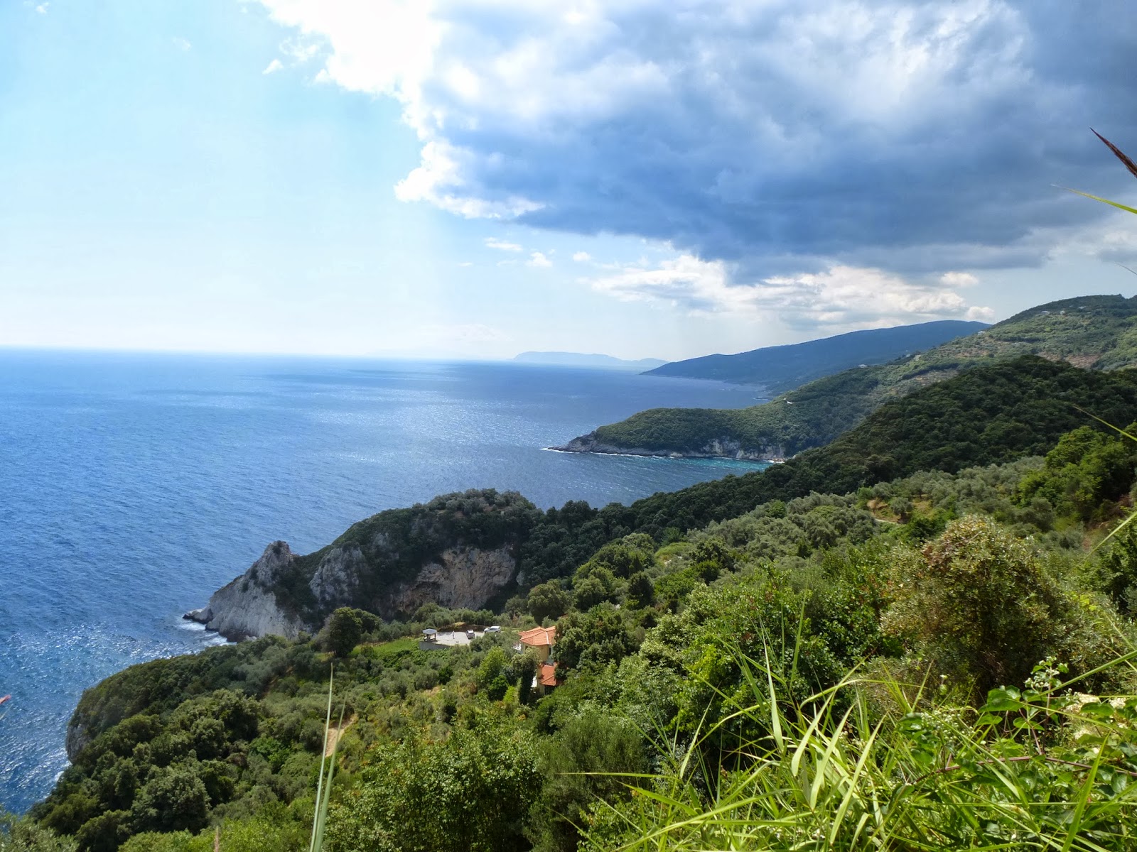
| View to the sea from Vigla |
A little further down, we reach a wooden kiosk. On the left a small
stone balcony is built, where one can sit in quiet and admire the view
to the Aegean. As the kalderimi zigzags its way down, we can feel the sea
breeze and hear the waves that hit the rocky coast below.
 |
| Climbing down to Damouchari |
Two paths cross on the right, going towards Krifo Scholio and Fakistra
beach. There is a protective low stone wall built on the outer side,
because the slope is very steep. Eventually, we cross the Chalorema
stream over a wooden bridge.
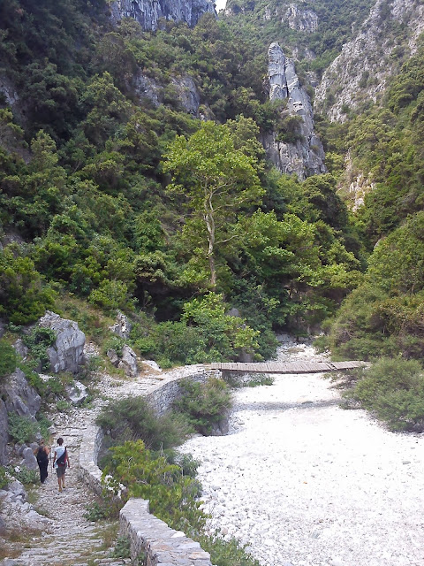 |
| The bridge over Chalorema stream at Damouchari |
As if to justify its name
(Chalorema=destroying stream), the stream has destroyed the concrete
lane on which we walk at the other side. Here we are at the beach of Damouchari, under the ruins of
the old castle, where we can have a swim into the Aegean sea.
 |
| The beach of Damouchari |
Walking on the flat stone paved lane parallel to the sealine, we
pass just above the small port, the only place in the whole east Pelion area
where a ship could safely dock. Some scenes of the movie ''Mamma mia''
were shot here in 2007 and there are happy pictures of the taverna owner
with Meryl Streep.
 |
| Damouchari port |
A little further on, as a concrete road continues ahead, we
notice the kalderimi climbing to the left. It soon opens at the end of the asphalt road, where we started our walk.


